
Jackson School Surveying Hurricane Harvey Damage to Coastal Systems
September 26, 2017
By Monica Kortsha
Jackson School Science Writer
This post is first in a series documenting the Jackson School of Geoscience’s Rapid Response mission to study the coastal impacts of Hurricane Harvey. Find the other posts here.
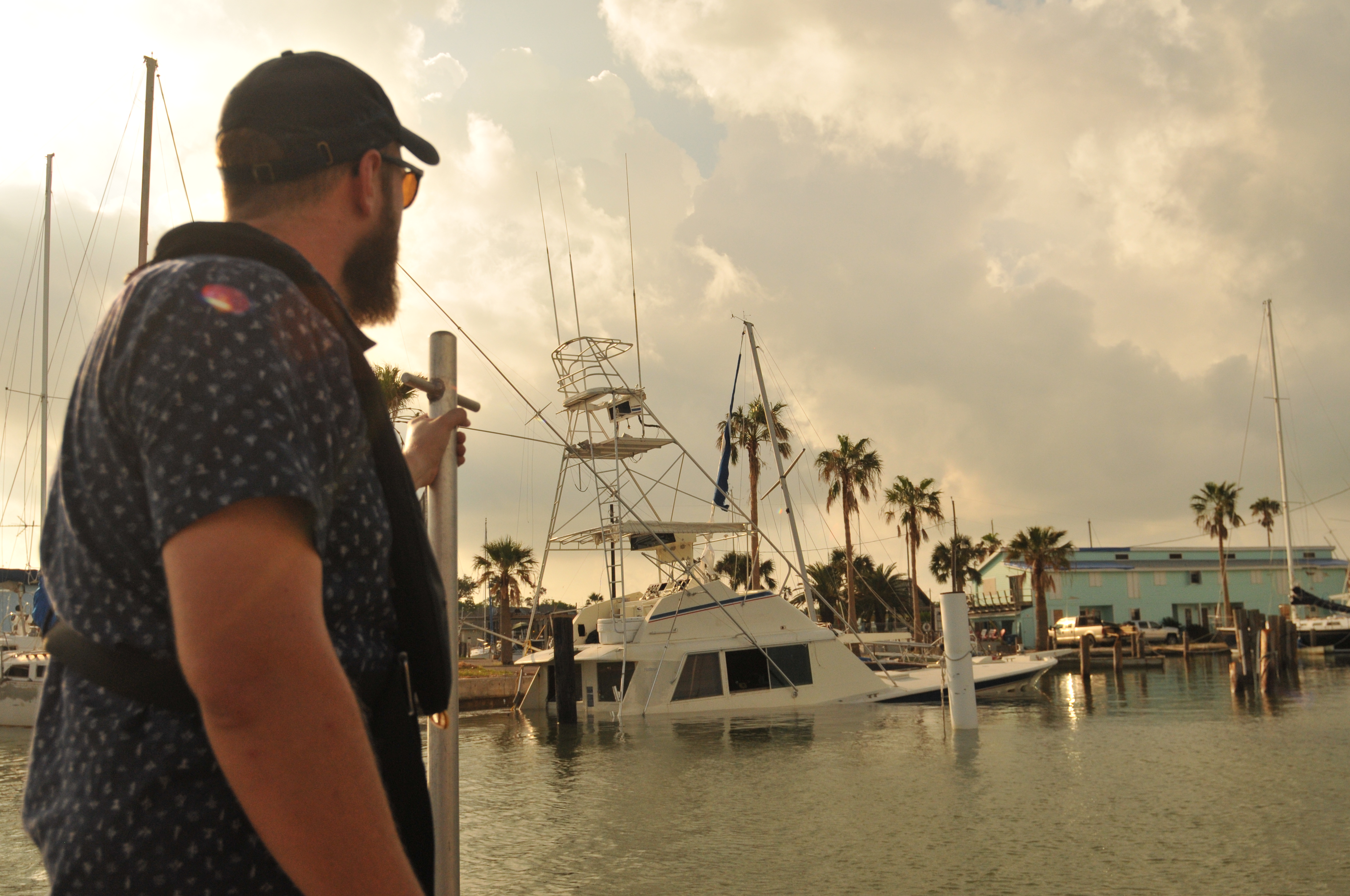
Portland, TX— A team from the University of Texas Institute for Geophysics (UTIG) arrived in this small South Texas community this weekend to study the impact of Hurricane Harvey on the Texas Gulf Coast.
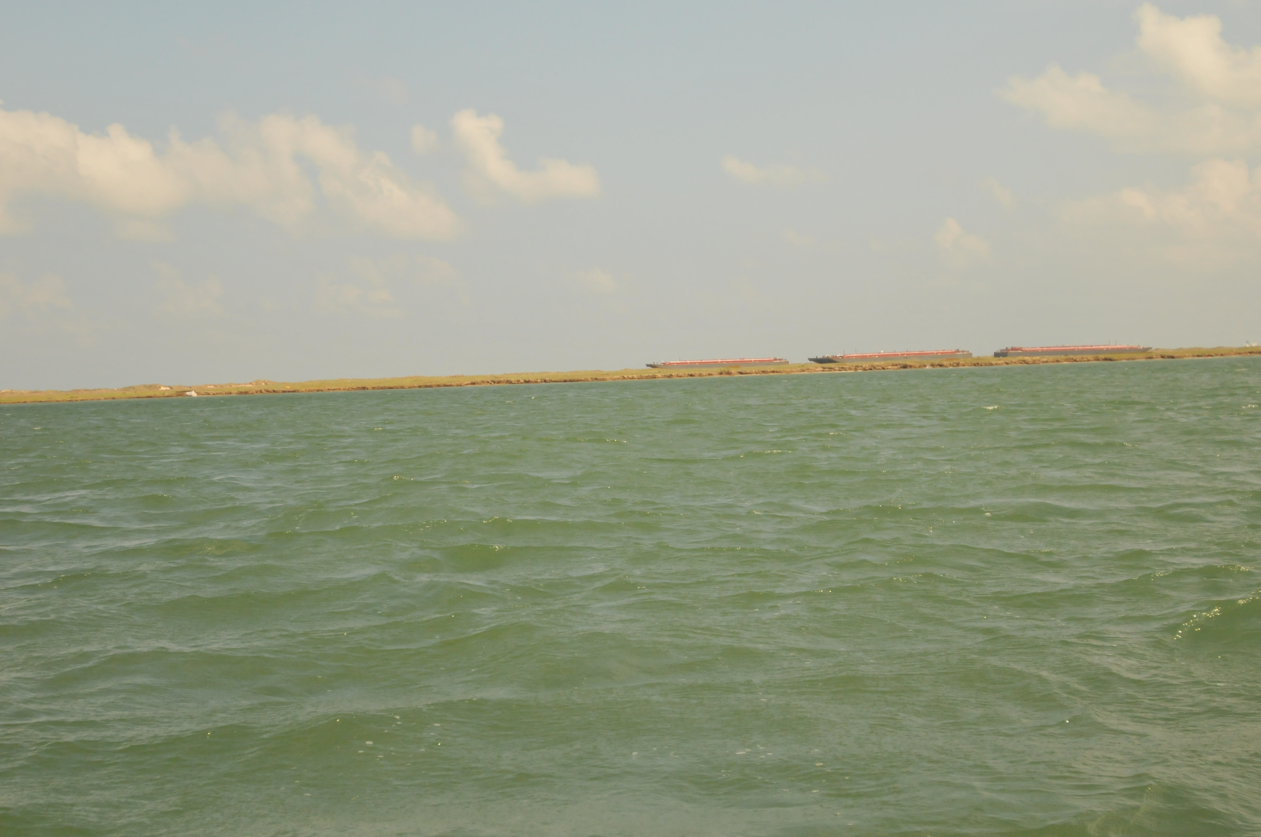
Damage from the storm was obvious, from the massive barges washed up on San Jose Island near Port Aransas to the large gaps in the island’s protective sand dunes. But what brought the team to the coast is hidden to most, and could soon fade away: the topography of sediment on the bottom of the seafloor.
The sediment—a mix of clay, silt and sand—helps build the barrier islands that surround the Texas Gulf Coast and serve as a natural buffer between coastal cities and storms. The team came to Portland to document the sediment on the seafloor to help understand how Hurricane Harvey impacted the material that makes up the barrier islands that helps keep Texans safe. Such information could be vital for any future plans to help restore the system and prepare for future storms.
“This research has a time-sensitive nature,” said John Goff, a UTIG senior research scientist. “In one or two years all evidence could be wiped away.”
The project is part of the UT Jackson School of Geosciences Rapid Response Program, which conducts science on areas hit by extreme weather and natural disasters to better determine how to respond to the events and better prepare for them in the future
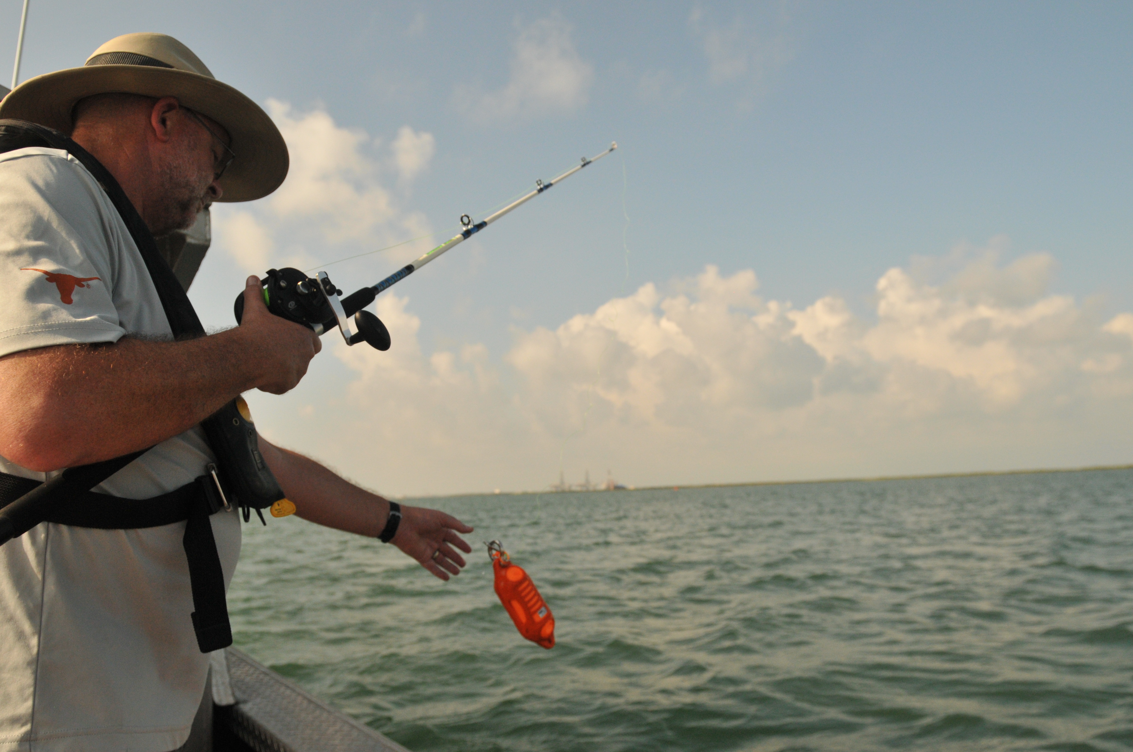
Goff is joined by three other UTIG scientists: Research Scientist Associates Marcy Davis and Dan Duncan, and Ph.D. student John Swartz, a graduate research assistant.
To understand what the hurricane did to the sediment, researchers need to know what the seafloor looked like before the hurricane hit. Luckily, the Jackson School’s Marine Geology & Geophysics field camp had surveyed the area in 2009 and 2012. The Rapid Response team will compare the readings they are collecting post-Harvey to earlier readings to understand the hurricane’s impacts.
The area they are specifically studying is Lydia Ann Channel, near Aransas Bay. Research involves slowly driving the research vessel, the R.V. Scott Petty, back and forth along the channel, capturing data on the sea floor. One of their main tools is a multi-beam sensor, a sonar system that sends out six “pings” each second to capture topographical data about the seafloor, data which allows the researchers to quantitatively measure the height and depth of seafloor features. At a frequency of 400 kilohertz, humans cannot hear the pings, but they ring loud and clear to dolphins, which frequently appear in the area when the device is activated. The sonar does not harm the dolphins.
The other primary tool is a side-scan sensor, a different type of sonar system that shows what the features of the seafloor look like in greater detail, but without quantitative information on height and depth. Search teams use the side-scan sonar to comb large areas of the sea for wrecks. The Rapid Response team was primarily interested in capturing the patterns of ripples on the seafloor—formations that can give clues about how water pushed sediment around and the coarseness of the sediment grains.
Knowing where the sediment goes is an essential part of understanding the barrier island’s long-term health, Goff said. If sediment goes too deep (the depth itself is still up for debate), it reaches a zone called the “depth of closure” where it can’t be reincorporated back into the barrier island. Over time, this can cause these important ecosystems that protect the coast to erode away.
The team started surveying on Sunday and got through the lower half of the Lydia Ann Channel with multi-beam and side-scan. On Monday, they completed the upper portion of the channel, spending most of the day “mowing the lawn,” or taking turns driving the boat slowly back-and-forth along the channel so the multi-beam sonar could adequately scan the seafloor. The careful “mowing” appears to have paid off. Uploaded back on a computer at the team’s rental house, the multi-beam data showed smooth swaths of color associated with consistent data, and signs of seafloor “scouring” or erosion along the bases of wood pylons stuck in the channel.
“It looks like a painting,” Duncan said about the data.
Tomorrow, the team heads out to the Lydia Ann Channel again with a different sonar device called CHIRP to see if the picture of how Hurricane Harvey impacted sediment can be made even clearer.