
Sinking Seamount Offers Clues to Slow Motion Earthquakes
June 15, 2023
Scientists have long puzzled over what happens when seamounts — mountains and volcanoes on the seafloor — are pulled into subduction zones. Now, new research from The University of Texas at Austin shows that when seamounts sink, they leave behind a trail of soft sediments. The researchers think the sediment patches help tectonic pressure escape gradually in slow slip earthquakes instead of violent tremors.
The findings, published June 7, 2023, in the journal Nature Geoscience, can be used to adjust earthquake models and help scientists unravel the mechanisms that drive earthquakes.
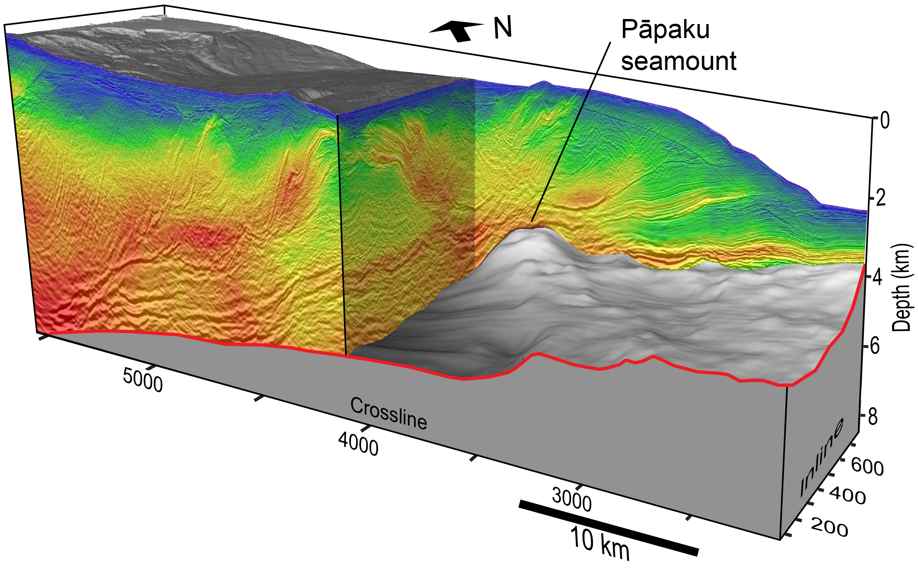
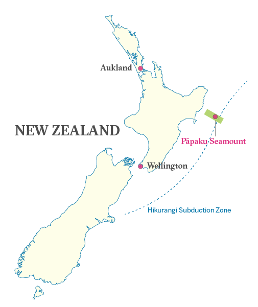
The research was led by Nathan Bangs, a senior research scientist at the University of Texas Institute for Geophysics. In 2018, Bangs led an ocean seismic survey that resulted in the first ever 3D scan of a large subducting seamount. Known as the Pāpaku Seamount, the long extinct volcano lies some three miles under the seafloor inside the Hikurangi subduction zone off the coast of New Zealand.
Images from the scan show the seamount colliding with the subduction zone and the pattern of stresses, fluids and sediments surrounding it. Previous models suggested sediments are pushed down the subduction zone ahead of the seamount, but the scan revealed something different: a massive sediment trail in Pāpaku’s wake.
In another surprise, the scientists spotted the fading trail of a much larger seamount that had long since sunk beneath New Zealand’s North Island.
According to Bangs, the discovery suggests that sinking seamounts drag down enough water-rich sediment to create conditions in the crust suitable for slow slip earthquakes, at least in New Zealand.
“That older one seems to be very much linked to an uplifted ridge that’s really in the bullseye of where recent slow slip activity has been,” Bangs said. “There could be other places like Cascadia (in the U.S. Pacific Northwest) that have subducting seamounts and a lot of sediment, but because the subducting crust there typically has less water than Hikurangi, they may be less likely to have the same kind of shallow slow slip activity.”
Slow slip earthquakes are slow motion versions of large earthquakes, releasing similar levels of pent-up tectonic energy but in a harmless creeping fashion that can take days or weeks to unfold. Scientists believe that the make-up of the crust is a major factor in how tectonic energy is released, with softer, wetter rocks allowing plates to slip slowly, while drier, brittle rocks store energy until they fail in violent and deadly megaquakes.
The new findings reveal how those conditions sometimes come about and importantly, said Bangs, tell scientists what to look for at the world’s other subduction zones.
The research and seismic survey were funded by the National Science Foundation and similar scientific agencies in New Zealand, the United Kingdom and Japan. The University of Texas Institute for Geophysics is a research unit of the Jackson School of Geosciences.
For more information, contact: Anton Caputo, Jackson School of Geosciences, 210-602-2085; Monica Kortsha, Jackson School of Geosciences, 512-471-2241; Constantino Panagopulos, University of Texas Institute for Geophysics, 512-574-7376.