
Creating Virtual Field Sites of Moroccan Reefs
December 5, 2022
The expanded section provides visible examples of extinction induced changes.
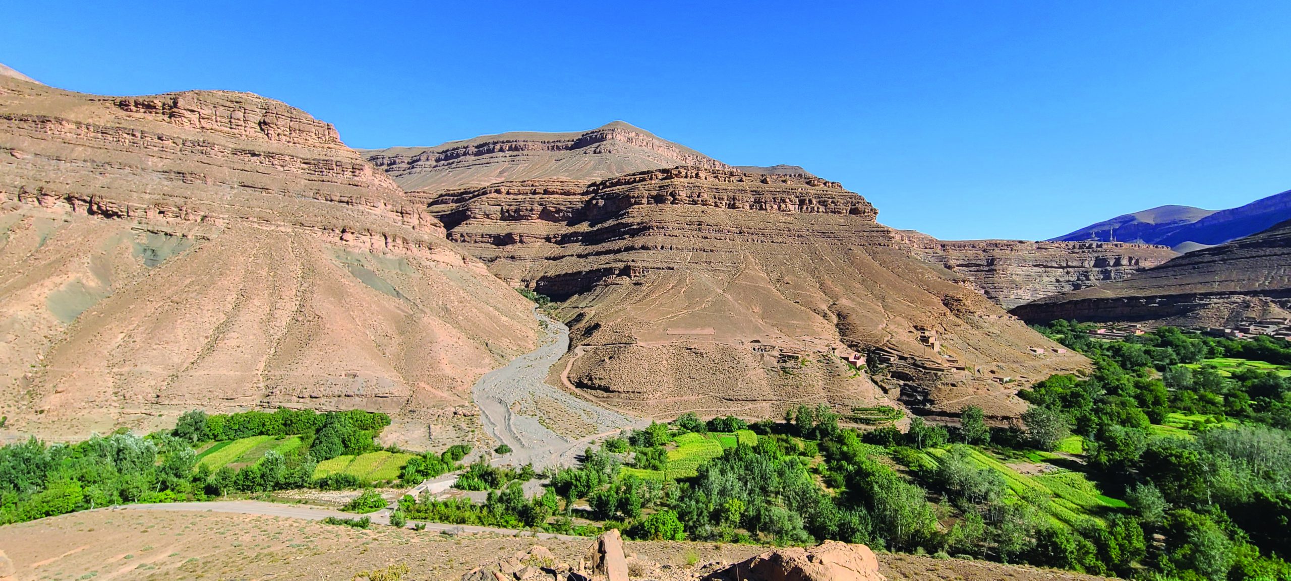
In the fall of 2021, Dr. Rowan Martindale, Tanner Fonville of the Martindale Lab, and I did fieldwork in the Central High Atlas Mountains of Morocco. We’re studying how a series of mass extinctions that occurred during the Early Jurassic affected reef ecosystems by collecting hand samples from field sites across the mountain range. It was our first time back in the field since the pandemic had begun and delayed this trip by more than a year, so we needed to make up for lost time.
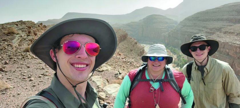
Martindale lab. Left to Right: Travis
Stone, Rowan Martindale, Tanner
Fonville.
We spent a month in the field and collected more than 500 hand samples to build a dataset for my dissertation. I used many of these samples to make thin sections for point counting, so I could quantify each reef’s community and structure. In addition to studying the reefs though, I also wanted to create new ways to teach people about them. This led me to partner with Ryan Petterson, of Stanford University, to create virtual field sites for each of our actual sites in Morocco. This would be helpful in a few ways. First, due to some travel restrictions still in place, not all of the members of our lab were able to travel with us, so the virtual sites would allow those lab members to better visualize the locations. Second, I’m working towards making guided virtual field trips to accompany future publications, so virtual field sites were a necessary starting place.
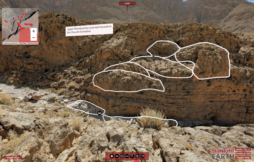
While we were collecting our samples, Dr. Martindale and I would pause whenever we moved to a new area and use the Google Street View app on our smartphones to create a 360° photosphere by stitching together 32 individual pictures. We were sure to include key features of each site, and include frequent enough photospheres to make line-of-sight connections between each one possible.
The GPS coordinates in each photosphere’s metadata allows us to connect them on a map in a program called Pano2VR, where other helpful info can be augmented into the virtual sites like strat columns, geologic maps, and on-site lectures. The virtual sites themselves are a lot of fun to explore, and the potential for this augmented imagery to inform our own lab members and other researchers is something we’ll be investigating over the next few years as I continue to expand and improve them.
Travis Stone,
Doctoral candidate
Back to the Newsletter