
Dissecting a Glacier
October 22, 2014
A decade of research on Thwaites Glacier has greatly advanced knowledge of the West Antarctic Ice Sheet’s potential contribution to sea level rise
By Tim Green
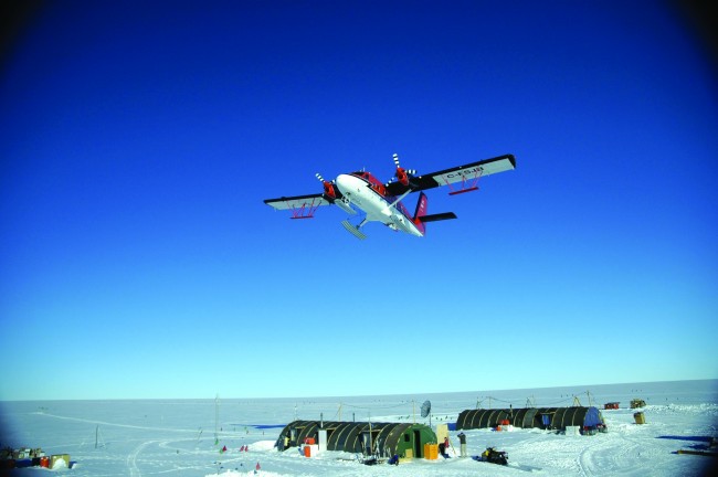
About a decade ago, a de Havilland Twin Otter aircraft flew back and forth over an area the size of New Mexico in the West Antarctic Ice Sheet, sending radar signals deep into Thwaites Glacier.
The plane made three trips a day, six days a week, flying about 600 meters above the stark, white surface—except where a volcano poked out of the ice here and there.
On board, researchers from the University of Texas at Austin’s Institute for Geophysics (UTIG) operated the radar and instruments that measured gravity and magnetism.
In all, they collected about a terabyte of data in the survey of Thwaites.
Then they deployed UTIG’s characteristic combination of developing innovative radar technology and geophysical expertise to mine the data for crucial information about Thwaites.
Over the decade since the survey, UTIG geophysicists have revealed the glacier’s size, shape and how precariously it is situated on the West Antarctic Ice Sheet, as well as the complex water and geothermal systems under the glacier.
“These are big problems that take time,” said Don Blankenship, a senior UTIG researcher and a leader of the project. “That’s what we tackle here at Texas.”
More than 70 research papers and other scientific presentations have come out of the expedition, known as the Airborne Geophysical Survey of the Amundsen Sea Embayment, Antarctica (AGASEA).
The detailed physical characteristics of the glacier that UTIG research has produced have helped sharpen computer models of climate change and sea level rise.
The project was just one of UTIG’s numerous investigations that have extended across the Antarctic continent.
The AGASEA expedition was one of the largest field projects in Antarctic exploration when conducted in the 2004-2005 austral summer. UTIG researchers Jack Holt, David Morse and Blankenship led the project, which the National Science Foundation funded with $1.6 million.
Work on the expedition began even earlier. UTIG researchers started to build support for it in 1997. For the next seven years, the UTIG team found funding and scientific partners and improved the radar technology.
Mammoth Task
The area to be surveyed was big, even for a research group from Texas. To cover the survey area, UTIG teamed up with the British Antarctic Survey (BAS). UTIG flew radar runs over Thwaites and the British surveyed the neighboring Pine Island Glacier.
In making their case for the survey, UTIG researchers pointed out that scientists realized the West Antarctic Ice Sheet was the potential source of up to 5 meters of sea level rise because of climate change. Yet, UTIG researchers noted, its isolation—more than 2,000 kilometers from McMurdo Station, the main U.S. base on Antarctica—made it logistically difficult to study.
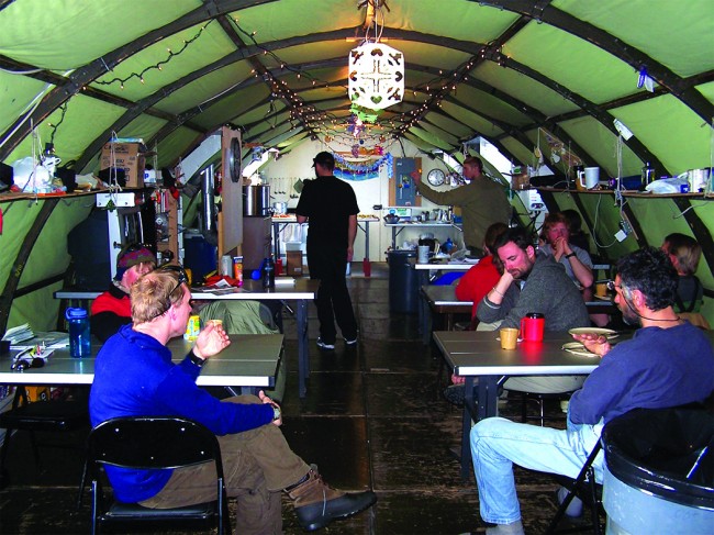
In practice, the research was difficult to stage, but doable. For example, two refueling stops had to be set up for the C-130 aircraft that supplied the Twin Otter with fuel.
Overall, the UTIG and BAS teams made 107 flights and flew 60,000 kilometers to collect data.
Between flights, researchers checked the collected data to make sure the instruments were operating correctly.
“There was a lot of work in getting the data quickly processed,” said Duncan Young, now a UTIG research associate whose first expedition was AGASEA. “Are we seeing what we’re supposed to be seeing? Are we flying where we’re supposed to be flying?”
When the team returned to Austin, they set to work processing and analyzing the data. The first task was to determine the glacier’s core shape, Young said.
Undergraduates helped with some of the less technical tasks while the researchers fine-tuned the processing methods for understanding the radar data. The computational work was done on a high-performance system at the university’s Texas Advanced Computing Center.
The first result was a 2006 paper that comprehensively showed that Thwaites Glacier was more likely than the Pine Island Glacier to contribute to a massive release of ice from the West Antarctic Ice Sheet because it is more directly connected to the rest of the ice sheet.
They found that Thwaites’s interior lies more than 2 kilometers below sea level while, at the coast, the bottom of the glacier is shallow.
Because its interior connects to the vast portion of the West Antarctic Ice Sheet that lies deeply below sea level, the glacier is considered a gateway to the majority of West Antarctica’s potential sea level contribution.
The collapse of Thwaites Glacier would cause an increase of global sea level of between 1 and 2 meters, with the potential for more than twice that from the entire West Antarctic Ice Sheet.
Since then, UTIG researchers have worked with the data to extract more information about Thwaites. The most recent papers from the AGASEA expeditions were published in 2013 and 2014.
Clearing the Noise
Dustin Schroeder arrived at the university in 2007 with undergraduate degrees in electrical engineering and physics from Bucknell University. He applied both degrees in working with the Thwaites Glacier radar data.
Radar data of Antarctica has been collected from the air since the 1970s, Blankenship said. But technologically, it was the equivalent of radio where you just hear noise, not words.
In 2000, UTIG researchers started to work on understanding the phase of the signal coming back.
“These are called phase coherent radars,” Blankenship said. “That’s like the difference between AM and FM radio. We’re using the phase to make the signal clearer and understand more about it.”
Schroeder’s original work was to process the radar return so that you could tell when the signals were in phase and when they weren’t.
In a 2013 paper, Schroeder showed that Thwaites’ subglacial water system consists of a swamp-like canal system several times as large as Florida’s Everglades lying under the deep interior of the ice sheet, shifting to a series of mainly stream-like channels downstream as the glacier approaches the ocean.
The findings suggested that the dynamics of the subglacial water system may be as important as well-recognized ocean influences in predicting the fate of Thwaites Glacier.
Schroeder’s work was instrumental in drawing the information from the radar data.
Previously, scientists had attempted to use ice-penetrating radar to characterize subglacial water, but the effects of ice temperature on radar made it difficult to confirm the spread of water systems and how they were organized.Schroeder’s technique looked at the geometry of reflections and solved the problem, because the temperature of the ice does not affect the angular distribution of radar energy.
With that water information in hand, Schroeder and the UTIG team published another paper that showed how they were able to estimate ice melting rates and thus identify significant sources of geothermal heat under Thwaites Glacier. They found these sources are distributed over a wider area and are much hotter than previously assumed.The geothermal heat contributed significantly to melting of the underside of the glacier, and it might be a key factor in allowing the ice sheet to slide, affecting the ice sheet’s stability and its contribution to future sea level rise.
Unique Combination
Schroeder said UTIG is one of the few places where researchers are as interested in developing and applying radar technology as they are in the geophysics of research.
“UTIG takes a radar scientific approach to data and a geophysical approach to ice,” he said. “And we put those together to answer the important problems. There are just a few environments that encourage this in those two ways and very few groups who enjoy both.”
Schroeder, who received a Ph.D. in geophysics in May 2014, said the UTIG approach encourages hard thinking on both fronts that can result in novel research.
“That’s what Texas is good at,” Blankenship said. “That’s what the Institute for Geophysics is here for. We’re here to understand the techniques from the perspective of what they tell us about Earth problems.”
It comes down to the appropriate instrument.
“Here radar is the right tool and we understand the whole signal and we build our own instruments for this stuff,” he said. “We understand how to tune the instrument to solve the problem.”
Back to the Newsletter