Salt of the Earth: Martin Jackson Rises to the Top of Salt Tectonics Research
November 8, 2013
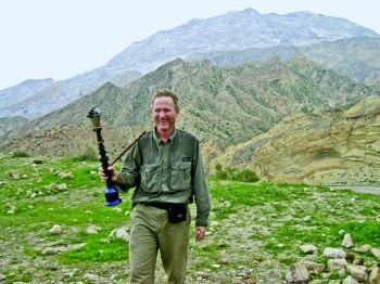
When he came to the Bureau of Economic Geology in 1980, Martin Jackson was a hard-rock kind of guy. He was grew up in what was then Rhodesia (today, Zimbabwe), prospected for minerals there and in South Africa and Namibia, studied the metamorphic history of Precambrian gneisses in the Forbidden Area of the Namib Desert and taught structural and metamorphic geology at the University of Natal in South Africa. The geology he knew in southern Africa tended to be old, hard rocks sampled and mapped in outcrops. Nothing about his background suggested he might become the world’s leading expert in salt tectonics, the study of the structure and movement of salt. Then after ten years he came to Texas and it was back to basics.
“I was plunged into a subsurface world of very young, soft rocks,” he says. “It was a major retooling when I got here.”
His first project was evaluating Oakwood salt dome in East Texas as a possible federal repository for high-level nuclear waste. His part of the Department of Energy (DOE)-funded project was to determine whether the salt was tectonically stable or not. Would the waste stay where it was put after millennia? After a few years of research, the whole study became moot when Congress directed the DOE to stop work on salt domes and focus on Yucca Mountain in Nevada.
Not long after, Bill Fisher, director of the Bureau at the time, called Jackson down to his office.
“He said, ‘Jackson, it’s time to bring in the groceries,’ meaning that instead of being part of a large funded team, I had to attract support to replace the DOE by starting something completely new,” recalls Jackson.
So he hatched a plan to build a physical modeling lab, which he dubbed the Applied Geodynamics Laboratory (AGL), to investigate the poorly understood world of salt tectonics. No such lab existed in the U.S. To augment seed money from UT Austin, he visited 13 oil and gas companies and asked them to join a consortium which would become one of the first two Industrial Associate programs at the Bureau and a model for several more programs later created by others. Marcus Milling, associate director of the Bureau at the time, helped him make some of those early pitches. Happily, all 13 companies accepted the offer.
At the time, says Jackson, the field of salt tectonics was “moribund.” An NSF program manager assured him in 1981 that “the NSF would never waste funds on such a dead topic as [salt] diapirism.” (A salt diapir is a blob of salt that has pierced, or appears to have pierced, surrounding sediments and is typically shaped like a plug or a ridge.) Because salt is impermeable and can trap oil and gas, knowing the location and shapes of salt domes was useful in finding hydrocarbons, but that’s about as far as geologists understood salt diapirs. Their interest was all very applied. Few geologists were interested in how salt domes got to be where they were or how they related to the overall evolution of continental margins.
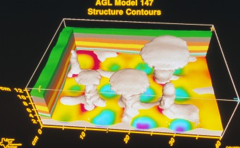
Jackson imagined that the AGL, which began in 1988, would run for perhaps three or four years and then wind down.
Fast forward 25 years. The AGL now has 32 participating companies and is widely considered the world’s preeminent salt-tectonics laboratory. The AGL has brought in nearly $20 million in research funding to the university. Jackson and his colleagues undoubtedly delivered the groceries.
Some of the hottest areas in the world for oil and gas exploration today are deepwater salt basins such as the Gulf of Mexico, the North Sea, the Persian Gulf, the Caspian Sea area, and offshore Brazil and West Africa. Petroleum companies are spending billions of dollars in these areas searching for the next giant field. It’s hard to imagine that the salt frontier would have been cracked open without the string of key insights that have sprung from the AGL.
Jackson too has risen diapir-like to the top of his field.
“He’s the number one person in the world by a goodly margin,” says Michael Hudec, senior research scientist and co-principal investigator at the AGL. “His papers are universally regarded as the most authoritative on salt tectonics. And his name is associated with most of the major concepts in salt tectonics.”
Jackson doesn’t consider himself a petroleum geologist, yet his work has had such an impact on the field that the American Association of Petroleum Geologists has awarded him more technical awards than anyone else, including what amounts to a lifetime achievement award, the Robert R. Berg Award for Outstanding Research. Likewise the Geological Society of London recently awarded him one of its highest honors, the William Smith Medal, which recognizes outstanding contributions to applied and economic aspects of geoscience.
Inspiration
The seeds of the AGL’s success were planted near the end of the research project on a proposed east Texas nuclear waste repository. Even after four years working on a salt dome, Jackson realized he still didn’t fully understand the mechanics of salt tectonics. So he headed to Uppsala, Sweden to work with the leading light on the subject, Chris Talbot.
“He has influenced my career in salt tectonics more than any other person,” says Jackson. “He’s one of these clever, creative and original thinkers. In the early 1980s he alone was advancing the frontiers of salt tectonics.”
Talbot’s lab, which was named after Hans Ramberg who started it, was considered the best tectonic modeling lab in the world at the time. At its center were two big centrifuges that whirled around fist-sized models generating thousands of times normal gravity. That meant you could use stiff materials to mimic rock, sediments and salts and they would flow easily under these high gravity forces, but when you took them out and cut them, they would maintain their shape and intricate structures like slices of marbled rye bread.
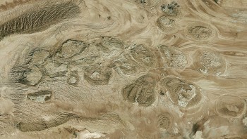
Together, with some of his remaining DOE funds, Jackson and Talbot created models of salt structures in the Great Kavir in Iran. The largest salt desert in the world, the Great Kavir, looks like endless plains of mud flats studded with low hills. Those hills are the tops of salt diapirs. The researchers saw in their models an astonishing process: salt diapirs could coalesce near the surface, like individual trees merging into a high forest canopy. When they reviewed photographic and geologic evidence from the Great Kavir, they recognized similar structures to those they had modeled in the centrifuge. They dubbed the coalesced salt diapirs a salt canopy.
From above, a salt canopy looks like a single, huge, lobed mass of salt. Their key insight was that if salt diapirs were shaped like trees, there would be a lot of extra space around and between the trunks that wasn’t filled by salt. Instead, there were sedimentary rocks and fluids, including maybe, just maybe, hydrocarbons. Within a short time, much larger salt canopies were found in great abundance by the oil industry in the northern Gulf of Mexico and later in basins such as offshore Angola and the Precaspian Basin of Kazakhstan.
“Some of these canopies are very thin and if you drill past this salt, you pass into enormous thicknesses of sediment,” says Jackson. “Here underneath the canopy, you might find subsalt treasure.”
After two formative months in Talbot’s lab, Jackson had his inspiration for a physical modeling lab at the Bureau.
“This was part of my initial sales pitch to the companies,” says Jackson. “I’d say, ‘Have you heard of a salt canopy?’ And of course very few people had. They were intrigued to learn more.”
A Great Ride
From its earliest days, the AGL has been fertile ground for salt tectonics research. In 1992, Jackson and his collaborator Bruno Vendeville published a set of papers that flipped the field on its head.
For 50 years, scientists had assumed that all of salt tectonics could be explained by treating salt bodies and the sediments surrounding them, called overburden, as stiff fluids. To make a physical model in the lab, you simply placed a denser fluid to represent the overburden on top of a less-dense fluid to represent salt. As the denser fluid sank, the buoyant fluid simulating salt was forced to rise as diapiric blobs through the sinking overburden. Along with scientists at Rennes University in France, Jackson and Vendeville believed this view was flawed because almost all overburden sediments are brittle and stronger than salt so that instead of flowing, the overburden tends to crack into pieces.
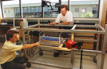
“It was thought that the salt would rise up like a fist from the deep, blasting its way through everything on top,” says Michael Hudec. “In most cases, that’s not true. Salt can only rise when sediment permits it to rise.”
Unlike fluids, brittle materials can resist small forces, such as the buoyancy of less dense salt. As the deforming forces increase, the brittle overburden breaks as faults. And that allows salt to move.
“Their insights changed the world,” says Hudec. “Much of the literature became obsolete. For oil companies, every presentation that described how a salt structure grew had to change. You cannot work effectively in salt tectonics without reading Martin’s work.”
And the hits kept coming. Today, it’s almost impossible to talk about salt tectonics without using terms and concepts developed at the AGL, including salt canopy, salt weld, allosuture, autosuture, reactive diapir, falling diapir, squeezed diapir, extrusive salt sheet, multidirectional extension, cryptic extension, and mock turtle.
One key to the AGL’s success has been its ability to combine world-class physical models by colleagues Bruno Vendeville and Tim Dooley, numerical models especially by Dan Schultz-Ela and Maria Nikoulinaku, and industry seismic data exchanged through this industrial-academic consortium.
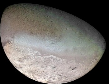
Following his boundless curiosity, Jackson has also hunted for signs of salt-tectonic activity on other planetary bodies. Applying what he’s learned from lab models, seismic data and terrestrial field work, he explained how a puzzling canyon on Mars five times as large as the Grand Canyon likely formed as an enormous karst chasm, whose collapse triggered the rise of diapirs and outflow of a pale viscous material that may include salts. He also revealed a diapiric mechanism that makes parts of the surface of Neptune’s icy moon Triton dimpled like the skin of a cantaloupe.
In 2008, Jackson and two colleagues, David Roberts and Sig Snelson, published the AAPG Memoir Salt Tectonics: A Global Perspective, a definitive book on the subject.
In 2012, Jackson and Hudec produced the much-anticipated digital and paper atlas The Salt Mine, an interactive resource about salt tectonics. The most comprehensive collection of salt-tectonic images and animations ever assembled, the atlas contains more than 1400 images of salt structures around the world, including field exposures, seismic sections, geologic cross sections, conceptual sketches, animations and AGL’s physical models.
Jackson and Hudec are now writing a textbook on salt tectonics. Even after decades of research, and writing over 100 scientific papers and three books, Jackson says the textbook project is revealing new aspects of salt tectonics he had never studied previously.
According to Hudec, there are three traits that make Jackson such an effective scientist: great people skills, healthy skepticism and openness to different viewpoints.
“First, he’s a great guy, which means anybody and everybody wants to collaborate with him,” says Hudec. “Second, he’s very good at ignoring conventional wisdom when the data point in the other direction. And third, he doesn’t insist on being right. Some people, when they become famous, become the authority beyond question. That’s not Martin, he’s still open to debate and changing his mind.”
For his part, Jackson attributes much of his success to being in the right place at the right time. Petroleum exploration in the 1980s and 1990s was moving out into deeper and deeper water, where salt tectonics became more and more complicated. When he began, there was a vacuum of researchers and fundamental knowledge in salt tectonics even in much simpler settings.
“The whole salt tectonics thing could have worked out completely differently,” says Jackson. “I could have been continuing to work in a field that I enjoyed but nobody was interested in and was of no practical use. And fortuitously, salt tectonics became of vital practical importance to industry. It was pure chance that I had a head start in understanding the topic when it began attracting so much interest.”
by Marc Airhart
