
Dissecting Hill Slopes
October 21, 2021
A first-of-its-kind study has found that rock weathering and water storage appear to follow a similar pattern across undulating landscapes where hills rise and fall for miles.
The findings are important because they suggest these patterns could improve predictions of wildfire and landslide risk and how droughts will affect the landscape, since weathering and water storage influence how water and nutrients flow throughout landscapes.
“There’s a lot of momentum to do this work right now,” said study co-author Daniella Rempe, an assistant professor in the Department of Geological Sciences. “This kind of data, across large scales, is what is needed to inform next-generation models of landsurface processes.”
The research was led by Michelle Pedrazas, who conducted the work while earning a master’s degree at the Jackson School of Geosciences. It was published in the Journal of Geophysical Research: Earth Surface.
Despite the importance of what’s happening inside hills, most computer models for simulating landscape behavior don’t go deeper than the soil due to a lack of data that can scale to large areas, Rempe said. This study helps fill that knowledge gap, being the first to methodically sample the interiors of a sequence of hill slopes.
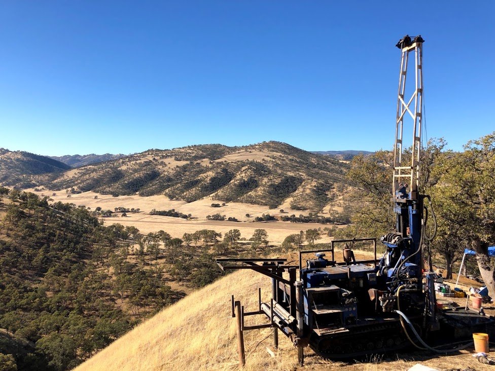
The research focused on investigating the “critical zone,” the near surface layer that includes trees, soils, weathered rock and fractures. The research site in Northern California is part of a national network of Critical Zone Observatories. The scientists drilled 35 boreholes across a series of hill slopes and their valleys to collect subsurface samples and other data. They also collected a core sample at the peak of each hill slope that captured the entire height of the hill.
Back to the Newsletter