
The Q&A: Todd Caldwell
February 11, 2015
 With each issue, Trib+Water brings you an interview with experts on water-related issues. Here is this week’s subject:
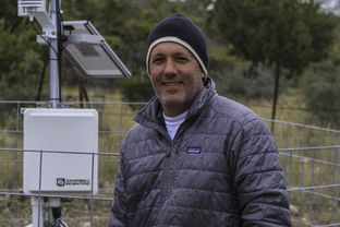
Todd Caldwell is a hydrologist and geoscientist at the Bureau of Economic Geology at the University of Texas at Austin. He specializes in field investigations and numerical modeling associated with soil and vadose zone processes and its application to remote sensing of water resources. His current research focuses on soil moisture monitoring, modeling and scaling, as well as soil-plant interactions, near-surface geophysics and evapotranspiration. Caldwell is currently the principal investigator at the bureau for NASA’s Soil Moisture Active Passive satellite project, or SMAP, to measure and model soil moisture.
Editor’s note: This interview has been edited for length and clarity.
Trib+Water: How did you get involved in this satellite project to measure the state’s soil condition?
Todd Caldwell: Soil moisture is one piece of the whole water cycle, and it has kind of always been the overlooked one, which is why SMAP came about. The measurements weren’t there. There is not very much water in the ground right now to use for this data. Until now, everything has come out of a numerical model for the last decade or so, and there are a lot of flaws in that. We showed some flaws in a 2013 paper that showed in Texas during the 2011 drought, we lost somewhere around 62 cubic kilometers of water total, which is a ton.
Texas Tribune, Feb. 10, 2015
Featuring Todd Caldwell, research associate at the Bureau of Economic Geology