
Martian Mirage
December 5, 2022
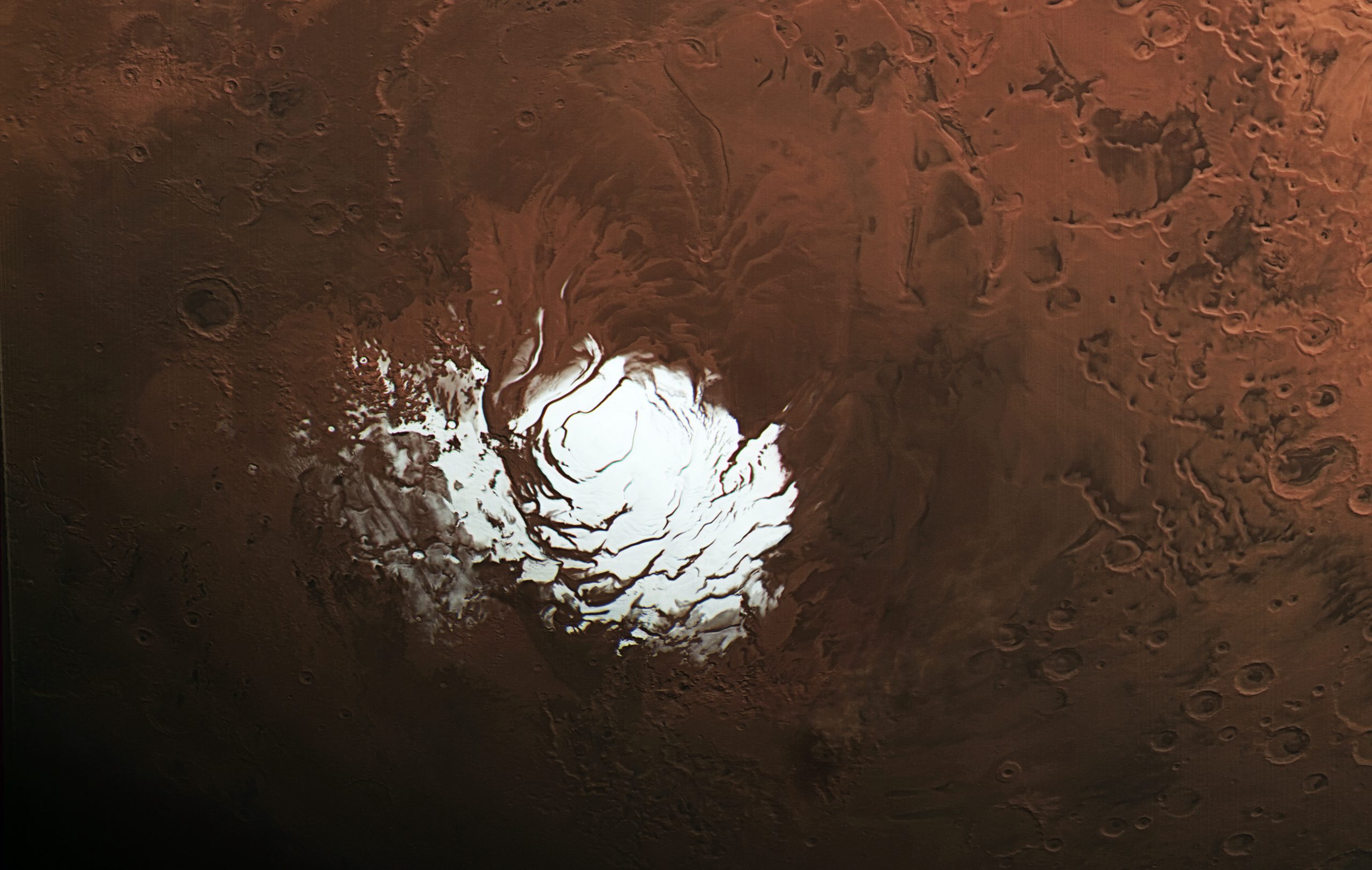
Liquid water previously detected under Mars’ ice-covered south pole is probably just a dusty mirage, according to a new study of the red planet led by researchers at the University of Texas Institute for Geophysics (UTIG).
Scientists in 2018 had thought they were looking at liquid water when they saw bright radar reflections under the polar cap. However, the study published in the journal Geophysical Research Letters found that the reflections matched those of volcanic plains found all over the red planet’s surface.
The researchers think their conclusion — volcanic rock buried under ice — is a more plausible explanation for the 2018 discovery, which was already in question after scientists calculated the unlikely conditions needed to keep water in a liquid state at Mars’ cold, arid south pole.
“For water to be sustained this close to the surface, you need both a very salty environment and a strong, locally generated heat source, but that doesn’t match what we know of this region,” said the study’s lead author, Cyril Grima, a planetary scientist at UTIG.
The south polar mirage dissolved when Grima added an imaginary global ice sheet across a radar map of Mars. The imaginary ice showed how Mars’ terrains would appear when looked at through a mile of ice, allowing scientists to compare features across the entire planet with those under the polar cap.
Grima noticed bright reflections, just like those seen in the south pole but scattered across all latitudes. In as many as could be confirmed, they matched the location of volcanic plains.
On Earth, iron-rich lava flows can leave behind rocks that reflect radar in a similar way. Other possibilities include mineral deposits in dried riverbeds.
Grima’s map is based on three years of data from MARSIS, a radar instrument launched in 2005 aboard the European Space Agency’s Mars Express that has accumulated tremendous amounts of information about Mars.
Back to the Newsletter