
2020 Research Highlights
December 22, 2020
Despite the pandemic, 2020 was another great year for research at The University of Texas at Austin Jackson School of Geosciences. Check out some of the highlights from across the school.
Hot or Cold, Weather has Little Effect on Coronavirus Spread

Dev Niyogi, a professor in the Department of Geological Sciences, led a study that examined the relationship between coronavirus infection and weather across scales that ranged from counties in the United States to the world at large. At every level, the weather had almost no influence. >> READ MORE
A Giant Fossil Egg From Antarctica Might Belong to a Mosasaur
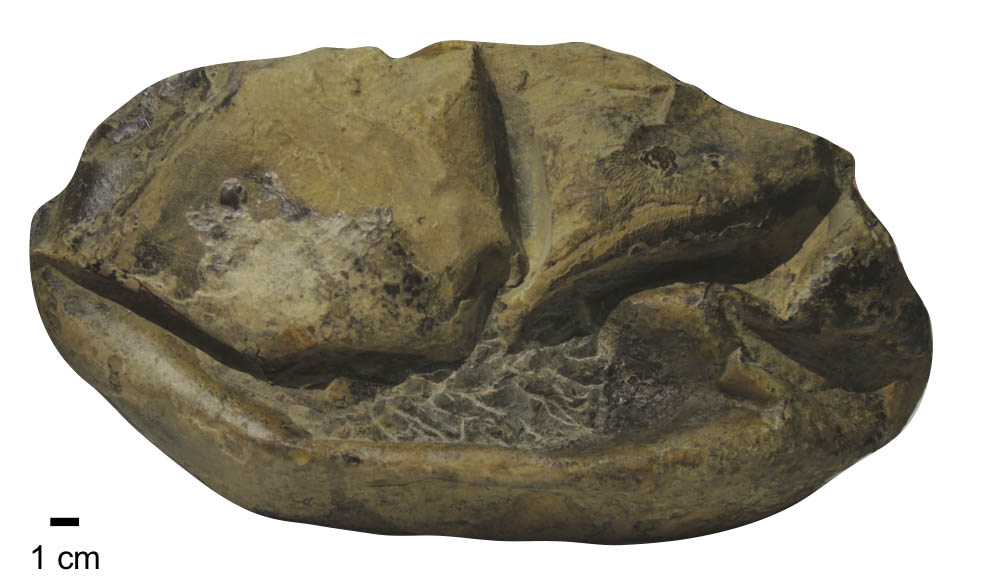
Postdoctoral fellow Lucas Legendre used microscopy to determine that a mysterious fossil nicknamed “the Thing” was a giant egg, confirming the hypothesis of Julia Clarke, a professor in the Department of Geological Sciences. >> READ MORE
Researchers Revealed How Methane Hydrates – A Potential Future Fuel – Form Massive Deposits
Doctoral student Dylan Meyer and collaborators built a computer model of gas bubbles flowing through hydrate deposits. The new model helps explain how some deposits grow into massive natural gas hydrate reservoirs, such as those found beneath the Gulf of Mexico. (Meyer is now a post doctoral researcher at Academia Sinica in Taipei.) >> READ MORE
The Age of Earth’s Inner Core Could be on the Younger Side
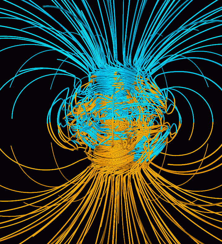
By creating conditions akin to the center of the Earth inside a laboratory chamber, Jung-Fu Lin, a professor in the Department of Geological Sciences, and collaborators have improved the estimate of the age of the planet’s solid inner core, putting it at 1 billion to 1.3 billion years old. >> READ MORE
Model Links Patterns in Sediment to Rain, Uplift and Sea Level Change
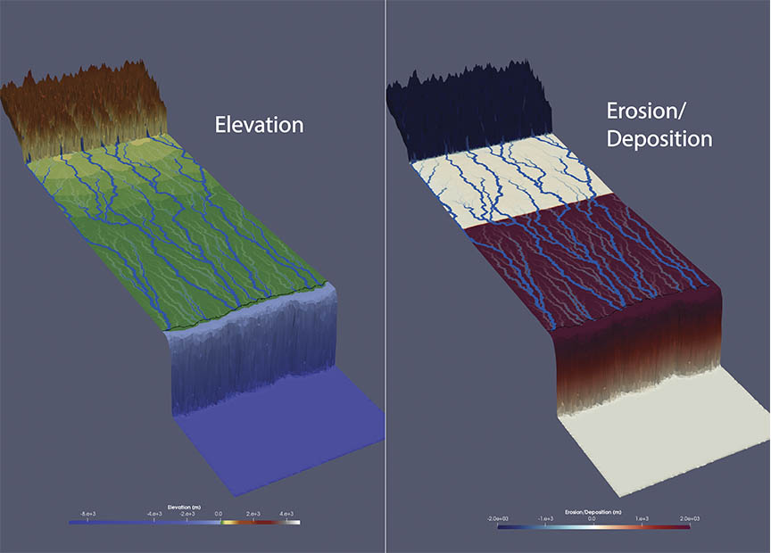
Jinyu Zhang, a research associate at the Bureau of Economic Geology, and collaborators created one of the world’s first “source-to-sink” 3D models that tracks how changes in precipitation, tectonic uplift and sea level influence sediment erosion and deposition. >> READ MORE
Reusing Water Produced by Hydraulic Fracturing Could be Key for Future Operations
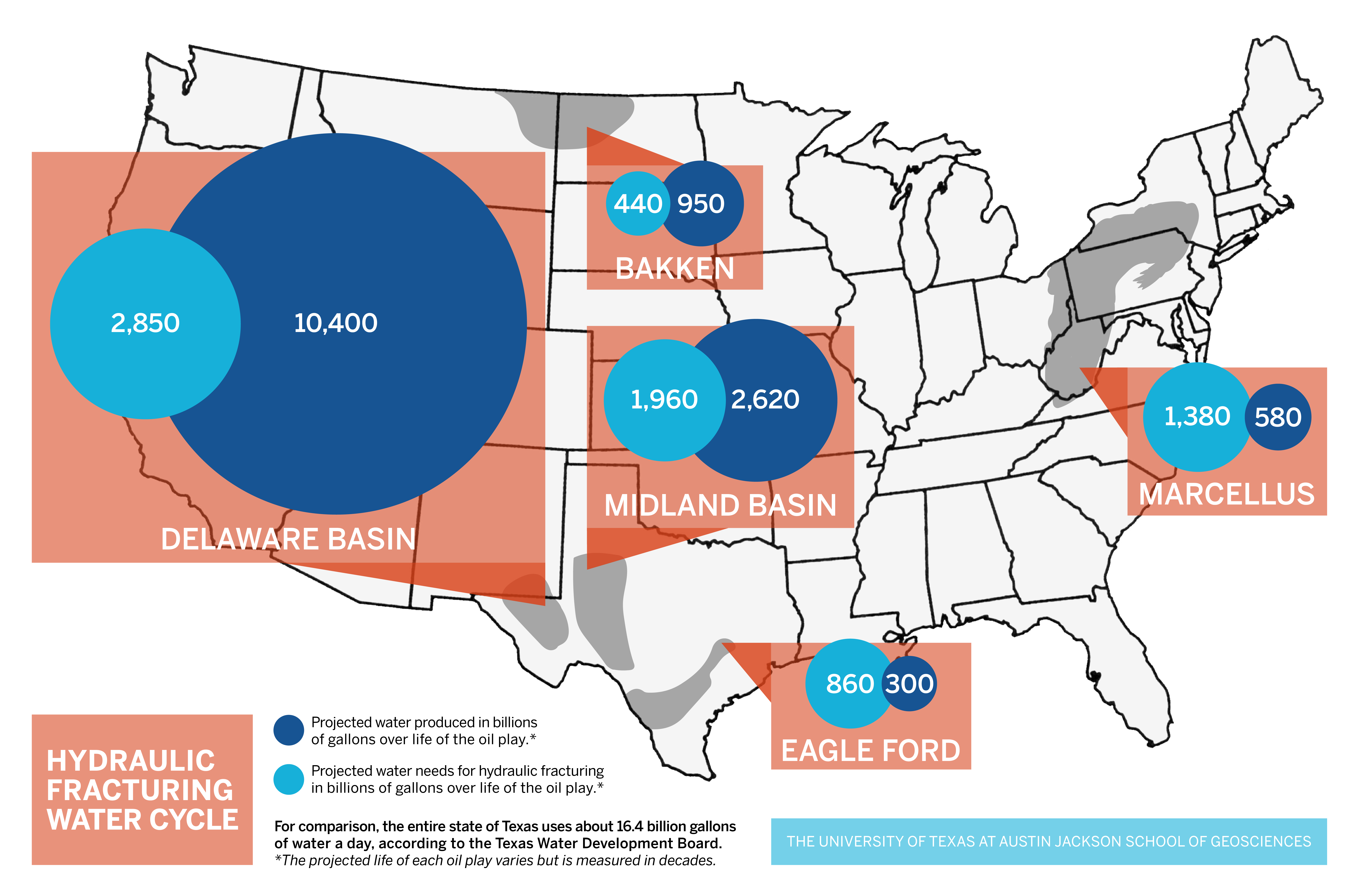
Bridget Scanlon, a senior research scientist at the Bureau of Economic Geology, is the lead author on two studies that examined water produced by hydraulic fracturing. The first study quantifies the amount of water that stands to be produced by major shale plays. The second examines potential uses for the water. >> READ MORE
Sinking Sea Mountains Might Trigger Earthquakes and Muffle Them, Too.
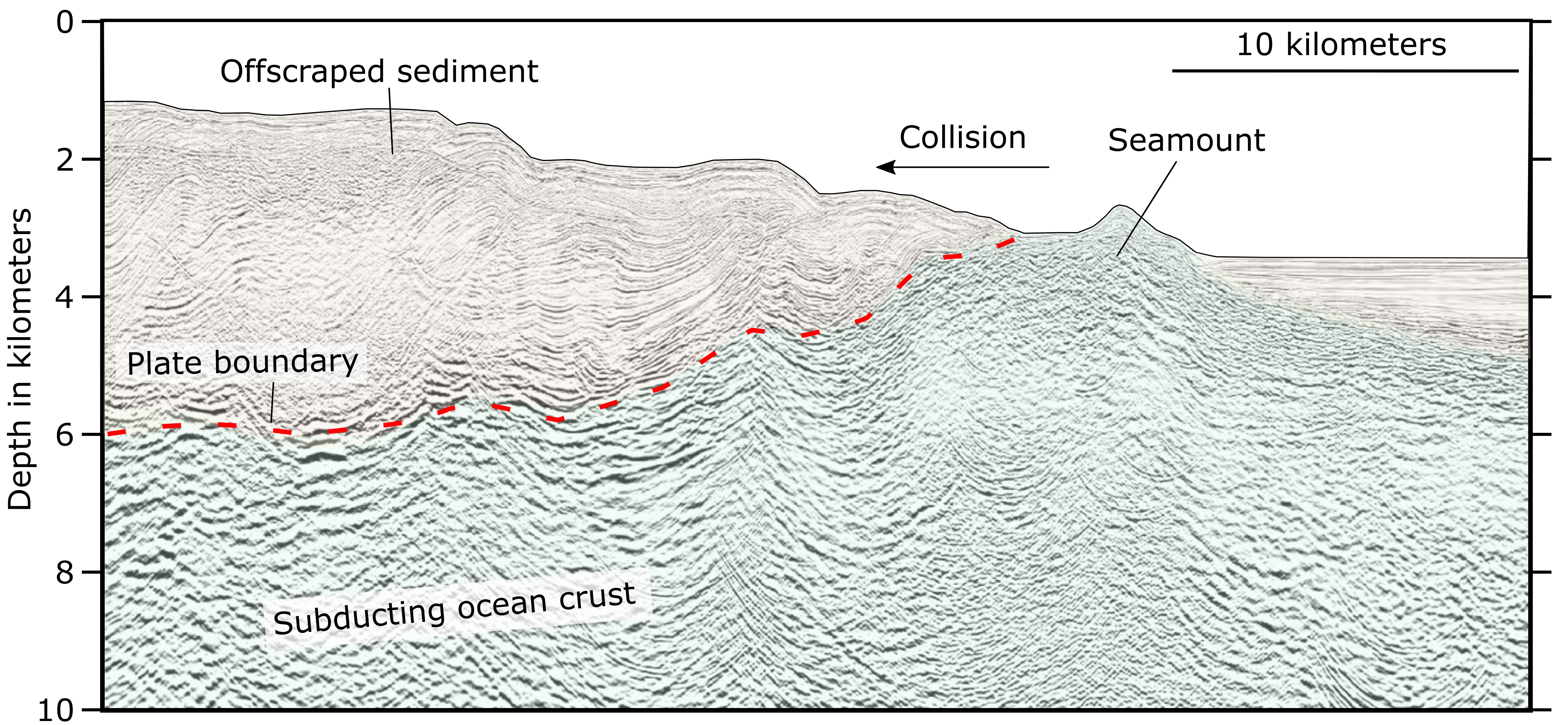
Research co-authored by Demian Saffer, the director of the University of Texas Institute for Geophysics, found that when underwater mountains are pulled into subduction zones, not only do they set the stage for these powerful quakes, but also create conditions that end up dampening them. >> READ MORE
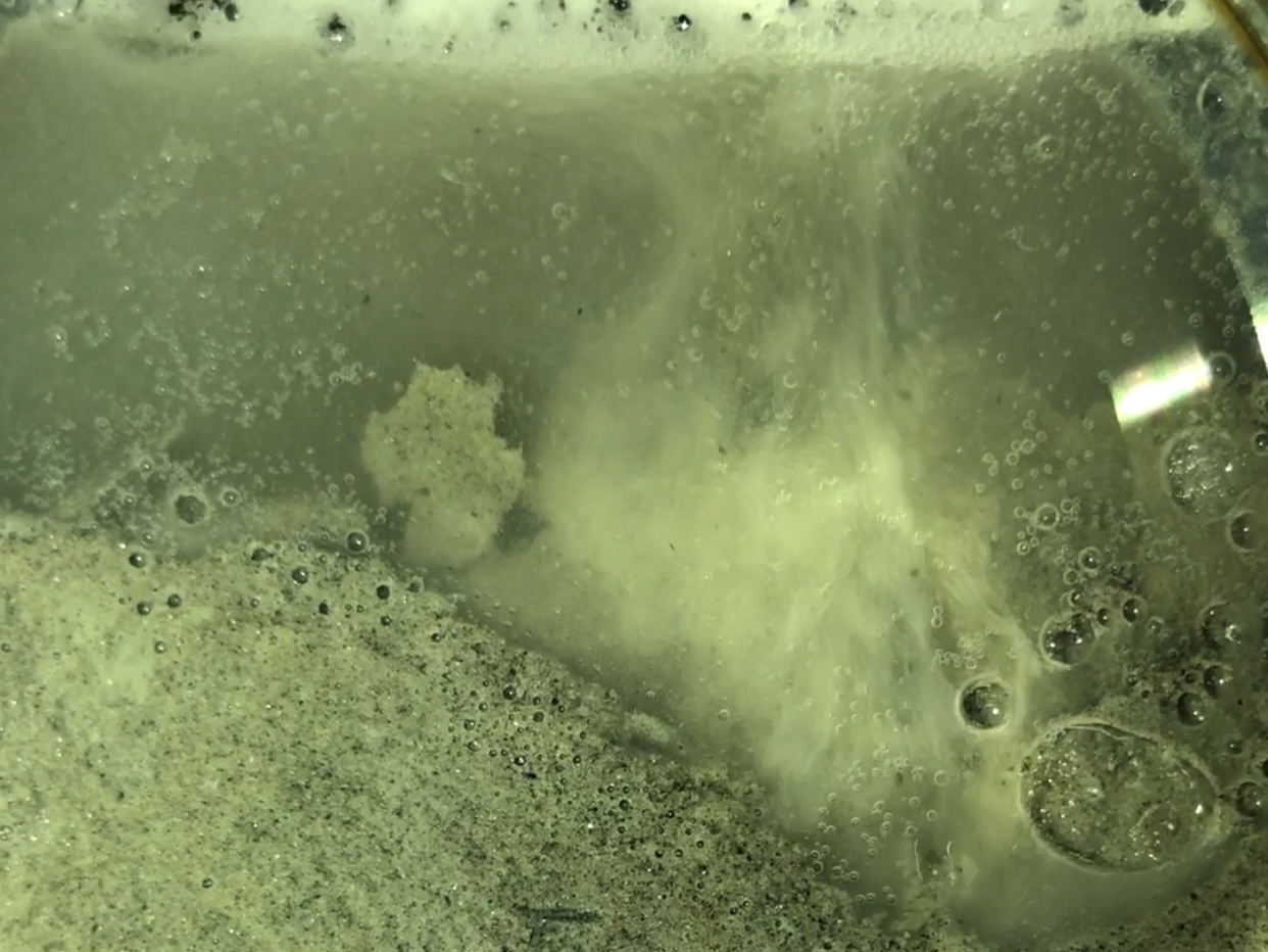
A CO2 Hotspot in the Philippines Could Host the Highest Levels of the Gas Recorded in Nature
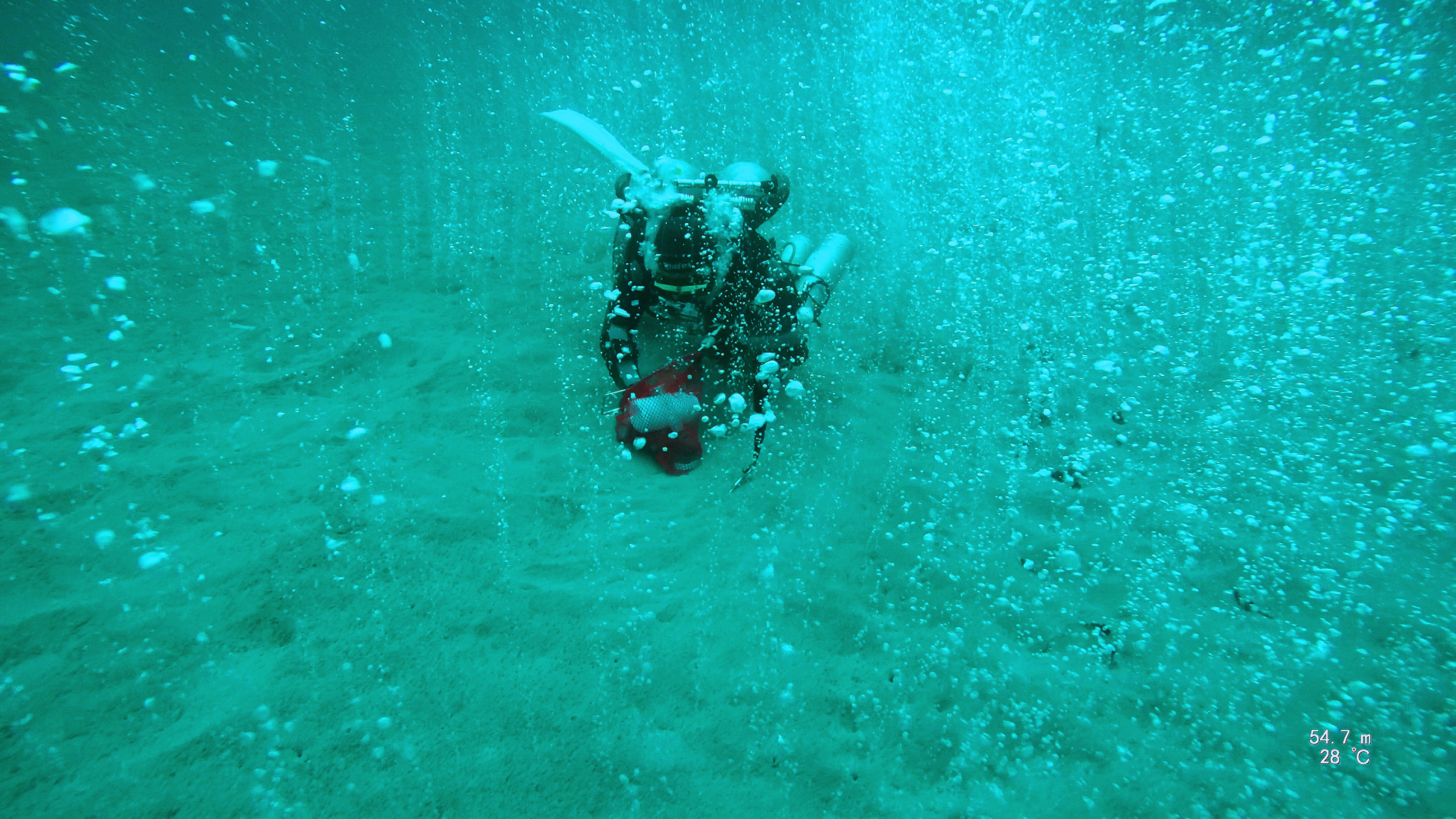
Diving 200 feet under the ocean surface to conduct scientific research can lead to some interesting places. For Bayani Cardenas, a professor in the Department of Geological Sciences, it placed him in the middle of a champagne-like environment of bubbling carbon dioxide with off-the-chart readings of the greenhouse gas. >> READ MORE
Key Indicators Discovered of Climate Change’s Impact on California Water Supply
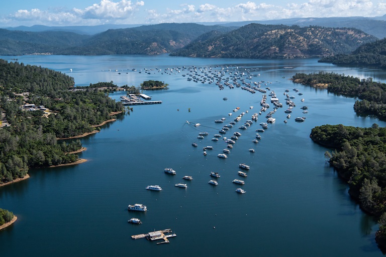
Determining how climate change is affecting water supplies is difficult in a state like California that swings between floods and droughts, but a study led by Geeta Persad, an assistant professor in the Department of Geological Sciences, found that climate models agree on key metrics that could help water managers in the Golden State. The study was conducted in collaboration with the Union of Concerned Scientists. >> READ MORE
Sustained Rainstorms May Have Filled Lake Beds and River Valleys on Mars Billions of Years Ago
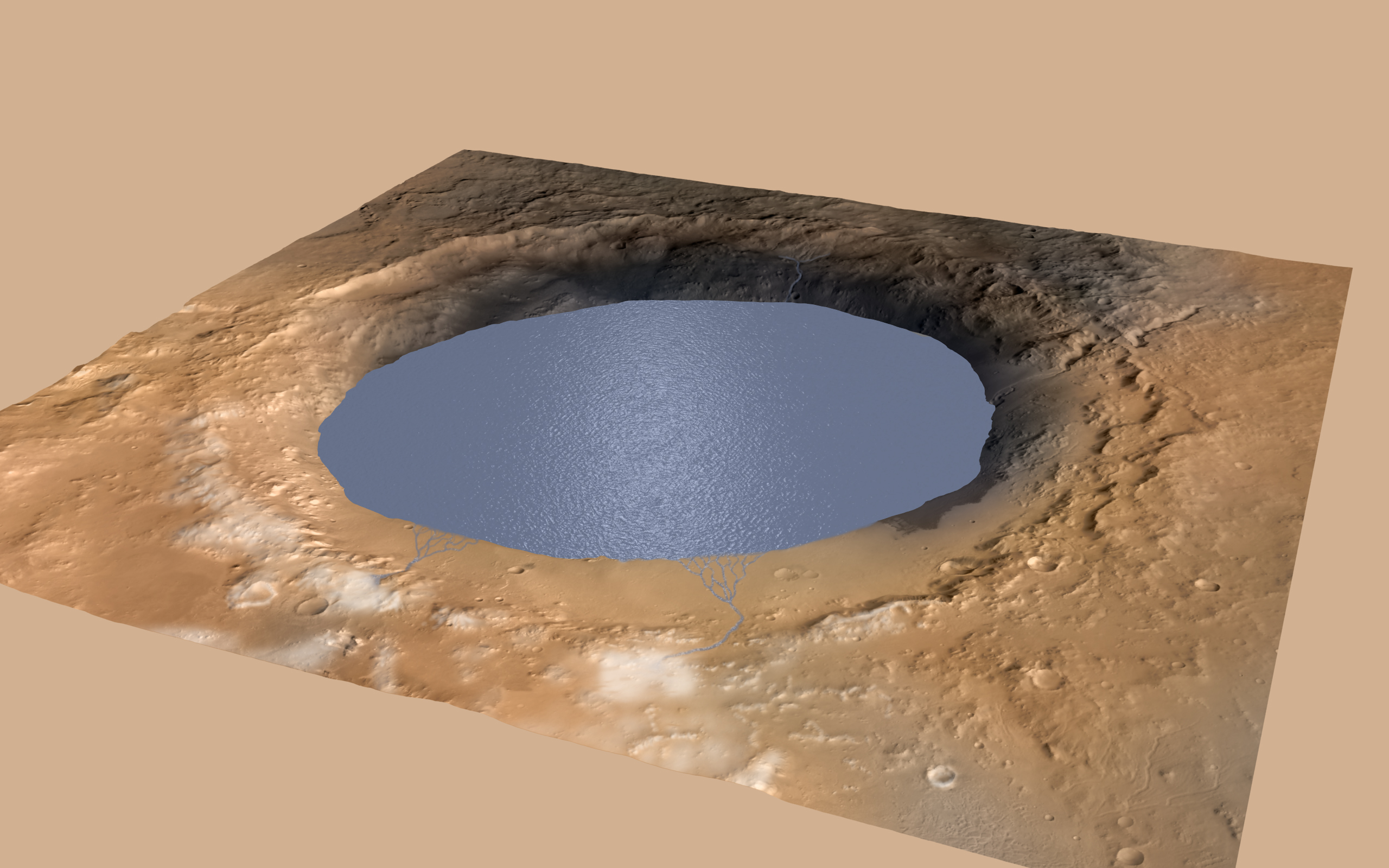
Gaia Stucky de Quay, a postdoctoral fellow, led research that examined rainfall on Mars billions of years ago. The research found that precipitation on the Red Planet must have been between 13 and 520 feet (4 to 159 meters) in a single episode to fill lakes and, in some cases, provide enough water to overflow and breach the lake basins. Although the range is large, it can be used to help understand which climate models are accurate. >> READ MORE