
Key Indicators Discovered of Climate Change’s Impact on California Water Supply
October 7, 2020
Determining how climate change is affecting water supplies is difficult in a state like California that swings between floods and droughts, but a new study has found that climate models agree on key metrics that could help water managers in the Golden State.
In a new study, scientists at The University of Texas at Austin in collaboration with the Union of Concerned Scientists found that leading climate projections used by the state strongly agree that climate change will shift the timing and intensity of rainfall and the health of the state’s snowpack in ways that will make water management more difficult during the coming decades.
The findings are significant both because of their implications for California’s future water supply and the fact that scientists found that the 10 climate models most widely used in state decision-making agree on the key metrics. In many cases, regional and state water managers have been hesitant to use climate models for future management decisions because the models often disagree on the regional effects of large-scale climate change, particularly average precipitation changes. But scientists in this study found that the models agreed at least 80% of the time on hydrological metrics that are more important for water management, said lead author Geeta Persad, an assistant professor at UT Austin’s Jackson School of Geosciences.
“The point we make in our paper is if you think about the type of shifts that matter to water managers, it’s typically these much more complicated aspects of the hydroclimate like how long the wet season is or how extreme the most extreme event is or how frequent high-risk events are,” Persad said. “And these are the types of hydroclimate metrics where we see much higher agreement across climate projections.”

The study was published in the journal Climatic Change. It focuses on 10 global climate models that have been identified to have the best performance at representing climate conditions in California.
“Collectively, these findings suggest that decision-makers and water managers may find greater consistency in climate projections by looking beyond average conditions and focusing specifically upon the extreme drought and flood events that are most likely to stress water systems and infrastructure in the first place,” said co-author Daniel Swain, a climate scientist at the University of California, Los Angeles. “These findings also suggest that California is likely to experience a large increase in both year-to-year and even season-to-season water variability in a warming climate — which has significant implications for everything from wildfire risk to groundwater sustainability to flood insurance policies.”
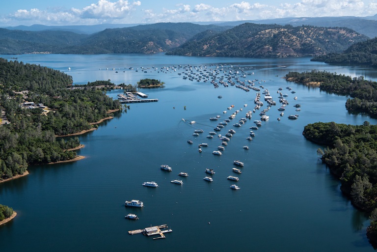
In the paper, the scientists illustrated the effects on water supply during the next several decades in two case studies — Scott Valley in Northern California and Lake Oroville, which is about 80 miles north of Sacramento. They looked at Scott Valley because it is one of the few basins in California with a publicly accessible groundwater model. They chose Lake Oroville because it is the second largest reservoir in the state, and its stability has come under scrutiny since the Oroville Dam spillway was damaged during intense flooding in 2017.
By looking solely at changes in extreme precipitation shown by the climate models, and holding constant all other meteorological conditions and the availability and cost of surface and groundwater, the team, led by co-author Claire Kouba at the University of California, Davis, found a significant increase in the need for irrigation water throughout the Scott Valley even without a change in total rainfall. The study points out that this trend could be more pronounced in other areas of the state.
In the case of Lake Oroville, the projected hydroclimate shifts led to an average decline in water stored in the reservoir of about 17% over the year, with losses greatest in September and October when the reservoir is at its lowest levels.
Although the study examined only California’s water supply, the researchers said that similar analysis looking beyond changes in average precipitation is worth pursuing in other regions with emerging water management challenges.
This study has been released in conjunction with a report from the Union of Concerned Scientists, where Persad previously held an appointment as a senior climate scientist. The UCS report further explores options for changing water management practices in response to a changing climate.
“The perception has been that climate projection data is too uncertain to be used in water decision-making, but there is actually a lot more agreement among the climate models for the metrics that matter most for water management,” Persad said. “We’re trying to encourage the water resource community to think about these types of shifts by demonstrating that the data exists to start integrating this into their decision-making.”
The study was partially supported by funding from The Water Foundation and Environment Now.
For more information, contact: Anton Caputo, Jackson School of Geosciences, 512-232-9623; Monica Kortsha, Jackson School of Geosciences, 832-768-0915.