Earthquakes Are Moving Northeast in Midland Basin of Texas
May 6, 2024

After analyzing seven years of earthquake data from the Midland Basin, a team of scientists at The University of Texas at Austin has found that seismic activity is probably on the move northeast toward the community of Big Spring.
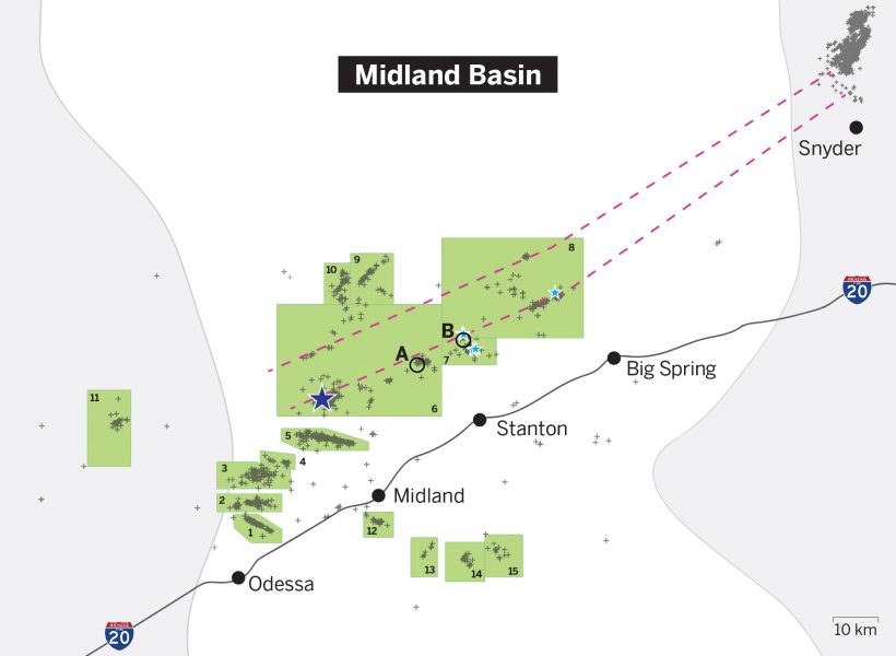
Although most past quakes happened in the southwest region near Odessa and Midland, the researchers identified a seismicity trend moving along a newly identified and extensive seismogenic fault zone stretching toward the northeast edge of the basin.
“The fault zone has been activated, and it has the capability to trigger additional earthquakes that can be felt by humans, especially because it’s so close to major cities along Interstate 20,” said Dino Huang, a research assistant professor at the Jackson School of Geosciences who led the research.
The results were published in the journal Seismological Research Letters.
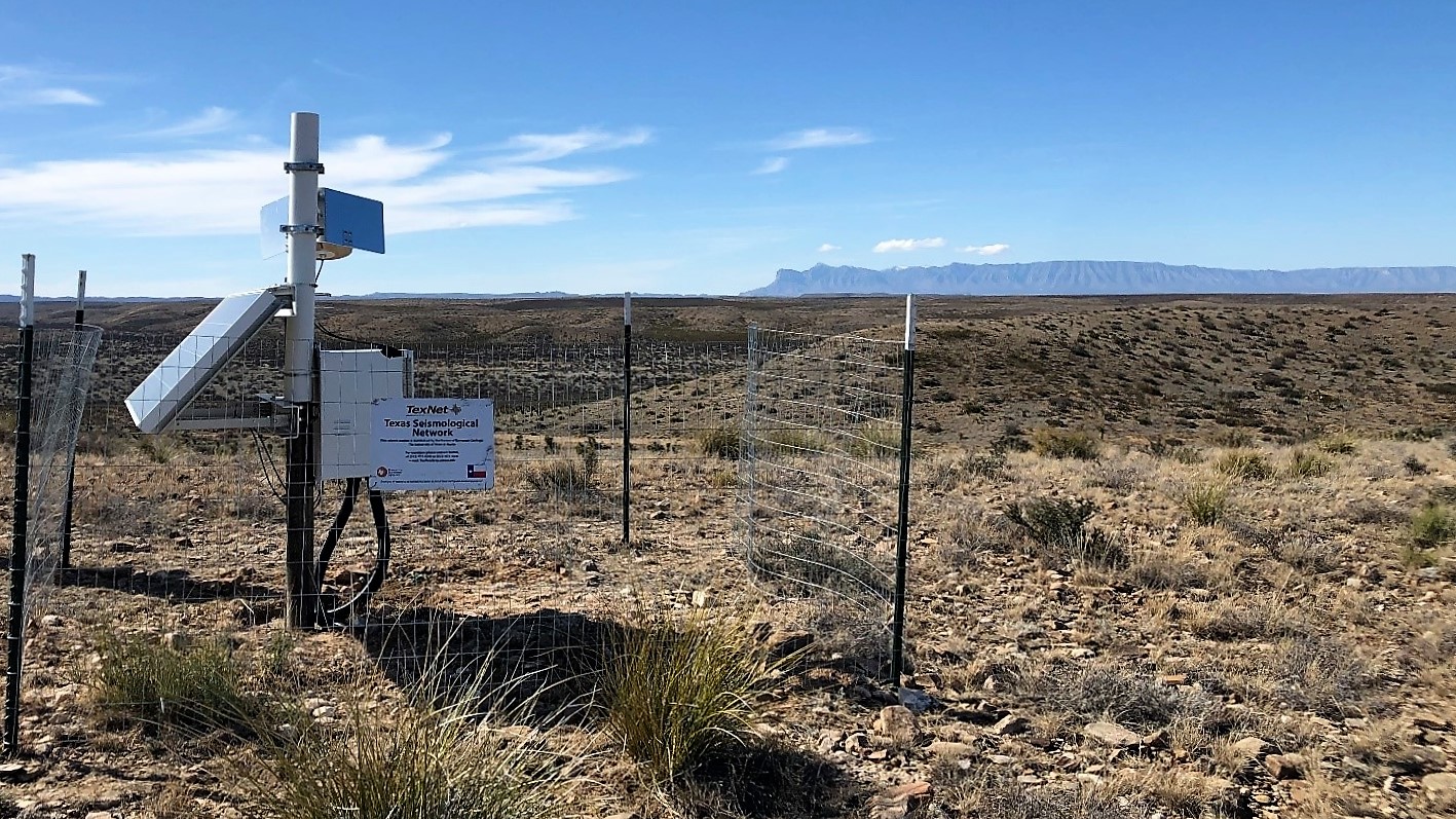
The study is based on data collected by TexNet, a statewide seismic monitoring network operated by the Bureau of Economic Geology, a research unit of the Jackson School. From January 2017 to November 2023, TexNet recorded 1,305 earthquakes in the area, the vast majority of them very small and causing no damage.
The TexNet seismometers detect earthquakes by recording the ground motion caused by seismic activity. The researchers used this data to determine the depth, location and orientation of geologic faults — large cracks under the ground where earthquakes can occur — using a technique called a passive seismic analysis. Unlike active seismic analysis, this technique does not require manually firing a seismic energy source, such as an air gun, to explore the underground fault structures.
The analysis allowed the researchers to piece together previously unmapped parts of the Midland Basin fault system. Major features include what looks like a rift structure stretching across the middle of the basin in the deep basement rock that is slowly widening over time. This rift structure is surrounded on either side with a complex network of smaller faults.
Within this fault system, the researchers identified 15 distinct earthquake-producing zones — places where earthquakes have already occurred and where the quakes can be traced back to common sources of stress in the subsurface. The researchers then combined the data on earthquake frequency and magnitude from all the zones to determine the future seismic potential of the entire Midland Basin — that is, the potential for future earthquakes to occur.

Using statistical analysis of TexNet data, the researchers determined that the basin seismicity has elevated since 2018. Although this potential indicates that the basin has a higher likelihood of future earthquakes compared with earthquake risk before 2018, it does not provide insight into future earthquake frequency, magnitude or when they might strike. However, based on recent seismic activity, the researchers have an idea of which zones will be more prone to earthquakes in the future.
The team hypothesizes that a 5.2 magnitude quake that struck Range Hill in 2022, which is in zone 6 and northwest of the city of Midland, introduced additional stress into the fault system that has propagated northeastward along the same path as the rift structure revealed by their passive seismic analysis. The scientists expect more quakes to happen in zones 6-8, northwest of the cities of Big Spring and Stanton, as the stress travels through the fault system.
The researchers point to two recent earthquakes in zone 8 — a 3.7 magnitude and a 3.8 magnitude that occurred in March and November of 2023 — as evidence for their hypothesis.
The Midland Basin is one of the major hubs for oil and gas extraction in Texas. Over time, the injection of wastewater from these operations into the subsurface has introduced stress along faults that has triggered earthquakes. According to the researchers, data from TexNet is helping them understand that state of stress on the fault system and how to mitigate induced seismicity associated with it. Also, knowing which regions where earthquakes are more likely to occur can help operators make adjustments to wastewater injection operations to keep stress low and the basin productive.
The research was funded by the Center for Integrated Seismicity Research at the bureau. TexNet manager and research professor Alexandros Savvaidis and research assistant professor Yangkang Chen are co-authors of the study.
For more information, contact: Anton Caputo, Jackson School of Geosciences, 210-602-2085; Monica Kortsha, Jackson School of Geosciences, 512-471-2241.
