Raucous Earth
November 17, 2026
The planet is always in flux. The ground beneath us is always moving, and there are forces acting on the surface sculpting the places we live. These subtle changes are always happening in the background. But sometimes they build up into something bigger — think earthquakes and tsunamis, wildfires, and debris flow landslides — that can take a serious toll on surrounding communities.
Understanding why and how these phenomena get raucous and risky is what’s driving the Earth hazard research for a host of experts at the University of Texas Institute for Geophysics (UTIG).
While we know the downstream effects of these hazards, the mechanisms that cause them aren’t simple.
Collecting real-time data in the field gives insight into what Earth hazards could be on the horizon, said UTIG Director Demian Saffer.
“The past informs the future only up to a point,” Saffer said. “The Earth can do things we haven’t seen it do, and having people in the field looking at these problems is going to be more important than ever.”
Keep reading to hear from three UTIG scientists on the questions they’re asking about Earth hazards, and the data they’re collecting that can help reveal how they work. The goal is to provide information that can help protect communities from these disasters.
What are the clues beneath the seafloor that can help us prepare for Cascadia’s next big one?
The infamous Cascadia earthquake that caused a tsunami to hit North America and Japan in 1700 was the last great earthquake in the Cascadia region. Since then, the 620-mile-long tectonic fault off the Pacific coast has been eerily quiet, leading many to ask, “When will the next big one happen?”
Pose this question to any seismologist and they’ll tell you it is difficult to answer. But that doesn’t deter experts like UTIG Research Assistant Professor Shuoshuo Han from looking for valuable clues in the Earth’s crust that can help us understand how earthquakes and tsunamis happen — and what they might look like in the future.
Han is a marine seismologist who studies the structure of subduction zones around the world, where one tectonic plate dives beneath another. These zones are responsible for some of the largest earthquakes and tsunamis on Earth.
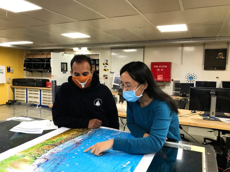
“My work is mainly to understand the structure and physical properties of the Cascadia subduction zone through seismic imaging,” Han said. “What I learn from this work can be used to better understand earthquake and tsunami hazards.”
In 2021, she sailed on a 41-day research cruise aboard R/V Marcus G. Langseth, traveling from offshore Vancouver Island to southernmost Oregon to conduct a large-scale seismic imaging survey of the roughly 1,000-kilometer-long Cascadia subduction zone. The survey used powerful sound waves to create detailed images of the rocks beneath the seafloor, allowing her and other scientists to see structures that are otherwise impossible to observe directly.
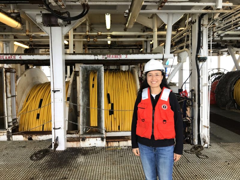
Since the cruise, Han and her colleagues have created detailed seismic images and velocity models of the subsurface, allowing them to map the structures and strength of the outer part of the Cascadia margin, a wedge of accumulated sediments. Their work revealed that the structure and strength of these sediments vary substantially along the margin, with different regions having differing fault geometries and styles of deformation.
These variations matter because these accumulated sediments cover the shallow part of the megathrust fault that generates great earthquakes, and its deformation during a large earthquake may influence the strength and size of an accompanying tsunami.
Understanding Cascadia’s structure, strength, and the geometry of faults within it provides important constraints for models that can offer a preview of how earthquakes and tsunamis might behave along the subduction zone.
For the people concerned about the “next big one,” these findings might not provide the exact answer they’re looking for, as scientists can’t use seismic images to say when the next earthquake will occur. But they can help the region prepare.
“By understanding the geometry of the faults and the strength of the rocks, we can build more realistic scenarios for how the margin might deform during a large earthquake,” Han said.
Communities living near the Cascadia fault can use this information to develop better building codes, preparation and evacuation plans, and other strategies to help them respond when the next big earthquake happens.
How can data from small earthquakes help train artificial intelligence?
Big earthquakes get all the attention. That’s for good reason — their tremors stand to cause the most damage in populated areas.
Still, smaller earthquakes, with magnitudes as low as 3, have much to teach us about the Earth. Their subtle shifts contain data about how and why a fault slipped, and whether this might be a prelude to a bigger event or say something about the pressure in the subsurface that affects the flow of fluids, such as water or hydrocarbons.
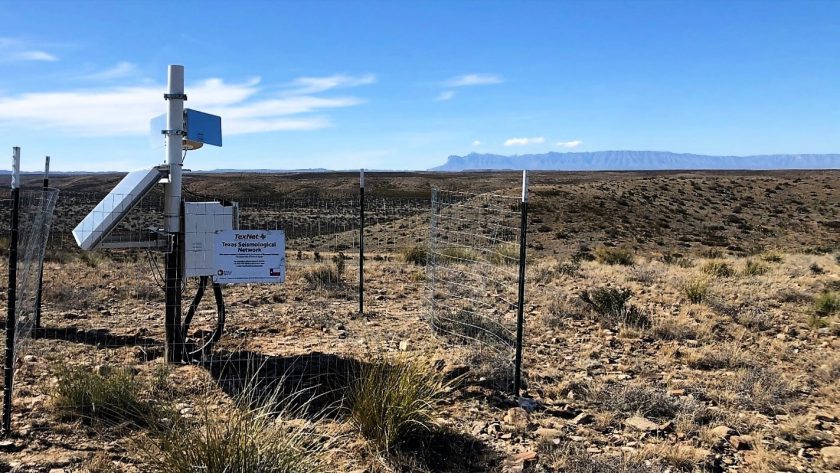
But understanding smaller events is tricky. Smaller quakes mean smaller waves traveling through various types of rocks, all of which alter the waves’ speed and strength before they reach a seismometer. Even then, there’s the possibility of seismometers capturing non-seismic-related “noise,” such as traffic, machinery or natural disasters, in their readings. This is compounded by the fact that seismic stations themselves can differ over time and location.
But by using machine learning algorithms trained with real-world data, Research Assistant Professor Zhe Jia believes artificial intelligence can learn to cope with the chaos and try to separate “noise” from useful information for researchers.
“The real Earth is messy, and training AI in an idealized world won’t allow it to fully grasp the complexities of each earthquake,” said Jia. “We need to train the AI to know the difference between signals from an actual quake and noise made by factories, roads or even the ocean.”
It’s these smaller quakes that Jia is most interested in. He is using real-world data to create a framework for artificial intelligence to analyze data produced by small quakes. The critical information they hold about stress and faults can help improve the accuracy of large earthquake rupture simulations and hazard assessments, which could ultimately help communities prepare better for the impacts of these dangerous tremors. They also happen more frequently than the big ones, which means more data to work with.
Before joining the institute, Jia spent time on the West Coast studying earthquakes. At UTIG, he and colleagues Xiaotian Zhang and Junpeng Li tested how machine learning algorithms can analyze earthquake data, like how a fault slipped.
Studying small quakes in Texas is different from studying ones out west for many reasons. The geology and seismic station layouts are different, but Jia said AI frameworks such as his can apply to the injection-induced earthquakes commonly seen in West Texas, once they have been retrained with Texas-specific simulations and data. Thanks to the seismic monitoring infrastructure established by the Bureau of Economic Geology’s TexNet program, that information is being recorded and has resulted in a large, detailed catalog of small earthquakes.
This data could help train AI to learn about the state’s complicated subsurface faster than traditional physics-based approaches, with the eventual goal of creating an early warning system for earthquakes.
How do debris flows form?
Imagine this: A wildfire roars through a mountainous region, decimating hundreds of acres of trees and forest. No one is hurt and the effects of this disaster are minimal, but now an invisible waxy layer sits atop the scorched forest floor that limits the amount of water the ground can absorb. Thousands of chunks of charred wood and other debris are scattered about the sloped surface while the latest forecasts call for heavy rains affecting the area — a common occurrence after wildfire seasons. Sitting at the bottom of this particular mountainside is a reservoir that supplies nearby towns with their drinking water.
The initial disaster had minimal effects, but rainfall could wash debris into the water source, contaminating the water supply for nearby populations.
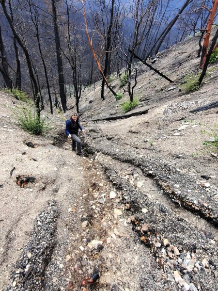
This hazard is a type of landslide known as a debris flow and is a common occurrence after a wildfire.
Scenarios such as these are becoming more common as wildfires and other natural disasters are becoming more frequent. Experts at UTIG are working to understand all the variables that can cause this chain of events that lead to bigger disasters.
“We call these cascading hazards, and it’s a relatively newer discipline that’s getting attention as we see more frequent and stronger natural disasters,” said Danielle Touma, a research assistant professor at UTIG. “People need to be educated about how just because the disaster passed doesn’t mean we’re necessarily out of the woods yet.”
Touma is a climate scientist who looks closely at the phenomena that cause and intensify fire weather and extreme wildfire events. She’s also a faculty adviser to Tanner Johnson, a doctoral candidate at the Jackson School studying debris flows.
Debris flows are fast-moving, fluid-like flows that are triggered by excessive runoff during heavy rainfall or rapid snowmelt. After a wildfire, the forest floor is unable to absorb as much water as it usually can, leaving steep hillslopes and confined channels susceptible to debris flow as runoff moves quickly across burned ground. Debris flows can also snowball, bringing debris from the tops of mountains to the bottom, creating a huge buildup of sediment, trees and anything else in their path.
After wildfires, landscapes are also susceptible to shallow landslides, as burnt plants and decaying root systems can reduce soil cohesion and slope stability. This weakening can lead to slope failure, moving soil, rock and other debris downslope. Add water, and the displaced material can become liquefied and develop into a debris flow.
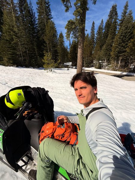
In February 2026, Johnson joined a team from the U.S. Forest Service to survey a watershed in the Sierra National Forest that was struck by the Garnet Fire in August 2025. Snowmobiling around the mountains, he helped collect measurements of stream flow, suspended sediment concentration, and snow water equivalent, an estimate of the amount of water contained in snowpack. In combination with data collected by the U.S. Forest Service in the same area before the fire, Johnson plans to monitor things like change in river base flow, peak flow events, sedimentation across the watershed, and erosion and depositional patterns as part of his doctoral research.
“We will be comparing this data with non-burned watersheds in the area to ultimately give insights on post-fire landscape change and debris flow potential in snow-dominated landscapes,” he said.
Many populations situated in the canyons of California and Oregon are especially prone to this cascading hazard, and providing this kind of information to communities can tune them into what to look out for, evacuation strategies, or even mitigation efforts through geotechnical engineering feats.
Johnson said he thinks post-wildfire debris flows should be examined from a multidisciplinary perspective because of the range of factors involved — from sediment mechanics to fluid flow — and he’s made sure the scientists helping him throughout his doctoral journey are reflective of that.
In addition to Touma, Jackson School hydrologist and Associate Dean for Research Daniella Rempe is also one of Johnson’s faculty advisers. Sitting on his dissertation committee are also Jackson School planetary geomorphologist and Associate Professor Timothy Goudge and Lawrence Berkeley National Laboratory mountainous hydroclimate scientist Alan Rhoades.
The questions he hopes to answer with his final dissertation reflect the multidisciplinary nature of the hazards themselves.
“I want to know how short-term climate and daily weather conditions lead to more severe fires, specifically in the western U.S.,” he said. “And after these fires and debris flows, how are these landscapes evolving?”