
Track Tremors Online
December 3, 2018
The University of Texas at Austin Bureau of Economic Geology has finished installing the state’s earthquake monitoring network, TexNet, and thanks to a new interactive website, the public can follow and sort seismic activity in Texas in real time.
TexNet, the most advanced state-run seismic monitoring system in the country, was authorized by Texas Gov. Greg Abbott and the Legislature in June 2015 with $4.47 million in
state funding. Like many areas in the south-central United States, Texas has experienced an increase in the number of earthquakes during the past decade, especially in the Dallas-Fort Worth area, the Permian Basin region and southcentral Texas.
The seismic monitoring system is being operated in parallel with the Center for Integrated Seismicity Research (CISR), a multidisciplinary research team led by bureau Research Scientist Peter Hennings and Professor Ellen Rathje in the Cockrell School of Engineering’s Department of Civil, Environmental and Architectural Engineering. CISR is conducting fundamental research to better understand natural and induced earthquakes in Texas.
“Gov. Abbott and the Legislature have put Texas in the forefront of data collection and research into the causes of seismicity in the state,” said bureau Director Scott W. Tinker, who led the formation of TexNet in 2015. “Small earthquake events have become more common in Texas recently, and we are now positioned to learn more about them and, hopefully, to understand how to mitigate their impacts in the future.”
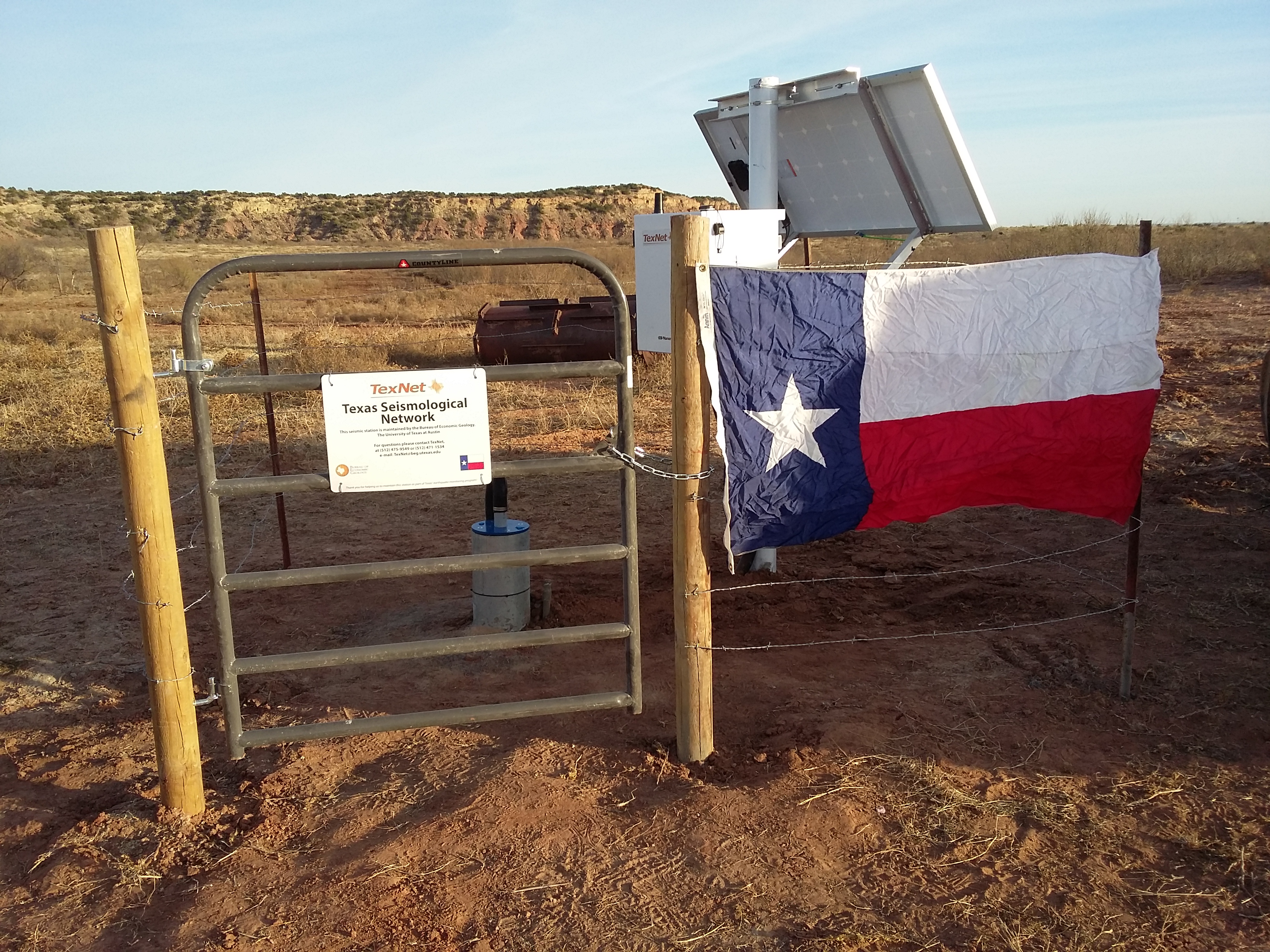
TexNet includes 22 permanent monitoring stations, which brings the state’s total number of permanent seismic stations to 40. The system
also includes 40 portable seismic stations that are being used to increase the density of stations in areas with increased seismicity. These portable stations allow for detailed examination of the location, depth, size and frequency of earthquakes, so scientists and engineers can better assess their cause.
For more information on TexNet and CISR and to view the interactive web page, go to www.beg.utexas.edu/texnet
Back to the Newsletter