
Ocean Front Property in Colorado
November 20, 2017
The most wonderful time of the year for a paleontologist is field season. It’s when new discoveries are made, and friendships and collaborations are strengthened. This year’s field season was special for me because I began what will be a long-term project in the Upper Cretaceous Mancos Shale of Colorado.Those rocks represent almost 15 million years of deposition in a shallow ocean, one that stretched from the modern-day Gulf of Mexico to the Arctic.
My long-term research goal is to understand the evolution of ecosystems throughout the greenhouse climate of the Cretaceous, with an eye toward
using those data to hypothesize how ecosystems of the future may respond to warmer global climate. For my dissertation, I am focusing on one particular group of marine reptiles called mosasaurs.
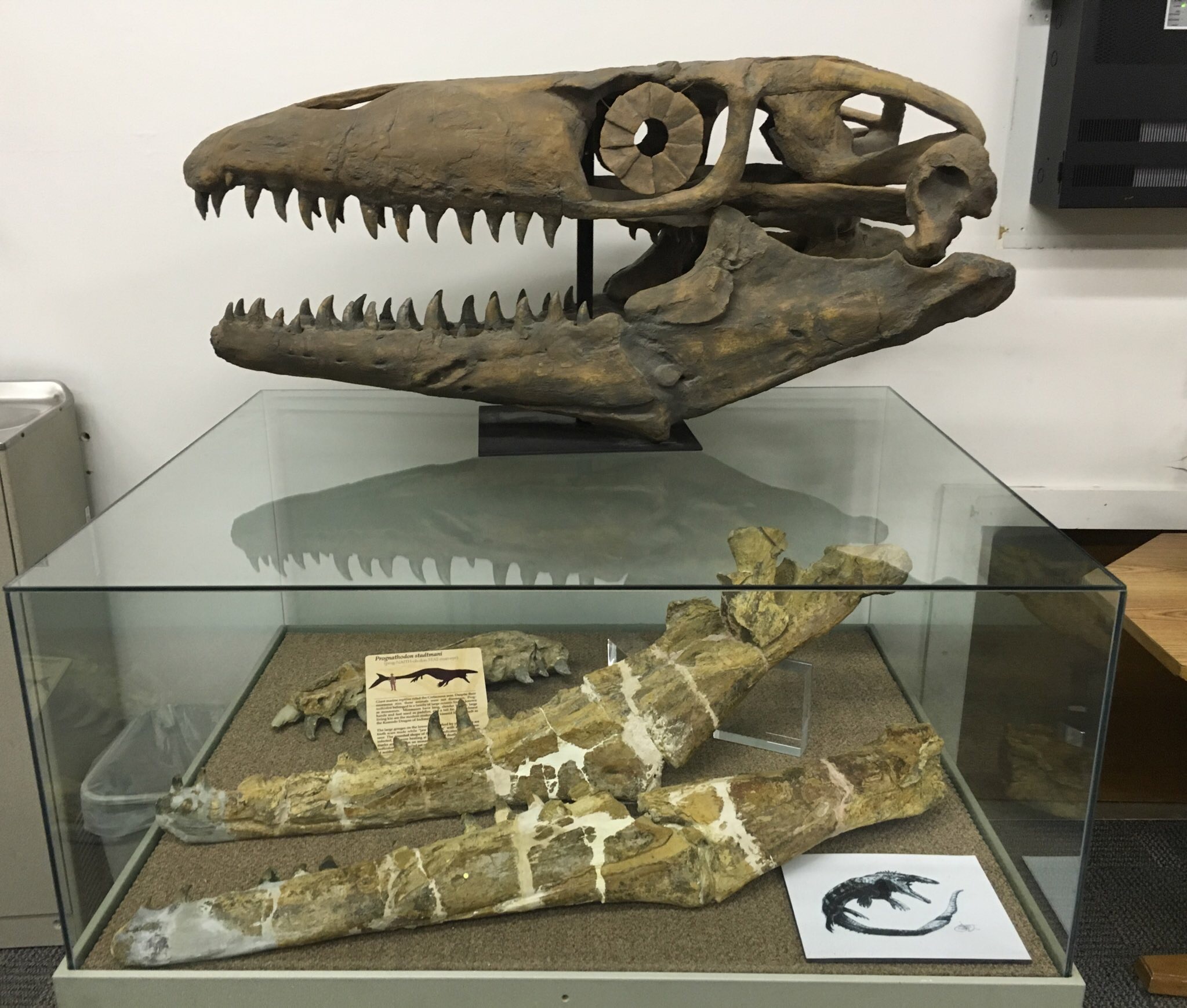
Mosasaurs were a group of fully marine lizards that ranged in size from a couple of meters up to 18 meters. My investigation of the Mancos Shale in western Colorado was originally motivated by a mosasaur specimen collected by Brigham Young University (BYU) in 1975. That specimen has a 1.2 meter lower jaw and represents an important part of the story of mosasaur evolution. I wanted to find this animal’s type locality to better understand its stratigraphic position within the Mancos. Very few notes were kept during the excavation, but I was ultimately able to track down the locality using Google Earth and a grainy photo of the excavation in a master’s thesis. It was extremely helpful that the vegetation had not changed much in 42 years!
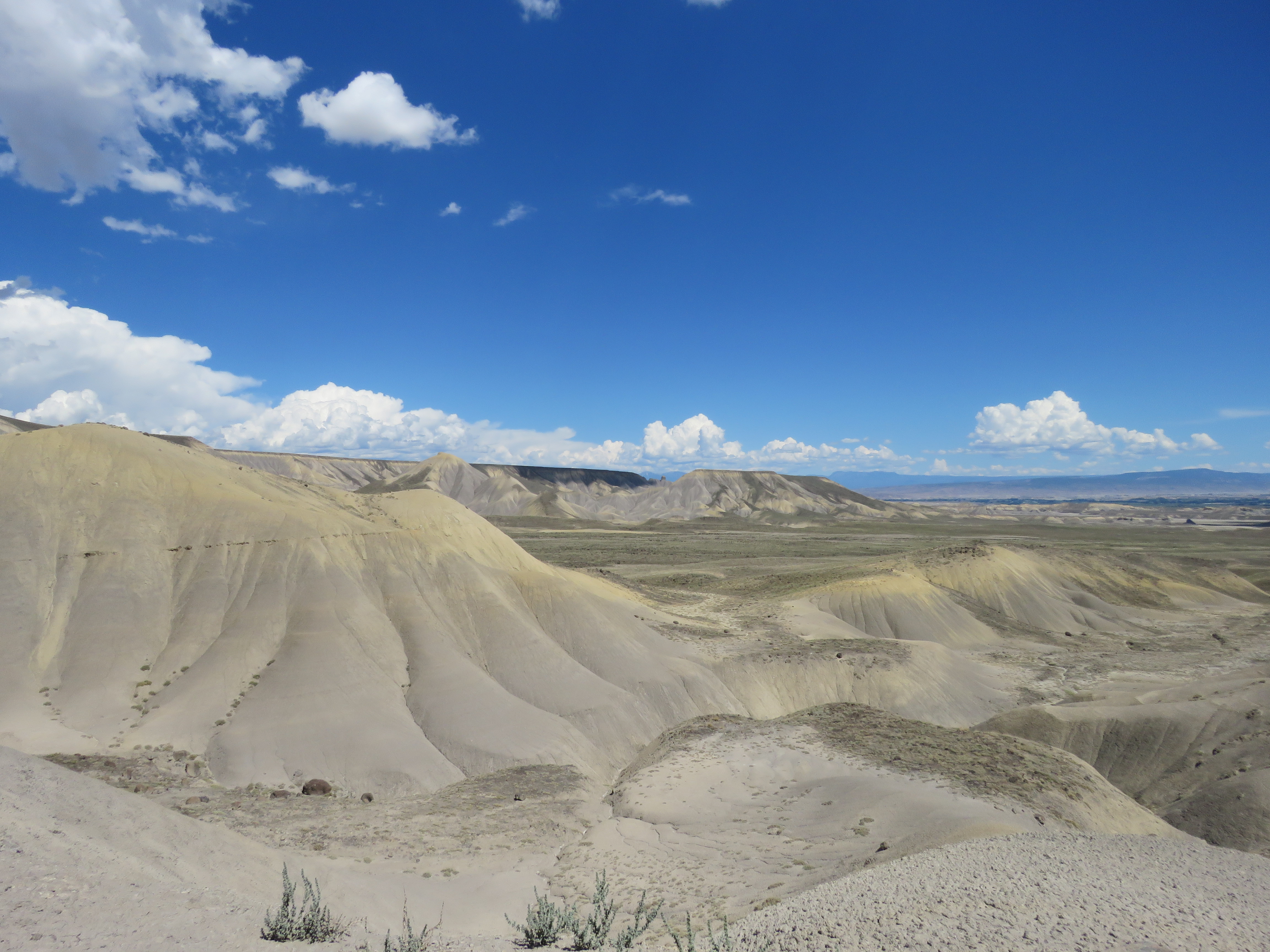
The Mancos is typically mapped as one homogenous unit — 4,000 feet of mud. However, on the Western Slope of the Rockies, Dr. David Noe (a UT geology grad) spent a major part of his career at the Colorado Geological Survey mapping the Mancos and correlating it with the sections across Colorado and Utah. Using Dr. Noe’s maps and expertise, we were able to nail down the unit (albeit a thick one) within the Mancos from which the BYU mosasaur was collected.
The area around Delta, Colorado exposes most of the Mancos Shale, eroding into beautiful badlands that seemed ripe for fossil prospecting.
I applied for a Bureau of Land Management survey permit and planned a trip for early August to explore the area. On the first day, Dr. Noe led my volunteers and me to a few localities of interest, explaining the various units he designated within the Mancos.
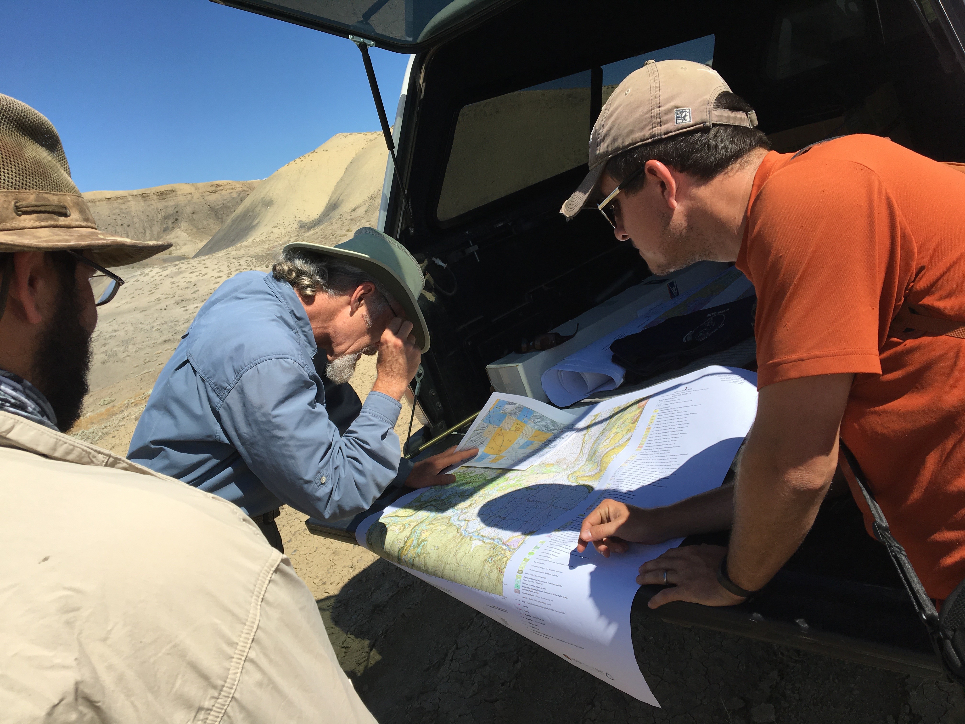
From there, we began prospecting a few select units near Delta. High in section, we found several specimens of the ammonite Baculites in the same unit as the BYU mosasaur. Those fossils will be incredibly helpful for refining the stratigraphic position of that specimen with reference to radiometrically dated sections. In the days to follow, a volunteer of mine, Lexy Holfeltz, struck gold by finding fish specimens in carbonate layers that correlate to the Niobrara Chalk of the Front Range and Kansas. These were thin, fragile fossils that are extremely difficult to preserve and find.
I’ve had the opportunity to work in a lot of field areas over the years, and each one was unique. This first expedition to the Mancos taught me a lot about what units within the formation are most fossiliferous, and what methods are best for finding fossils in each of those units. For just a few days of collecting, we ended up with a tremendous haul of fossils. These thousands of feet of Cretaceous mud were anything but the barren wasteland devoid of fossils that other geoscientists had made them out to be. This year’s Mancos field season is just the start of many more to come!
Joshua Lively
Ph.D. student
Back to the Newsletter