
Getting a Better Look at Shallow Subsurface Geology
October 12, 2016
Researchers at the Bureau of Economic Geology received $2.5 million in July 2016 from the U.S. Department of Energy to evaluate a new 3-D seismic imaging system that could improve subsurface resource exploration and carbon storage–a potential strategy to battle climate change–by providing a higher resolution view of shallow subsurface geology.
The project is led by Tip Meckel, a research scientist at the Bureau of Economic Geology’s Gulf Coast Carbon Center (GCCC), and involves surveying a carbon storage site offshore of Japan.
The survey is one of eight projects sponsored by the Subsurface Technology and Engineering Research, Development, and Demonstration Crosscut Initiative, a DOE program focusing on furthering geothermal energy and carbon storage technologies. Traditionally, seismic technology has focused on obtaining higher resolution at deeper depths.
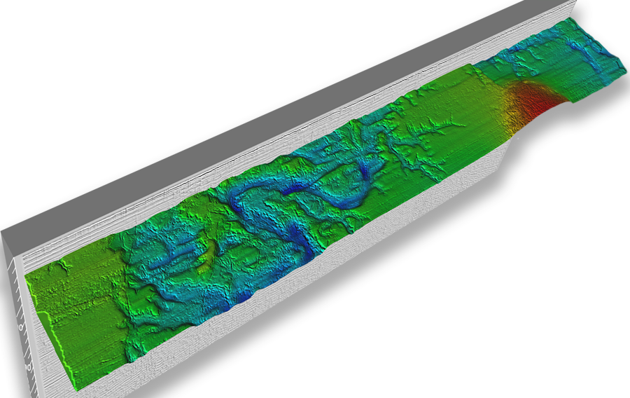
The new imaging technology, called P-Cable high resolution 3D (HR3D), is specialized for capturing data in the relatively shallow subsurface interval between ultra-shallow systems and the deep water. Compared to older methods, the new system results in a much finer resolution.
For example, in a 2013 survey of an area in the Gulf of Mexico, the HR3D system produced data with a vertical resolution of 2.5 meters. The vertical resolution from an older commercial survey of the area was
15.2 meters