Imagery & Video for Mars Glaciers Science Paper by Holt et al., Nov. 21, 2008
November 20, 2008
Click Images for Video or High Resolution Imagery
VideoThree Craters With Ice (97 MB MOV)
|
Images
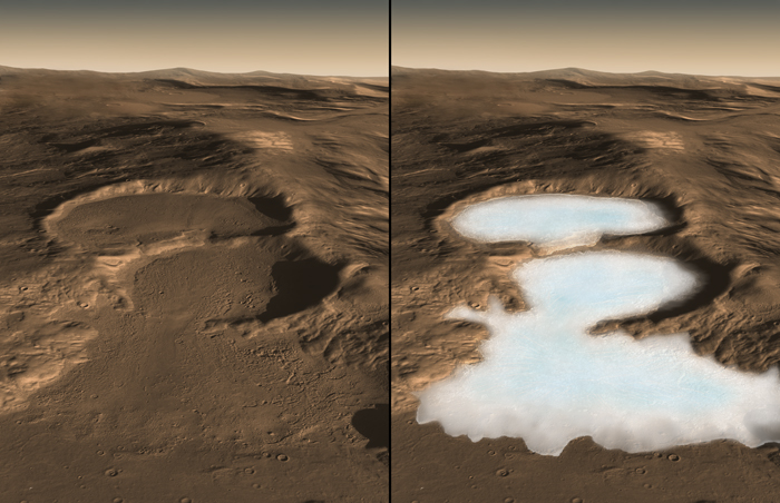
Three Martian Craters: Actual Surface (left), Without Debris (right)
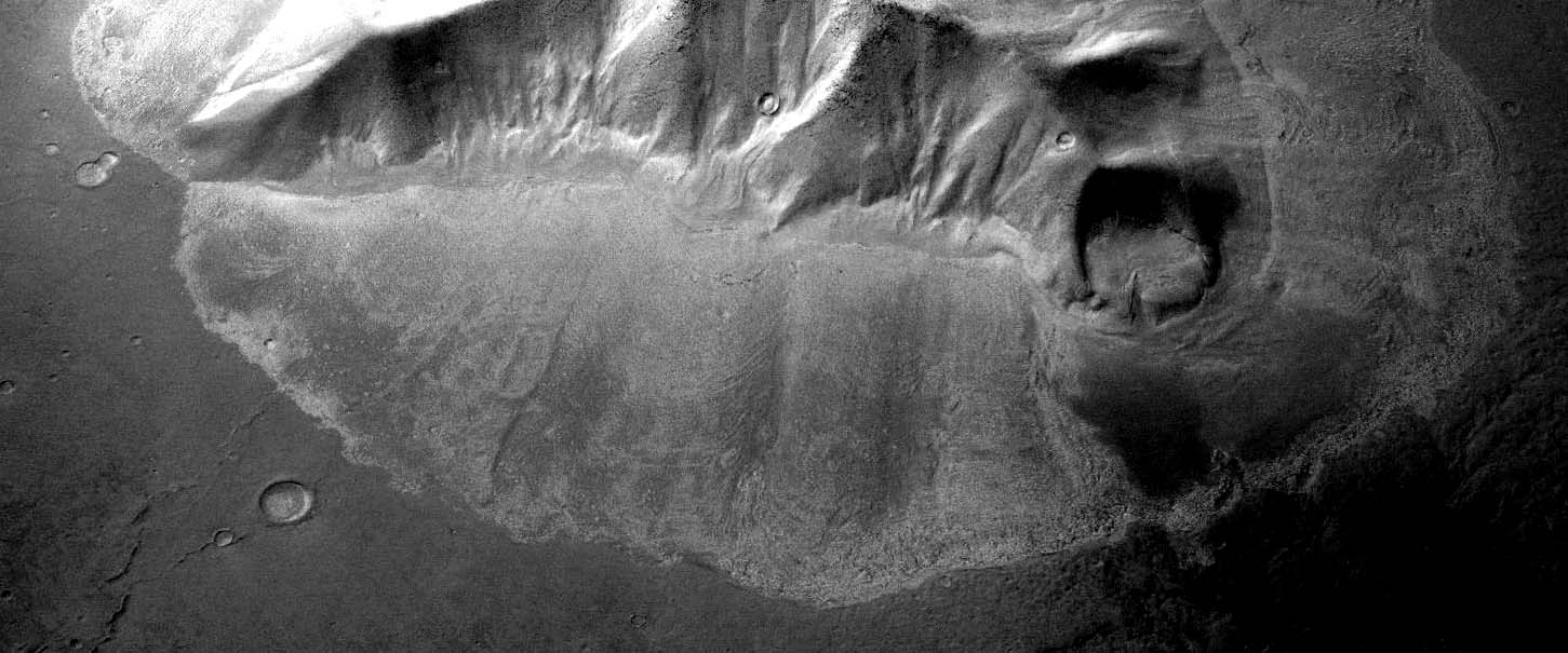
Martian Mountain With Lobate Deposit Similar to Those with Confirmed Glaciers
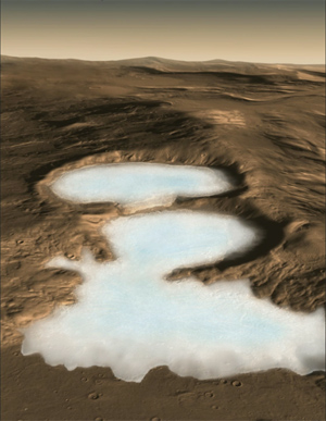
Location of Newly Discovered Martian Glaciers
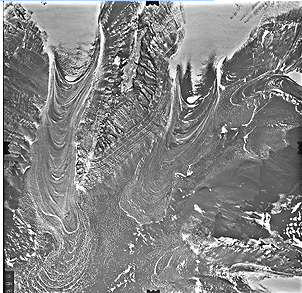
Analogous Formations on Earth: Rock-covered Glaciers in Antarctica
|
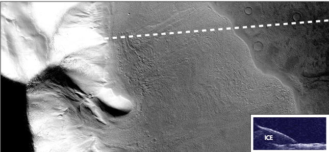
Radar on Mars Orbiter Reveals Debris-Covered Martian Glacier
Concealed Mars Glacier in Hellas Region
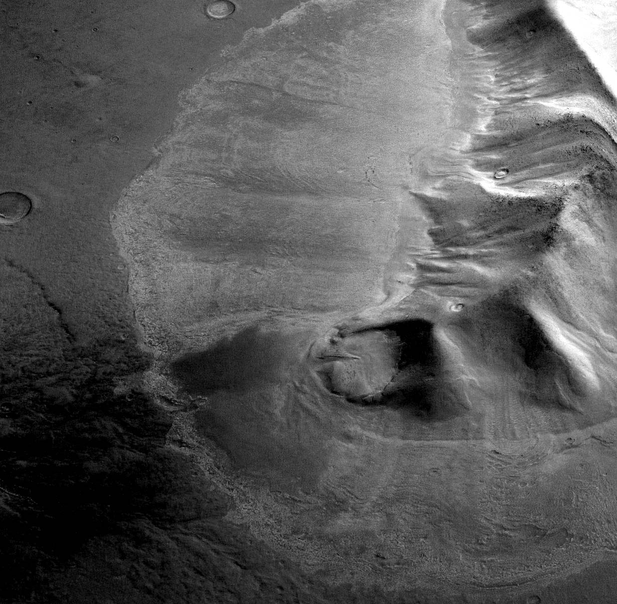
Concealed Mars Glacier in Hellas Region