Saving Austin's Water
UT Geoscientists are helping the City of Austin protect its water supply in the face of a changing climate
By Anton Caputo
On a good day, Big Sandy Creek winds 12 miles through the rural Texas Hill Country, carrying water to the Big Sandy arm of Lake Travis and helping the Jones Brothers Park boat ramp remain a popular launching point.
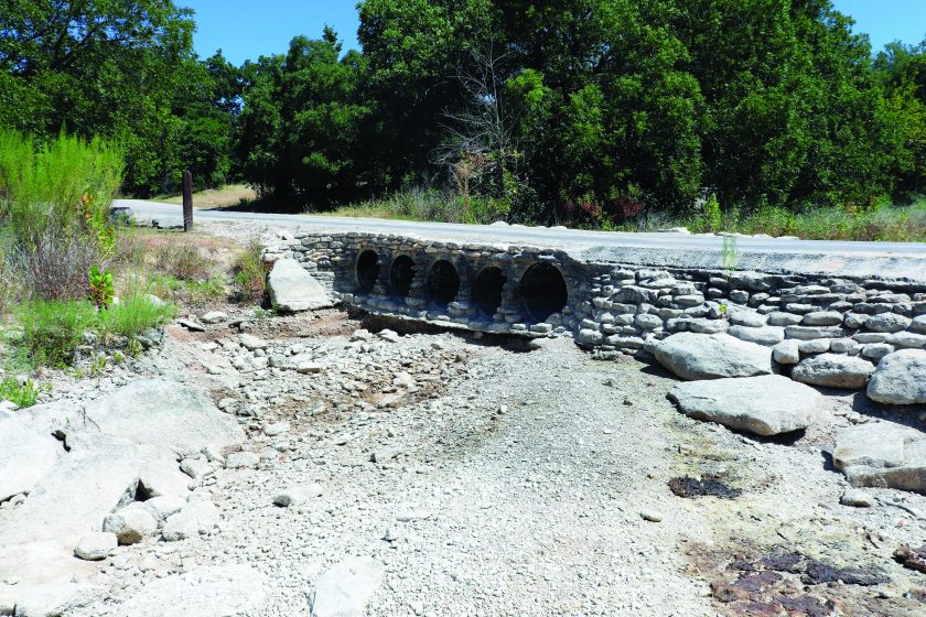
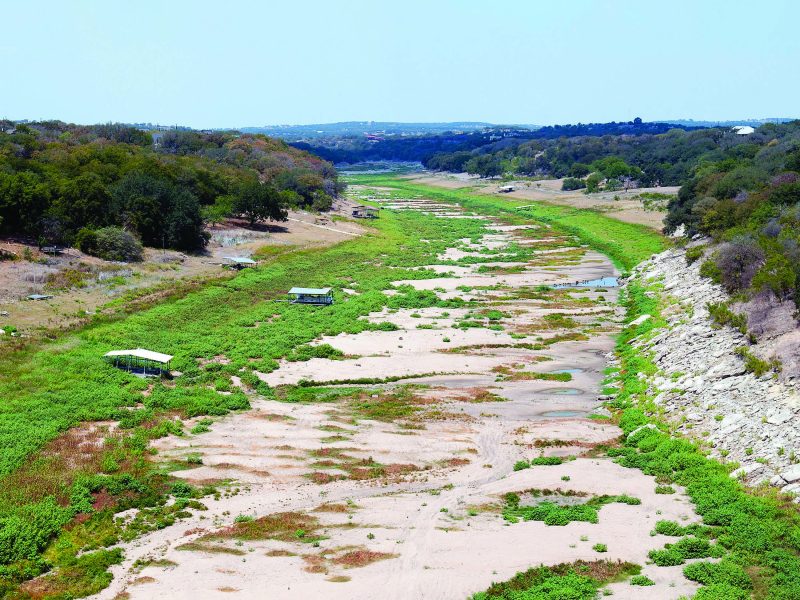
Today, the creek is bone dry, as it has been for weeks, leaving the boat ramp nothing more than a concrete walkway to a grassy field.
There’s nothing terribly unusual about a dry creek bed in the Hill Country during a Texas summer. Creeks that dry up one season can swell quickly the next, as torrential thunderstorms turn sun-cracked ground into flood zones.
But the fate of waterways like Big Sandy have impact far beyond local boaters, with creeks throughout the region filling the Highland Lakes and bringing life-sustaining water to the city of Austin and its booming population and growing economy.
With climate change expected to make dry spells more pronounced — and storms more violent and severe — it makes it vitally important to understand the future of these local watersheds, big and small.

Although global climate models are mostly clear on the overall trend of longer droughts punctuated by major storms, they paint a hazy picture at best on the local level. Austin water planners, who have watched local reservoirs drain to a third of their capacity in recent droughts, want to sharpen that picture and get a more detailed forecast of how climate change may affect the water the city depends on.
To tackle this critical issue, the city has turned to climate scientists at The University of Texas at Austin, led by the Jackson School of Geosciences. The project entails analyzing all the massive global climate models available, finding the ones that most accurately reflect local climate, and then downscaling and tweaking them to even more accurately mirror local conditions.
“We’re really excited about this partnership,” said Marisa Flores Gonzalez, supervisor of the Austin Water resources team. “I think it’s just really valuable in general for folks from academia to team up with folks who are applying the science that academia produces. It can help academic research become more targeted and have a real impact on decisions that are made in the real world.”
Targeting academic research to tackle pressing, real-world issues is exactly what the Jackson School has been focusing on in recent years. This project is one of many that the school is leading or participating in that deal directly with issues around Austin and Central Texas, thanks to a new interlocal agreement between the city and UT Austin. Others include a project to pinpoint areas around the city where hot temperatures are affecting people the most — and proposing solutions to cool down these places — and a project to help forecast wildfire conditions in Central Texas.
“In all regards, this is geoscience at its best,” said Jackson School Professor Dev Niyogi. “We are taking global data sets coming from global models — highly complex satellite data sets, highly complicated computational models — and we are deciphering that knowledge into a bite-size information, which is the framework of making knowledge useful and usable.”
Securing the Future

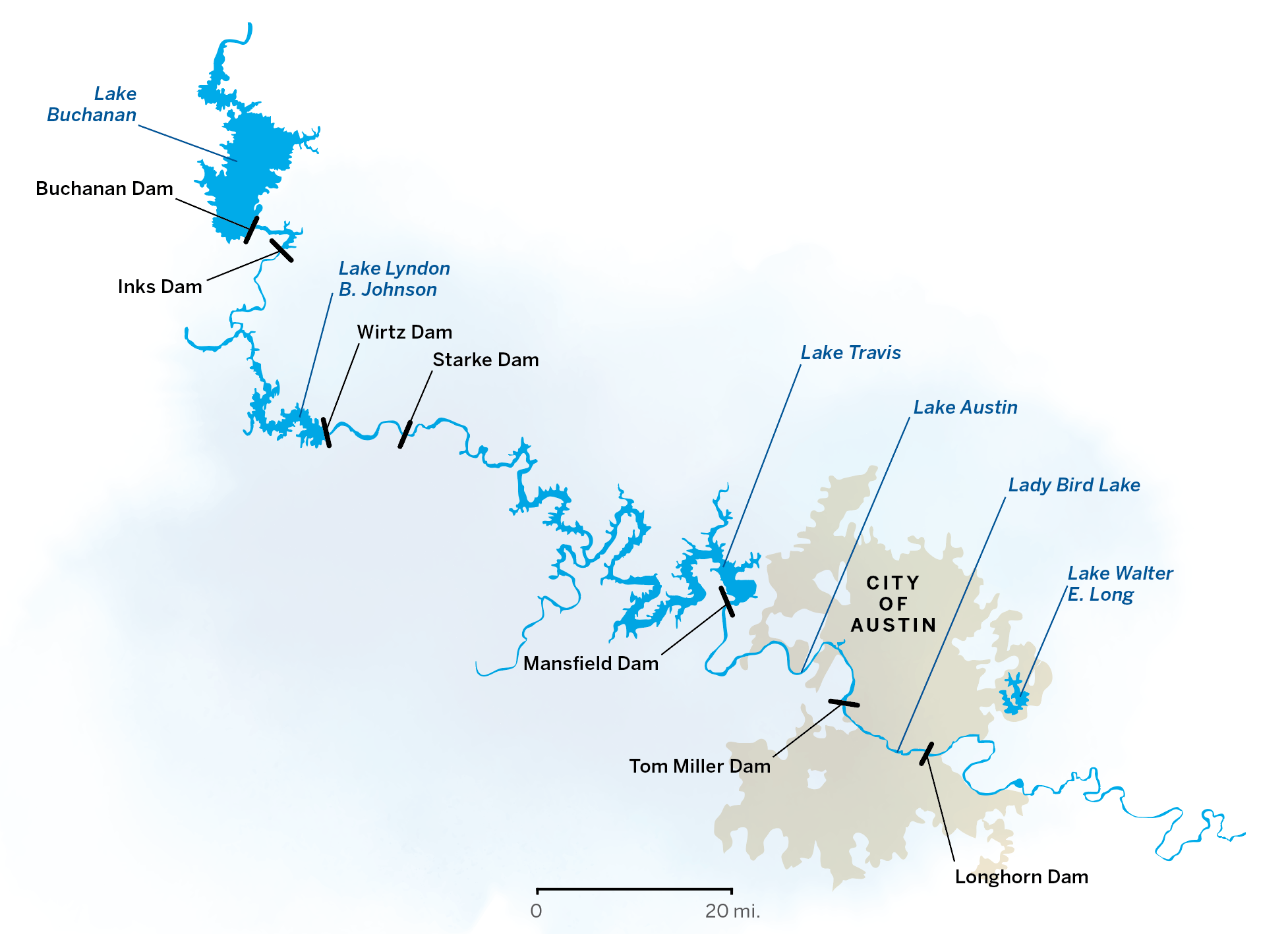
The Austin water climate project is part of the city’s 100-year water plan, which is a road map to providing reliable water to a population expected to grow from about 1 million people to more than 4 million people in a century. The city’s water plan addresses the issue from all angles — conservation, water reuse and new water supply projects. But Austin’s main source of water will remain the Highland Lakes, the chain of lakes in Central Texas created by dams built along the Colorado River in the 1930s, ’40s and ’50s.
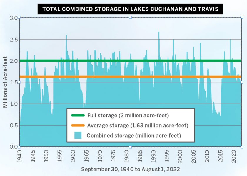
City officials first recognized the need for the 100-year water plan during the prolonged drought that affected Austin and Central Texas from 2008 to 2016. During those eight years, hot weather, long dry spells and parched ground that soaked up the little rain that did fall resulted in local creeks and rivers that remained dry for months. Residents were put under severe watering restrictions, and water that had historically been sent downstream to farmers was curtailed or cut off. Still, Lake Travis and Lake Buchanan, the massive water reservoirs in the Highland Lakes chain, dropped to a third full, and cities and communities throughout Central Texas had to make plans to move water intakes and even scramble to find backup supplies. Local water planners have said the drought even eclipsed the epic drought of the 1950s and now stands as the worst ever recorded in the Austin area.
The city adopted the 100-year plan in late 2018 and plans to update it regularly to keep up with the latest science, technological advances and demographic shifts. This time around, it wants to include the updated climate models used in the International Panel for Climate Change’s most recent report.
 Incorporating the data into the water plan would put Austin on the cutting edge of communities preparing for the realities of climate change, said climate scientist Geeta Persad, an assistant professor at the Jackson School. But the specialized expertise needed to do so involves both a proficiency with climate science as well as the access and the ability to work with supercomputers, a combination that is beyond what most communities can muster.
“That data is all publicly available, but it’s often not in the form that’s needed for local decision making,” she said. “There’s also a ton of data, so separating the wheat from the chaff and understanding how to use it appropriately can be a serious challenge.”
Jackson School Professor Liang Yang and others on the team had been assisting with the process as part of a volunteer climate technical advisory group, but Flores Gonzales said it soon became obvious that they were the best choice to do the job.
“That group initially was advising us on developing a scope of work to update this climate and hydrology analysis,” she said. “It became clear that Liang and his team had the necessary skills and expertise to perform that work.”


Sharpening the Picture
Led by Yang, the UT team includes Niyogi and Persad, with all three being faculty members in the Jackson School’s Department of Geological Sciences. Cockrell School of Engineering Professor Paola Passalacqua and several Jackson School students round out the team.
The team has evaluated the 35 global models available from the major modeling centers around the world to determine which best represent the climatology and hydrology of the Colorado River basin. These global models, Yang explained, are incredibly complex. They integrate the climate forces of the Earth’s oceans, atmosphere, land and ice sheets and take into account the impact of greenhouse gas concentrations, aerosol pollution, changes in land cover, urbanizations and natural variations such as solar output and volcanic eruptions.
The challenge is that the models are so large that the resolution literally becomes fuzzy when trying to zero in on local areas. That’s because, Persad said, a given global model might include only 10 data points for the entire state of Texas.
To overcome this problem, researchers improve the resolution by downscaling the models. To do so, UT climate scientists are using statistical relationships between what the models have shown on a broad global level and local climate data. In this instance there is a plethora of local data collected by the Texas Water Development Board and other agencies that covers precipitation, lake evaporation, stream flow and soil moisture. In some cases, the local data reaches back into the mid- 19th century.
After downscaling the global models to better reflect local conditions, the results will be plugged into the Water Availability Model (WAM) provided by the Texas Commission on Environmental Quality (TCEQ) for the Colorado River basin. TCEQ creates such models for all river basins in the state to determine how much water will be available in a given season or year. The Colorado River basin WAM encompasses all of the approximately 31,000 square miles of contributing drainage area and the 2,000 different legal water rights contained in the basin.
“We need to evaluate those models and find the best performing models in terms of producing precipitation, temperature, seasonalities and extreme events, drought and the floods as well as the stream flow, soil moisture and things like that,” Yang said. “These are the inputs needed by the water availability model.”
Currently, the team is working with about six of the global models that it has determined to best reflect local conditions. Most of the actual data crunching is being done by Jackson School doctoral student Sabiha Tabassum working with the Stampede2 supercomputer at UT’s Texas Advanced Computing Center.
Part of her job is correcting the models to reflect the specific climatological nuances of the area. For instance, Texas has a very noticeable moisture gradient running east to west throughout the state. As you travel east, conditions become wetter; as you travel west, it becomes drier. The local region also has two notable peaks in rainfall — May and October. Making sure that the models correctly reflect these two variables is vital for accuracy.

This project is putting Tabassum front and center in the relationship between the Jackson School and the city, which includes meeting regularly to discuss progress and presenting results. The setup involves much more communication with interested stakeholders than typical academic work. “For federal grants, you only write an annual report,” Yang said. “For this, we meet every few weeks with the city and with the advisory group once a month.”
For Tabassum, who is interested in a career in the private sector focusing on climate risk, the experience of regularly communicating with stakeholders who are not experts in the field has been invaluable.
“We have learned through the process because we have to present to people who are maybe not familiar with the climate data,” she said. “The goal is to make it easier to understand so they can continue to give feedback on the project. I never thought I would be given this opportunity, to be honest. I feel very lucky.”
This update of the plan is scheduled to be complete in 2024. It won’t provide a single answer about the future of the city’s water supply, but a range of possibilities depending on different climate scenarios, demographic possibilities and policy decisions.
Although the future will remain uncertain, the results of the local climate modeling will provide city leaders with valuable information to plan and prepare, said Persad.
“The thing I always come back to with these climate projections is yes, they have uncertainty ranges about them, but think about how much worse it would be if all of this was happening and we had no idea that it was coming and we had no idea what was causing it,” she said.
The 2024 update will be the end of this project, but not the end of the relationship between Yang’s UT climate team and the City of Austin. Both sides said they expect to continue to work together, painting a clearer picture of the future of Austin in a changing climate.
Austin isn’t the only city working on local climate modeling, but it is still rare and generally only being done in large cities with significant resources or with the support of state governments that are historically active in climate modeling like California and New York. UT climate scientists hope that the framework they are establishing, particularly the way academic scientists and local officials are working together, can be an example for other communities wrestling with similar issues.
“It is a framework that is considered as a model for what the cities want to do now and in the near future,” Niyogi said. “We are just perhaps a couple of steps ahead. And with that privilege comes the responsibility that we do this right and share the framework that others can emulate.”
The University of Texas at Austin
Web Privacy | Web Accessibility Policy | Adobe Reader

