BLUE SKY
Changing the World with High-Risk, High-Reward Research
By Constantino Panagopulos
Sometimes, to make a discovery, a scientist must take a chance on an idea, let it free into the sky and see where it lands.
At the University of Texas Institute for Geophysics (UTIG), visionary thinking is recognized and encouraged among its researchers and indeed supported through its new Blue Sky funding program. Under the program, a team of scientists has traveled to Alaska to try out an eccentric, but promising, idea to monitor ice sheets by listening to them. Another has attempted to geo- fingerprint sand as a way of solving an illicit trade problem. Yet another is working with the City of Austin to preserve the city’s lakes from climate wear and tear.
“The idea behind Blue Sky is to empower our research scientists by providing the freedom to flex their creative muscles and investigate a new idea that may lie outside of their research direction, without knowing if it’s going to work,” said UTIG Director Demian Saffer. “It’s for high-risk, high-reward research, the kind of serendipitous discoveries that could change how we approach long-standing problems or think about the world.”
Saffer launched UTIG’s Blue Sky Program in 2020 to fund unconventional research ideas. Unconventional doesn’t mean far out, cowboy science (the projects are peer reviewed by a science committee), it means pursuing new directions, investing in new capabilities and doing science for the sake of discovery.
A common riff among earth scientists is that you only get federal science grants when you’ve already done two-thirds of the research, or you know what you’re going to find. That’s largely a misconception, but it’s true that federal agencies must produce science while protecting tax dollars. Inevitably, opportunities will be missed.
It’s those opportunities that Saffer is aiming for with UTIG’s Blue Sky Program.
“It’s how slow earthquakes were discovered,” he said, referring to a kind of slow-motion tremor that was discovered in 2001 when scientists set out to investigate earthquake faults using GPS sensors. “No one went looking for slow earthquakes. They just thought to use this new technology to look at places where earthquakes happen. What they found has totally changed how we think about the earthquake cycle.”
"At UTIG we’re equipped for a different scale of science."
Exploration is a hallmark of UTIG. The institute’s in-house capability for expeditionary science is second to none. It has its own engineers and technical personnel, a nimble (and much envied) administrative team, and warehouses stuffed to the roof with field equipment: things like ocean bottom sensors, portable solar-powered seismometers, a one-of-its-kind portable coring drill rig, airborne ice-penetrating radar systems, advanced computing clusters, and UTIG’s own research vessel, the R/V Scott Petty.
This and more have for decades given UTIG’s researchers the flexibility and freedom to pursue research without the need to charter or seek funding for specialized equipment. That means lower research costs and quicker turnaround. In many ways, the institute was the perfect setting for the Blue Sky Program, but for many, the idea they could spend time on projects that weren’t in their primary line of research took a little getting used to.
Saffer faced similar problems when he launched the program’s first iteration at Penn State University in 2018, where he was then the head of the department of geosciences. Eventually, however, the ideas started to flow.
Among the Penn State projects was a collaboration between geologists and archaeologists to link tectonics with human evolution, and another to make a high-resolution map of the subsurface by plugging in to abandoned underground fiberoptic cables.
“Those were very cool projects, but at UTIG we’re equipped for a different scale of science,” he said. “That means thinking about how to tackle pieces of really fundamental, big questions, like how fast are sea levels rising, or how do we solve sand piracy, or why is climate change affecting our drinking water?”
Saffer wants to empower scientists to be creative without fear of being penalized. His only expectation is that research projects offer either a new collaborative partnership or strengthen an existing one.
For Jackson School of Geosciences Associate Dean for Research David Mohrig, the Blue Sky projects funded so far are perfect examples of research that tackle urgent societal challenges, a key mission of the school.
“I like that these projects let scientists engage with their creativity and push their research a few steps beyond the point assigned to a normal grant or contract. It’s also a great opportunity to get more students involved in research and to get them thinking as full-fledged earth scientists,” he said.
UTIG’s Blue Sky Program funding can be used directly to support research costs, or it can be used to fund research fellowships for undergraduate students. The program has an annual pool of $75,000 and is funded by the Jackson School to run until 2024; beyond that, Saffer hopes to attract the support of donor or endowment funding.
Since its launch, the program has supported efforts to model icy worlds, unravel the origins of plate tectonics, map the ocean floor, digitize 15th century ship logs and create a code of conduct for the institute’s researchers.
Among these are three with very different scopes, purposes and outcomes, but they embody the program’s philosophy of collaborative high-risk, high-reward research.
One is a collaboration with The University of Texas at Austin’s Department of Mechanical Engineering to develop new technology that can monitor glaciers under water. Another is a multi- institution effort to build and test a national forensic database for sand. And another is a partnership with the City of Austin to survey its lakes and find ways of preserving them.
The Acoustics of a Glacial Fjord
“Is that coming this way?” Matt Zeh asked. The engineering graduate student’s attention was fixed on the cable he was feeding into the water, but he kept an anxious eye on the ice suddenly spreading toward him and his UT colleagues across the bay.
Zeh had reeled out just 50 feet of line when a chunk of ice the size of a building broke away from the glacier and crashed into the water, setting off a small ice wave that threatened to snap the mooring line or worse, smash the floating sensor it was attached to.
Sixty feet, 50 feet.
The barrel-like sensor bobbed cheerfully on the shimmering blue water as the icy swell rushed toward it.
Twenty feet, 10. Chunks of ice had surrounded the floating sensor. He heard a clang.
“Come on, get under there!”
At the last gasp, the sinking line yanked the instrument underwater. Zeh breathed a sigh of relief as a cheer went up around the small boat. One down, three to go, he told himself.
The sensors that Zeh and his UT colleagues were busy deploying opposite Alaska’s Hubbard Glacier were underwater microphones that will remain anchored in the turbulent fjord for the next 12 months. When they are retrieved in August 2022, the sounds they will have recorded are hoped to be a goldmine of information about the most active part of a glacier and could help refine global sea-level rise projections.
The project’s lead investigator Ginny Catania, a Jackson School professor and UTIG senior research scientist, said that few had attempted what they were doing because glacial fjords are such dynamic environments.
“You have icebergs and meltwater from the glacier bringing in cold fresh water, which is very different in density to the ocean water. So we first want to understand how sound propagates in this kind of environment over time. Then we want to know if we can get ice volume losses and melt rates from the sounds,” she said.
The idea is to measure the sound of melting glacial ice, count the number of icebergs calving away from the glacier, and listen for the changing pitch of subglacial meltwater currents. By placing the sensors strategically around the fjord, sounds can be triangulated.
The system is the brainchild of Zeh, Catania, and engineering professor Preston Wilson, supported by funding from UTIG’s Blue Sky Program.
If it works, it could provide continuous, low-cost monitoring for ocean glaciers and reveal processes that aren’t visible from the surface.
At least that’s the idea.
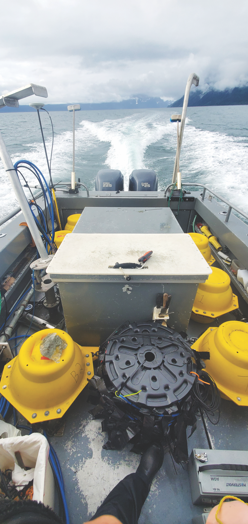
The problem is that no one really knows how soundwaves move, or propagate, in a glacial fjord. Even the U.S. Navy has struggled to understand the acoustics of these kinds of water environments — it’s why Zeh’s doctoral research in underwater acoustics is also funded by the Office of Naval Research.
Unlike the open ocean, glacial fjords are a mess of warm, salty seawater and cold, fresh water. They are also incredibly loud; the team described it like being surrounded by waterfalls and fireworks (the icebergs). That’s largely because glacial ice pops as it melts.
“It sounds like Rice Krispies in a big bath of soda,” Zeh said. The popping comes from air pockets trapped in the ice during snowfall, which become pressurized on the glacier’s relentless march to the sea.
Along with turbulent underwater currents and jostling icebergs, the environment is a nightmare for underwater acoustics. But the researchers think they can cut through all the noise. After mooring the four sensors, the team calibrated their equipment by driving the boat around the fjord while making controlled noises and measuring salinity and temperature (both of which affect sound propagation). This way of mapping the acoustic environment helps triangulate and isolate sounds, which they’ll correlate with melting events recorded from land.
If all goes to plan, they’ll have developed a new technological capability for the wider glaciology community, but there’s still a long way to go and much uncertainty.
“There’s been only a few studies in the past that listened to how glaciers sound in the submarine environment, which all ran into the problem that it’s a very loud and dynamic environment,” Catania said.
The measurements, models and sensor arrays mean that this time should be different, but they won’t know until they return next summer to pick up the recordings.
Until then, all they can really do is wait.
Even if they don’t hit pay dirt, Catania and Zeh have no regrets about the project. For Catania, it’s enough to have pulled off an against-the-odds field expedition with a resourceful and capable team: “the kind of people who’ll fix a broken propeller with duct tape, ice and a piece of plywood over lunch.”
Zeh, meanwhile, is happy to be part of something that could make a difference in the world. Among his favorite experiences from the trip was being on a tiny spit of land near the glacier called Haenke Island, where they’d been setting up a timelapse camera. Nearby but unseen, a newborn iceberg crashed into the sea. Its sound rolled over him like thunder.
“There’s only very rare moments in life when you take the time to sit and really listen to your environment,” he said. “Out there on that island, in that moment, I heard the environment for what it was. It gave me reassurance that my Ph.D., what we’re doing, all of this is real. It matters.”
Forensic Sand
It’s summer 2018 and Zach Sickmann is looking to occupy his mind on the flight back to Austin from San Francisco. Scrolling through NPR’s finance channel, he stops at a podcast about sand sustainability.
There’s still sand in his hair from scouring the California coast looking for an anomaly that had abruptly restricted river sand flowing into Monterey Bay. He’d traced that to a nearby sand mine, but why were economists suddenly interested in the stuff?
The podcast told the story of a case in Jamaica in which thieves carted away an entire beach in dump trucks. When investigators traced the stolen sand to a beach resort, they called in geologists to prove the sand had come from the same beach. The techniques they used are as familiar as a rock hammer to Sickmann, who is a sedimentologist and postdoctoral fellow at UTIG.
The podcast had described a crisis in global sand piracy in which entire Indonesian islands had disappeared overnight. Surely, he reasoned, there must be experts like him working on solving the problem. He imagined an entire wing of the Hoover Building bustling with FBI geologists employed to help break the illicit sand trade.
It turns out there wasn’t even one.
The thing about sand is that it’s everywhere. It’s the glass on your screen, it’s the silicon in microchips, it holds up our buildings, and it’s in the concrete paving our roads. It’s by far the most mined, transported and utilized commodity worldwide, and the good stuff is running out fast. That’s why a rising number of sand miners are going to environmentally damaging — and often illegal — lengths to get at low-cost, high- quality sand.
Inspired by that fateful podcast, Sickmann is today working on a proof of concept for a global sand fingerprint database that could help protect the world’s rivers and coastlines from illegal mining. To do that, he is building a pilot database in Central Texas and testing whether it works on store-bought ready-mix concrete. If the concept works, authorities could trace any sand regardless of where, and in what, it ends up.
The plan, which is funded by UTIG’s Blue Sky Program, is relatively straightforward. The first stage is to catalog samples from local sand mines and learn where processing plants source their sand. Next, he’ll test how well sand retains its fingerprint when it ends up in commercial products such as concrete. The tests range from sifting and measuring sand grains, to zapping zircons with lasers at the Jackson School’s formidable geochronology lab.
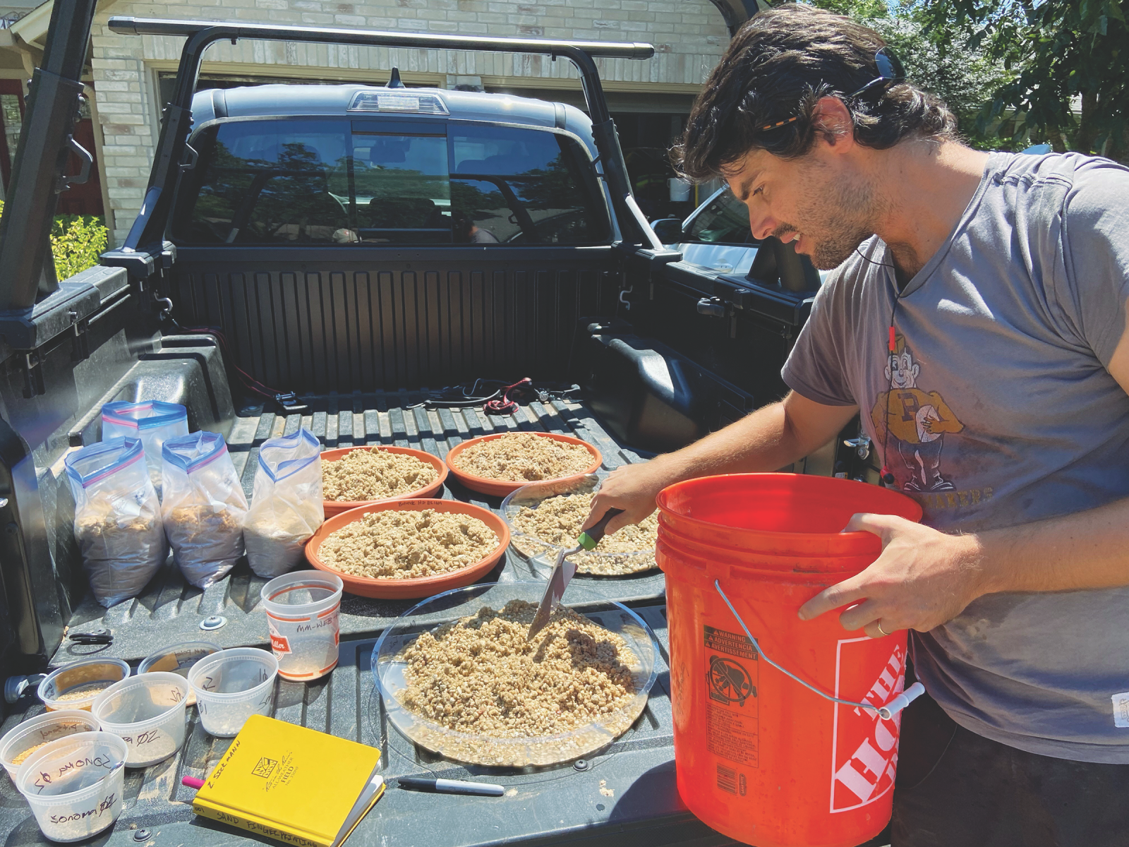
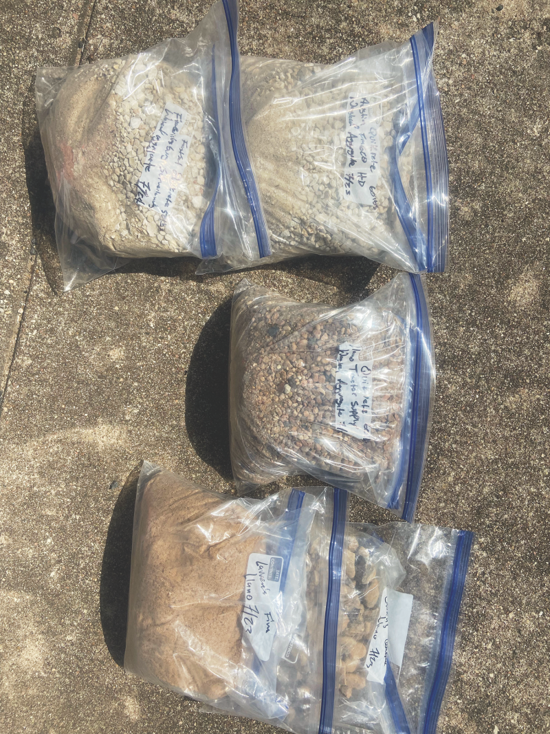
Importantly, he now has a team of collaborators: Aurora Torres, an ecologist at Université catholique de Louvain (Belgium) and Michigan State University; Raissa Ferron, associate professor of civil engineering at UT’s Cockrell School of Engineering; and Daniel Stockli, a professor at the Jackson School and chair of its Department of Geological Sciences.
Torres was the only other scientist he found who was actively working on the problem and who understands the societal impact of the crisis better than most. Ferron is an expert in concrete materials who has useful industry connections and her own UT lab, where they can slice concrete thin enough to put under a microscope. Stockli is an expert in the chemical analysis techniques used to find where sand comes from, and his geochronology lab is one of the best equipped in the world.
Early signs are positive. The Central Texas database was completed in August 2021 and had begun testing to figure out whether the concept could work on a global scale.
The tricky part, said Sickmann, is still to come. For the concept to be successful, it will have to work outside of Central Texas in places like Asia and Africa where sand production is not commonly reported but where illegal sand mining and sand piracy are major economic and ecological problems.
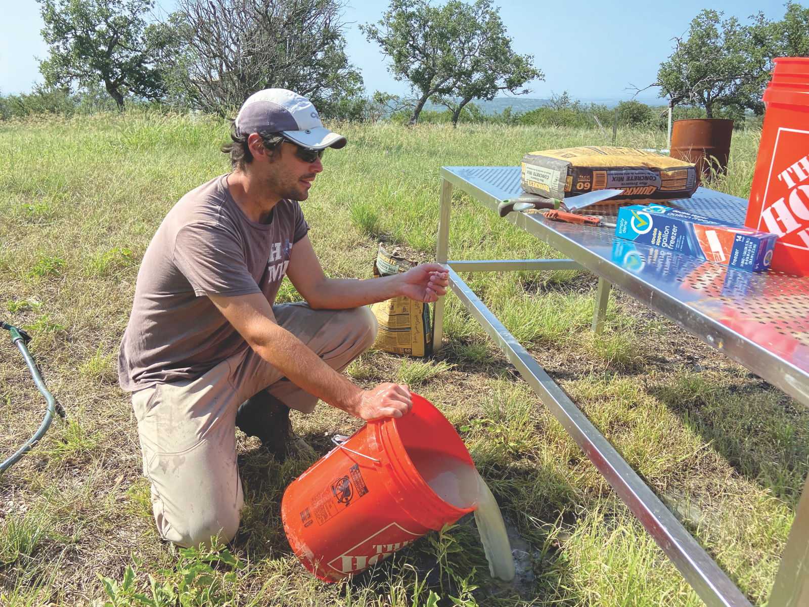
To lay some groundwork, Sickmann and Torres recently attempted to put a figure on how much sand was being stripped from the River Ganges, which flows from India into Bangladesh.
With no official production figures, or none that they knew of, they instead turned to Google Earth to locate sand mines, then calculated how much sand was leaving them by measuring the shadows cast from excavation tracks and onshore sand stockpiles. After some clever modelling in MATLAB, they figured that over the course of 2020, about 50 million cubic meters of sand was removed from just the Bangladesh section of the river, enough to fill the Houston Astrodome 40 times over.
“I’m having to wrangle so much information about things that aren’t my area of expertise,” Sickmann said. “It’s not just what concrete is and how it’s made. It’s things like learning about sediment supply networks in Asia, or how sand is pumped onshore from mining vessels, or what the average height and length is of a typical dump truck in Bangladesh. It’s about 3 meters, by the way. In all honesty, it can get stressful doing this. My brain is fried from trying to figure out how to make all this work, but in the long run I think it’s going to be worth it.”
The work has a way to go before it can be used to effectively regulate the global sand trade and protect the world’s rivers and coastlines, but if the immediate project only serves to attract attention to a growing problem, it will have made an important first step to avert future crises.
Saving Austin's Lakes
Floating on Lady Bird Lake among kayaks, paddleboards and Austin’s gleaming downtown, the iconic urban waterway is an idyllic setting for a lazy, summer day.
The city is rightfully proud of its inner-city lake. Its waters and lakeshore trails are enjoyed by thousands each year. But in 2019, the lake was afflicted by an outbreak of harmful cyanobacteria — blue-green algae that produce toxins when conditions allow them to bloom. The algae were so toxic that some dogs who drank the lake water died.
Outbreaks of dangerous algae remain a problem for the City of Austin, which manages Lady Bird Lake and the adjoining Lake Austin. It’s a problem that is likely to get worse because it’s connected to the city’s rapid urban development and climate change.
To tackle the problem, UTIG and the City of Austin are giving the lakes — which are artificial water bodies created by damming the Colorado River — a first-of-its-kind health checkup by taking high-resolution subsurface CT scans and performing biopsies of the normally benign algal mats that line the lakebed. The checkup will tell the city the extent of the algae problem, its underlying causes and how to treat it.
Project co-lead Marcy Davis has lived near the lakes for as long as she’s been a UTIG engineering scientist. For her, the project is a way to put her skills to use protecting her community. The chance to do that in partnership with a local organization is also why she sought UTIG Blue Sky funding for the project.
“For years, when we’ve tested equipment, we’ve put the boat on Lake Austin for a day or two and ended up mapping most of it at different periods,” she said. “It just seemed right that we should put our data to use.”
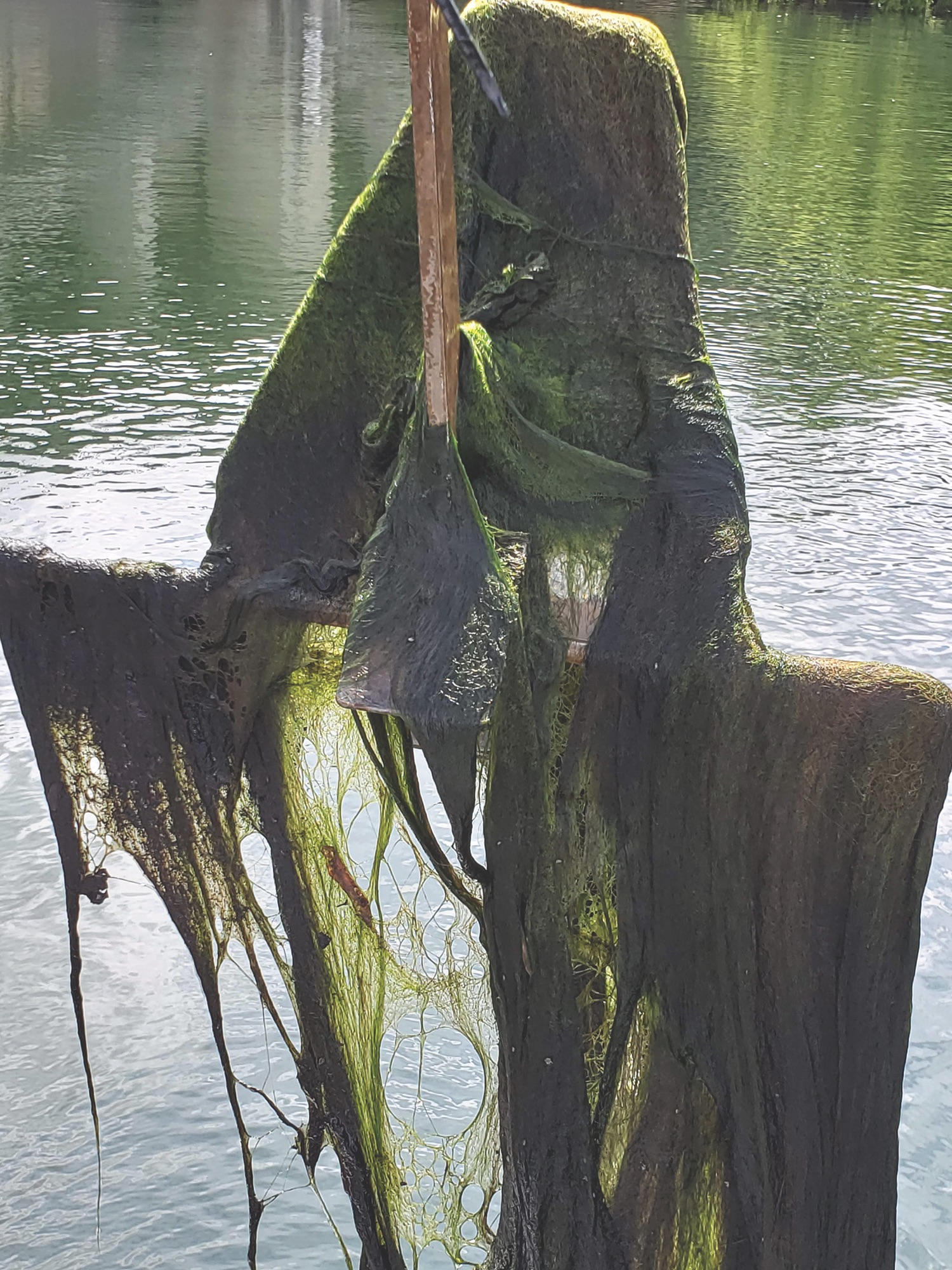
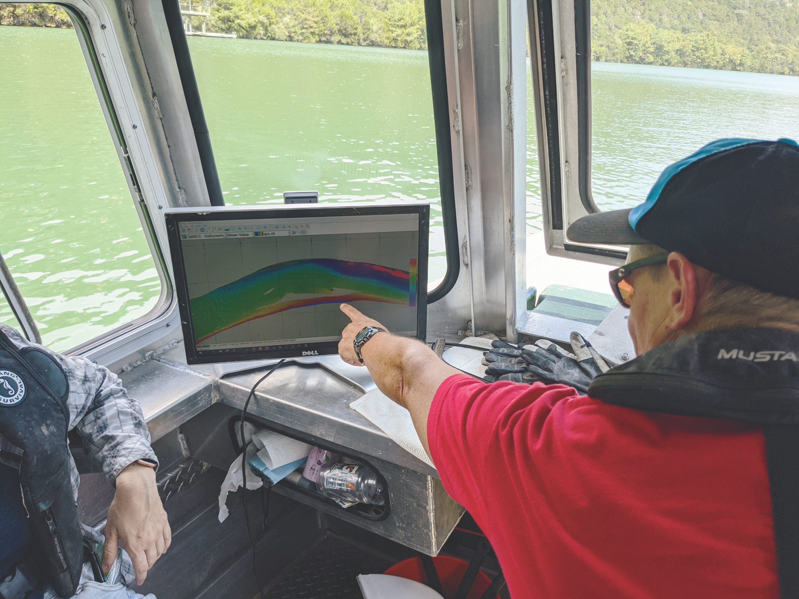
Over time, Davis had noticed the lakebed was changing. She didn’t know what the changes meant, so she reached out to Brent Bellinger, a senior environmental scientist with the Watershed Protection Department at the City of Austin.
Davis’ email was almost perfectly timed. It reached Bellinger not long after the 2019 toxic algae bloom had put a big question mark over the lakes’ changing biogeochemistry. When he saw the capabilities Davis and the institute offered, it was almost too good to be true.
“With technology like this, we can tackle questions I just didn’t have the tools to answer before,” he said. The yearlong project made its first comprehensive lake survey in early September 2021, when the lakes’ algae were at their most active. The team, which included UTIG engineering scientist Dan Duncan and Jackson School doctoral student Naoma McCall, deployed a full suite of geophysical instruments on each lake, cut sections from algal mats and took samples from lakebed sediments. A second survey will happen in the winter when algae are expected to be dormant.
The surveys will show how much the algal mats grow between seasons and the effect they’re having on the ecology of the reservoirs. Along with the cores, they will also reveal what’s feeding them and when.
The main culprit, said Bellinger, who’d seen similar issues in the Great Lakes when he worked for the U.S. Environmental Protection Agency in Minnesota, is likely to be excess nutrients carried by river sediments; the nutrients feed the algae, and enough nutrients will put them into overdrive. The problem is made worse when zebra mussels, an invasive species of mussels from Eurasia, are present because they filter the water, allowing more sunlight to reach algae on the lakebed. The more sediments and zebra mussels in a lake, the more likely that the algae will bloom.
According to Bellinger, the flow of sediments is connected to the region’s accelerating urbanization and increasingly frequent weather extremes. In the summer of 2018, a long drought baked the surrounding hills until they were hard. When the rains finally came, the water had nowhere to go but overland, picking up soil and pollutants from the surrounding countryside and washing it into the river, turning it the color of chocolate milk. The dirt, debris and silt in the reservoirs overwhelmed water treatment plants and left a million residents under a boil water notice for seven days. The following summer, lakes were hit by toxic algae blooms.
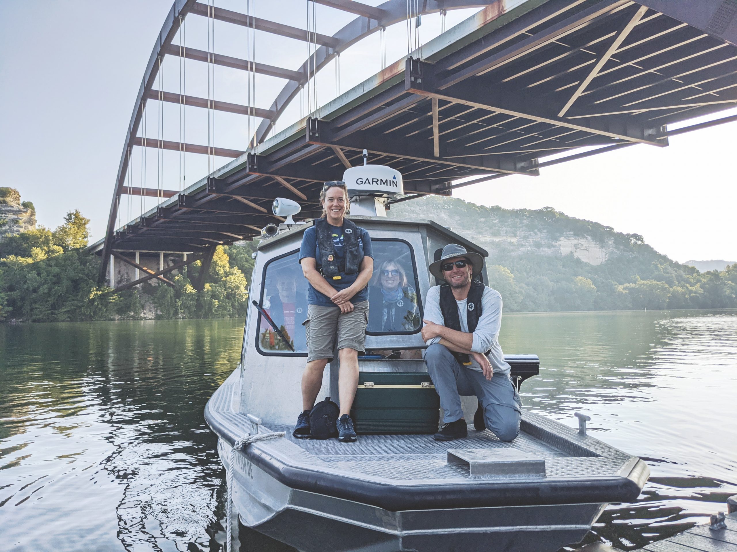
The rainfall that autumn was historic, but the pattern of drought and deluge is common to Texas and one that climate scientists say will only get worse as the world warms. The problem is made worse by urban development because buildings and paved roads channel rainwater and debris straight into lakes and rivers. That means more and dirtier water going into rivers, more algae, more severe flooding, and more harm to water quality.
The city mitigates the problem through engineering projects, land purchases and public campaigns to slow the flow: things like water conservation efforts, growing buffer vegetation and reducing lawn irrigation. The partnership with UTIG means the city has access to technology that can help guide its actions and make them more effective.
Bellinger said he is hopeful for the future because despite the recent issues, Austin’s lakes are in excellent health. He should know. He’s worked major research projects in the Florida Everglades, the Great Lakes and Lake Tanganyika in East Africa.
The project will be funded under UTIG’s Blue Sky Program until 2022. If all goes well, Davis and Bellinger hope to continue surveying Austin’s lakes with support from the City of Austin and The University of Texas at Austin Research Collaborations, a new program designed to facilitate research collaboration between UT and the city.
“I feel like I really lucked out with this UTIG collaboration because we’re learning about the health and condition of the reservoirs — which is essential to protecting them — in a way we’ve never done before. So, let’s ask some questions. Let’s see what this technology can do,” he said.
The University of Texas at Austin
Web Privacy | Web Accessibility Policy | Adobe Reader

