
Into the Glacial Abyss
In summer 2024, a Greenland expedition led by The University of Texas at Austin dove into an undiscovered frontier in search of answers about future sea level rise
BY CONSTANTINO PANAGOPULOS
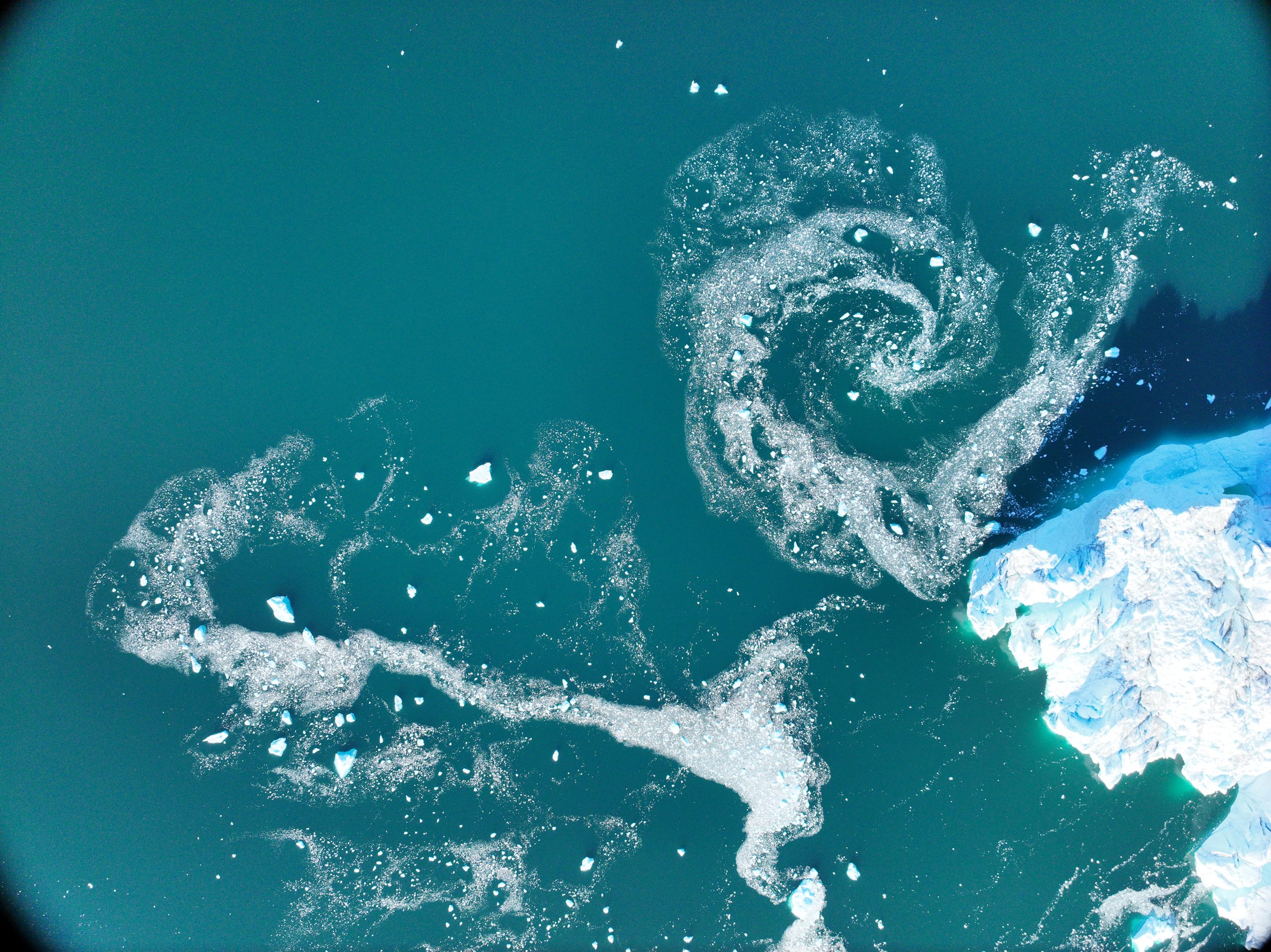
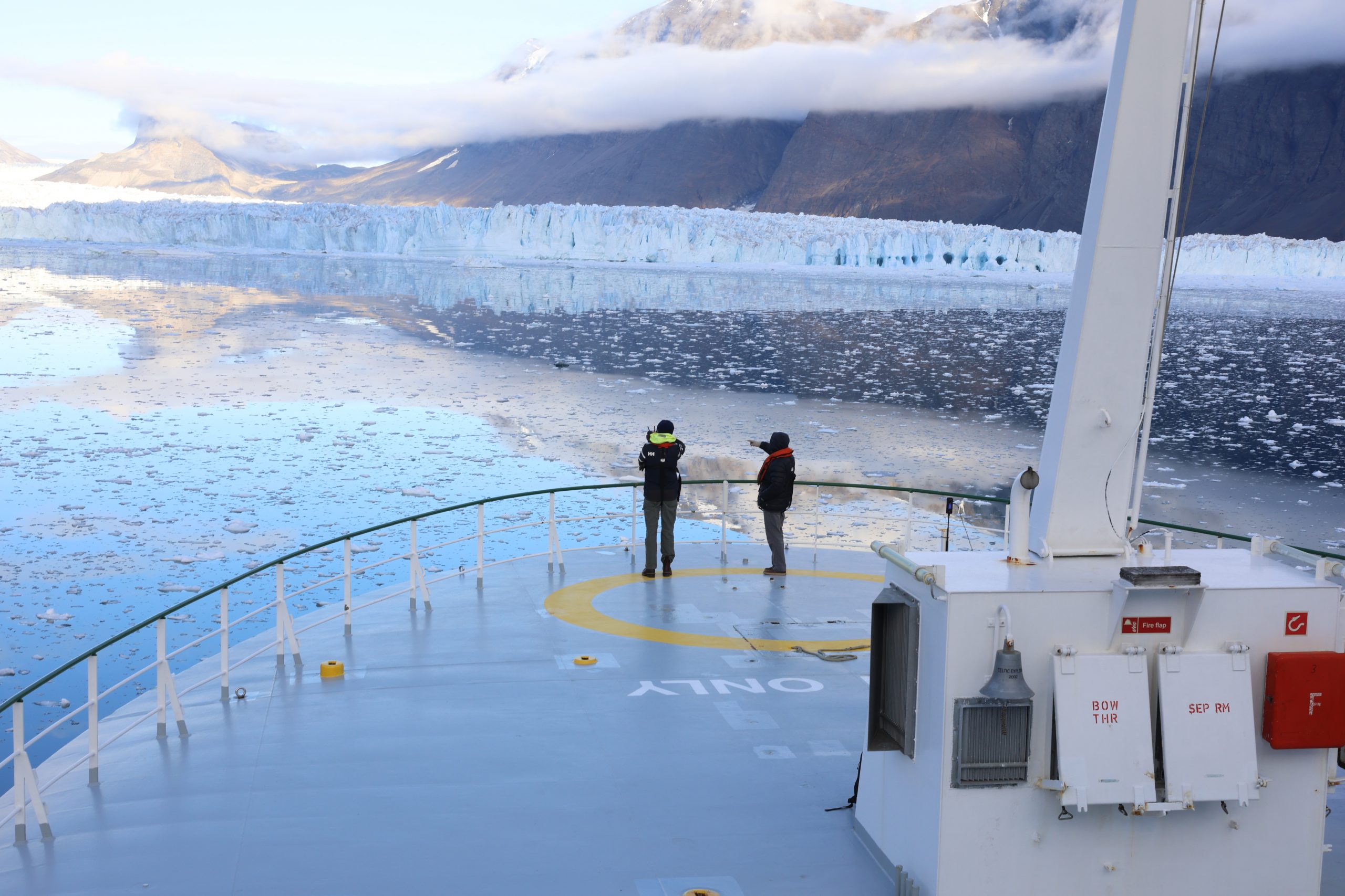
On the far western edge of Greenland’s ice sheet, a large glacier leads to the sea, where it breaks against the water like a frozen wave 5 miles across. Here, dark with mud, the sea seethes with the force of subglacial rivers rushing in from beneath grinding ice.
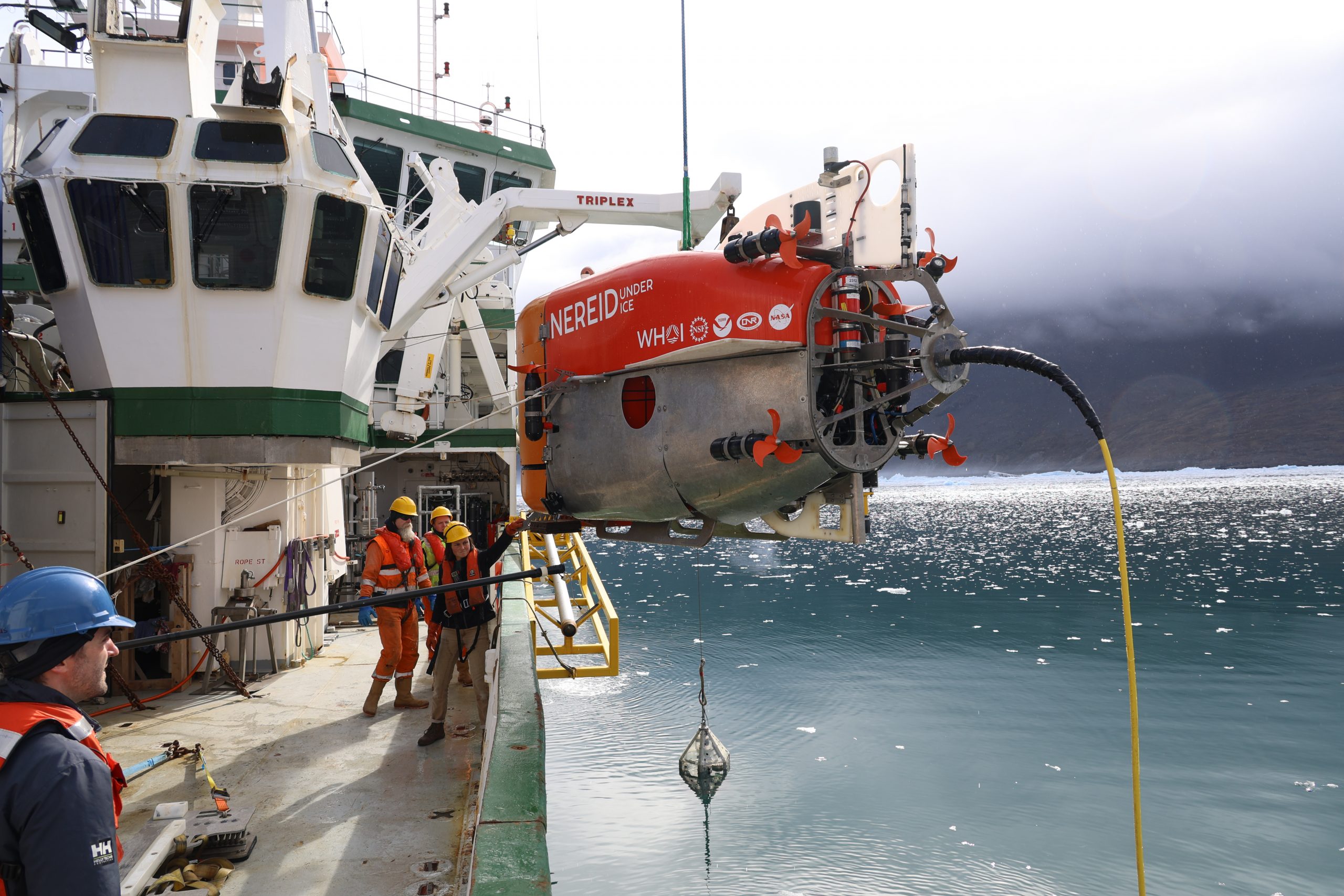
In the middle of the fjord, surrounded by mile-high mountains, a green and white research vessel, the Celtic Explorer, watches over the drama unfolding below. Its many cranes are in motion. Cables and poles hang over the side. A crowd of engineers and technicians hurries about the deck.
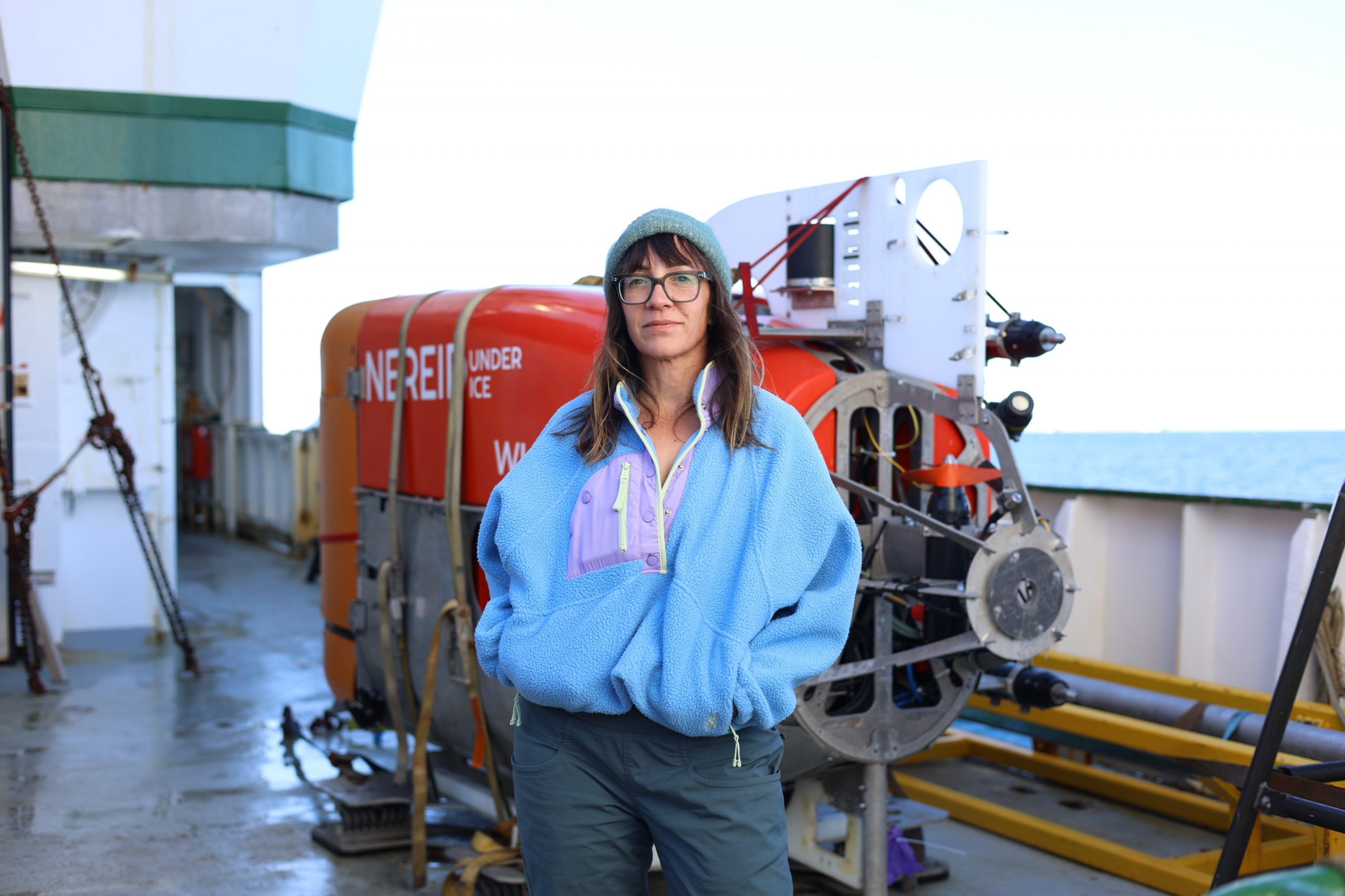
Suspended beneath the ship’s octopus arms is a car-size contraption. The large white lettering on the red and orange body reads Nereid Under Ice. This is NUI, a unique robot submersible that’s about to embark on the last of seven historic dives to survey the glacier underwater. For the first time ever, scientists are getting an up-close look at the underwater face of the glacier.
The dive is part of a scientific expedition led by the University of Texas Institute for Geophysics (UTIG) to study the turbid, treacherous waters where glaciers fall into the sea and learn why some of Greenland’s glaciers are retreating quickly under climate change while others are not.
“The biggest uncertainty in predicting sea level rise is how ice sheets will behave in the future and the biggest uncertainty in predicting ice sheet behavior is how the ocean, atmosphere and bedrock interact with the ice.”
That’s chief scientist Ginny Catania, a professor at UTIG at the Jackson School of Geosciences, and a veteran of polar fieldwork. Headed by Catania, the expedition’s primary mission is to survey naturally-forming underwater sandbanks — called moraines — and see whether they might be slowing the ice sheet’s retreat.
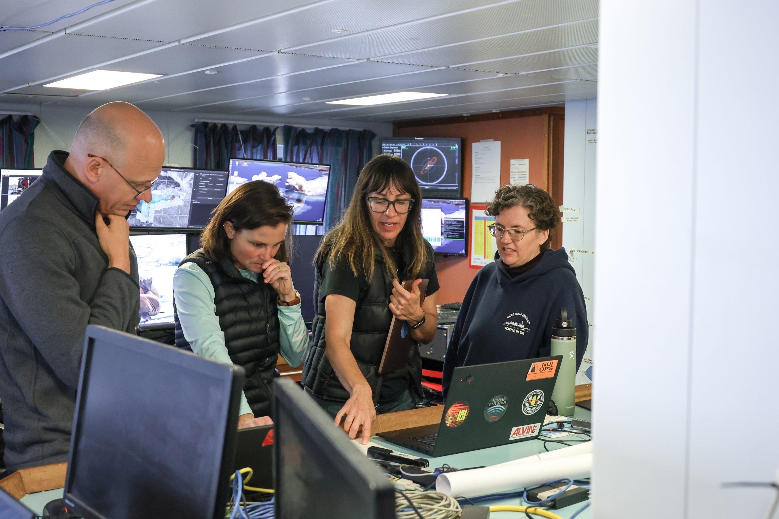
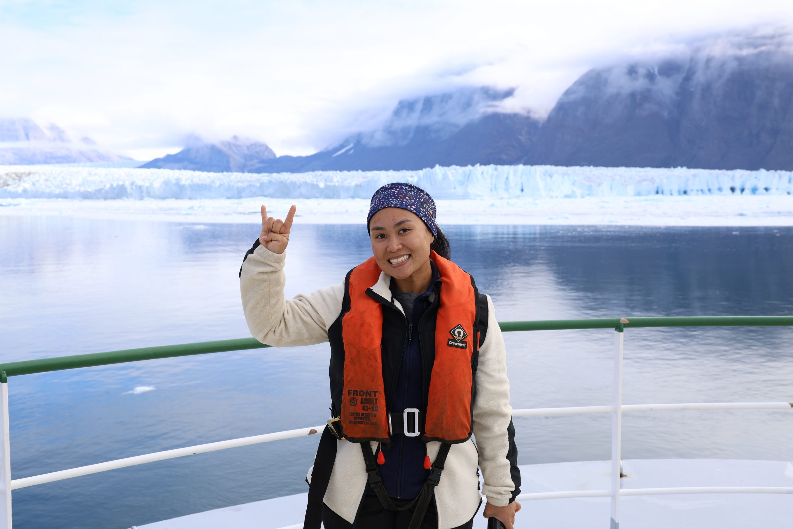
Catania has assembled a 23-strong team of scientists, students and engineers from seven institutions, including the Woods Hole Oceanographic Institution (WHOI), University of Florida, Rutgers University, Oregon State University, Tufts University and Aarhus University in Denmark. They’re supported around the clock by the 15 crew of the Celtic Explorer, a research vessel of Ireland’s Marine Institute.
In such a dynamic and unexplored environment, every measurement made could be new to science. That’s why both Celtic Explorer and NUI are bristling with sensors ready to measure everything, from the geology of the muddy seafloor to the size of microparticles in the swirling water.
Ships rarely come this close to large active glaciers and no submersible has ever gotten as close to one in Greenland as NUI has. There’s good reason. Aside from strong subglacial currents, icebergs the size of skyscrapers topple from the glacier’s edge or emerge from the depths without warning, filling the fjord with ice.
Into this maelstrom NUI must dive for up to 12 hours at a time. High-risk, high-reward research is the scientists’ oft-repeated phrase, and it’s one that NUI expedition leader Molly Curran fully embraces.
“It’s a hard and challenging environment, but I think what makes me feel comfortable putting NUI over the side every time is having the trust in my team, the scientists and the work that they’ve done,” she said.
Cables and cranes retracted, NUI’s thrusters spurt to life, and the plucky submersible disappears into the turbid depths.
From Greenland Moraines to Sea Rise in Texas
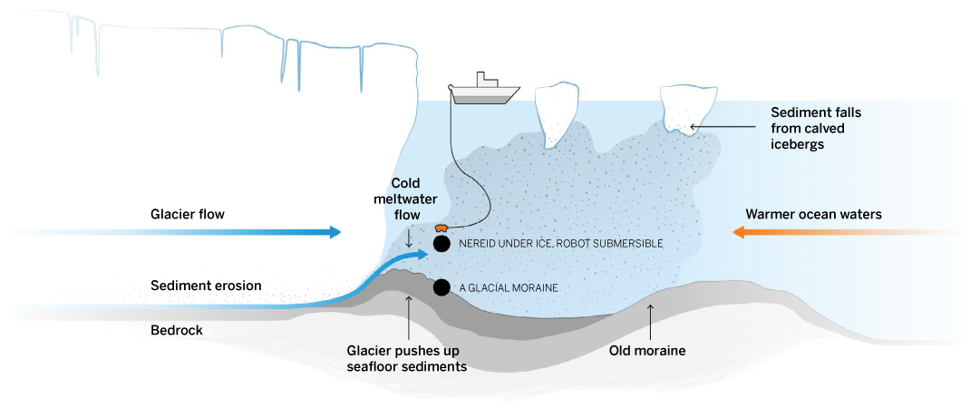
Greenland’s ice sheet is vast. It’s nearly three times the size of Texas and holds enough water to raise sea levels 23 feet. At the edges where it spills into the ocean, its glaciers carve wide valleys in bedrock. The way that happens is important to what comes next.
As glaciers slide downhill, loose rocks get frozen onto the bottom of the ice. The rough underside scrapes the bedrock to a fine powder. This gets washed into the sea via meltwater channels, visible from above as muddy sediment plumes. Over time, the sediments pile up in front of the glacier and form underwater moraines.
Most of Greenland’s 300 sea-facing glaciers have retreated in recent years. The expedition scientists think that these moraines could explain why some 30 have held fast or even advanced.
One idea is that glaciers get wedged on their moraines, giving them a grounding point and keeping the ice from retreating deeper into the fjord. A large-enough moraine may also block warm ocean currents from reaching the ice.
But the waters near Greenland’s active glaciers are so treacherous that no one has ever gotten close enough to say which scenario is accurate, or whether something else is at play. Until now, that is.
Getting here has been far from smooth sailing. A mission like this was long considered too big a risk for most funding agencies. But the W.M. Keck Foundation supports high-risk, high-impact research and saw the potential in Catania’s ideas to open new fields of science. With the Keck Foundation on board and additional funding from the National Science Foundation, the expedition set sail from Galway, Ireland, in July 2024.
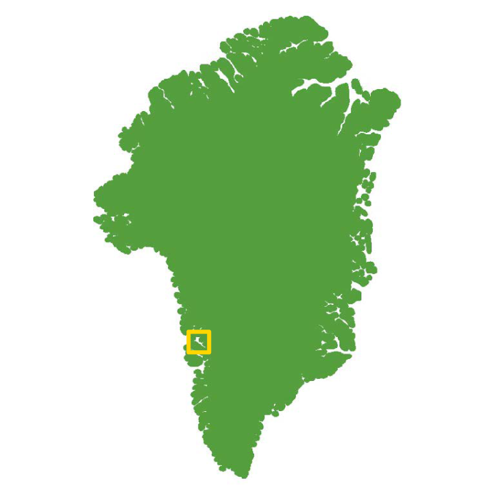
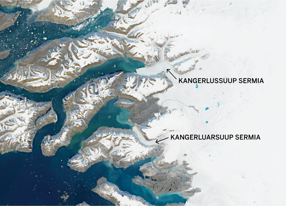
On arrival in Greenland, the expedition targeted two glaciers. The largest, Kangerlussuup Sermia, is about 5 miles wide. It sheds many icebergs during the summer, but despite that, its terminus, or edge, has stayed at about the same place since satellite observations began 30 years ago. The second glacier, Kangerluarsuup Sermia, is about half the size. Since 1998, its terminus has retreated about half a mile but stopped in 2016, where it has remained. Today it shows little activity and sheds few icebergs.
All this is important because Greenland is losing ice and raising sea levels fast — 270 billion tons of annual meltwater, or about 2 millimeters of sea level rise a year, twice that of Antarctica, and increasing.
“Understanding how much ice Greenland will lose by the end of the century is really important for coastal communities all over the world,” said Mikayla Pascual, one of the Jackson School students on the expedition. “Is it going to be a meter or 3 meters of sea level rise? Ultimately, that’s what we want to answer.”
Pascual has devoted her research to creating an ice sheet model that will include the Greenland data and perhaps answer that question.
Eventually, though, action to mitigate the effects of sea level rise will have to happen in the places where they are already being felt. These are place like Texas, where Pascual and much of the expedition team live and where rising sea level already threatens the Gulf Coast with storm surges and flooding.
On the Celtic Explorer, Pascual and the other scientists watch as NUI’s pilots and engineers run through checklists and key up waypoints. Hundreds of feet below the surface, NUI signals that its systems are healthy. All is well. A hair- thin communications line connects it to an instrument box suspended from the Celtic Explorer. Curran gives the word: The mission is a go.
Rotors spinning, the submersible turns from the vessel and begins its transit to the glacier.
Ice From Above
The drone shoots up from the Celtic Explorer and disappears into the brilliant blue sky.
On the bow, a portable speaker is playing mid-’90s hits. UTIG glaciologist Benjamin Keisling is monitoring Tern, one of two aerial drones the researchers have named after local seabirds: the other is Kittiwake. With him is Marcy Davis, a UTIG engineering scientist whose technical duties include planning, flying and processing data from the drone flights.
Keisling points at the glacier about a mile distant.
“Oh my God. What is that?” he says. “Looks like ice,” replies Davis. The pair burst out laughing.
Like any job, scientists sometimes deal with monotony. They crack jokes, often bad ones. Spontaneous dancing is not uncommon.
Flights typically last 30 minutes before the battery runs low, but this one’s short. Davis and Keisling have programmed Tern to scout the glacier’s southern face for the NUI team while the submersible is in transit.
The drone flights have not been without drama. The previous day, while Kittiwake was still 2 miles from the ship, a massive iceberg announced itself with a thunderous roar. Throttle open all the way, Kittiwake fought fierce headwinds to beat an ice wave barreling toward the Celtic Explorer. The drone landed hot and hard as the ship’s engines roared to life.
Aside from reconnaissance missions, the drones have hovered over the glacier’s turbulent plumes, videoed the vigor and speed of the water, and caught playful seals on camera. But their main scientific mission is to survey the glacier and map daily changes that connect the glacier with what’s happening elsewhere.
“Ultimately the processes that we’re trying to better understand here at the terminus impact how the whole ice sheet responds to changes in its environment and, in turn, how sea level might change in the future,” Keisling said.
Robot Bumblebee Goes Diving
A bank of screens shows a live feed from inside NUI’s bay doors. The submersible’s outstretched robot arm is all that’s visible in the muddy water. All of a sudden, the screen turns milky white. NUI has hit the seafloor, kicking up clouds of powdery fine sediments. It’s all very intentional.
With zero visibility at the base of the ice, the NUI team came up with an unorthodox way of collecting seafloor samples.
“We call it the bumblebee. It’s worked surprisingly well,” Curran said.
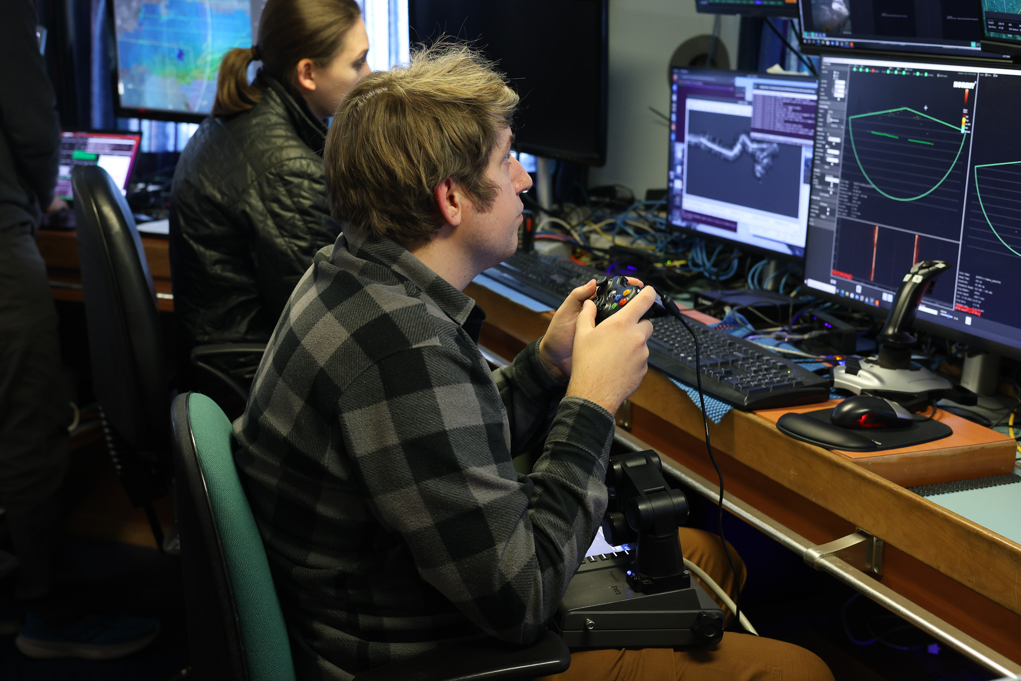
The technique involves rising to a depth with better visibility, directing the submersible to grab a coring tube from its basket, then diving to the seafloor with the tube held out in front. It takes immense coordinated skill from the NUI team, but especially pilot Victor Naklicki of the Woods Hole Oceanographic Institution.
A screen confirms the foot-long core is secure. For the briefest moment, Naklicki’s trademark scowl breaks into a smile.
“Piloting is the fun part of the job,” he said.
NUI is designed to operate in unique environments. Its chief advantage is that it is directly controlled with a single length of hair-thin fiber-optic tether nearly 25 miles long, much longer and lighter than the cable used by a conventional remotely operated vehicle (ROV). It can also operate as an autonomous underwater vehicle (AUV) if the fiber breaks.
“A conventional ROV couldn’t get up close to the terminus without endangering the ship it’s tethered to, and a conventional AUV can’t take samples or navigate a dynamic environment like this. Only a hybrid vehicle like NUI allows us to get to these hard-to-reach places and come back safely,” Curran said.
In terms of scientific exploration, NUI is probing glaciology’s event horizon. Nearly everything it’s done has been a scientific first: It has returned seafloor cores from the shadow of the glacier, surveyed the glacier’s underwater face, mapped moraines in real time, and measured swirling ocean currents inside ice caves.
On the face of it, what NUI encountered — sediments raining from above and holes in the ice — was unremarkable. But the size of almost everything at Kangerlussuup Sermia has been off the charts.
It’s led to some close calls. Curran remembered the first time NUI stopped beneath one of the glacier’s sediment plumes. When the submersible went to take off, it was as if something kept pulling it back down.
“Did we flood a housing? Did we lose some part of our (buoyancy) foam?” she said.
Curran gave the order to drop NUI’s emergency ballast, and the submersible rose free to continue its mission.
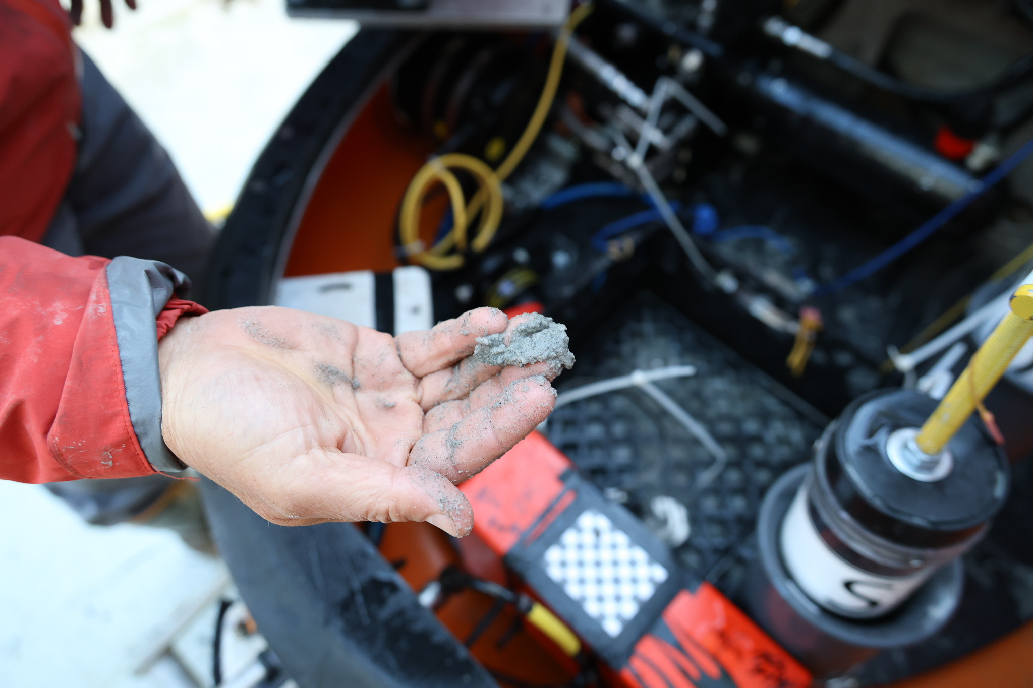
When it got home, the engineers found its instrument bay was filled with glacial sediments — a nerve-wracking experience for the NUI team but a 50-pound serendipitous win for the expedition’s sediment scientists.
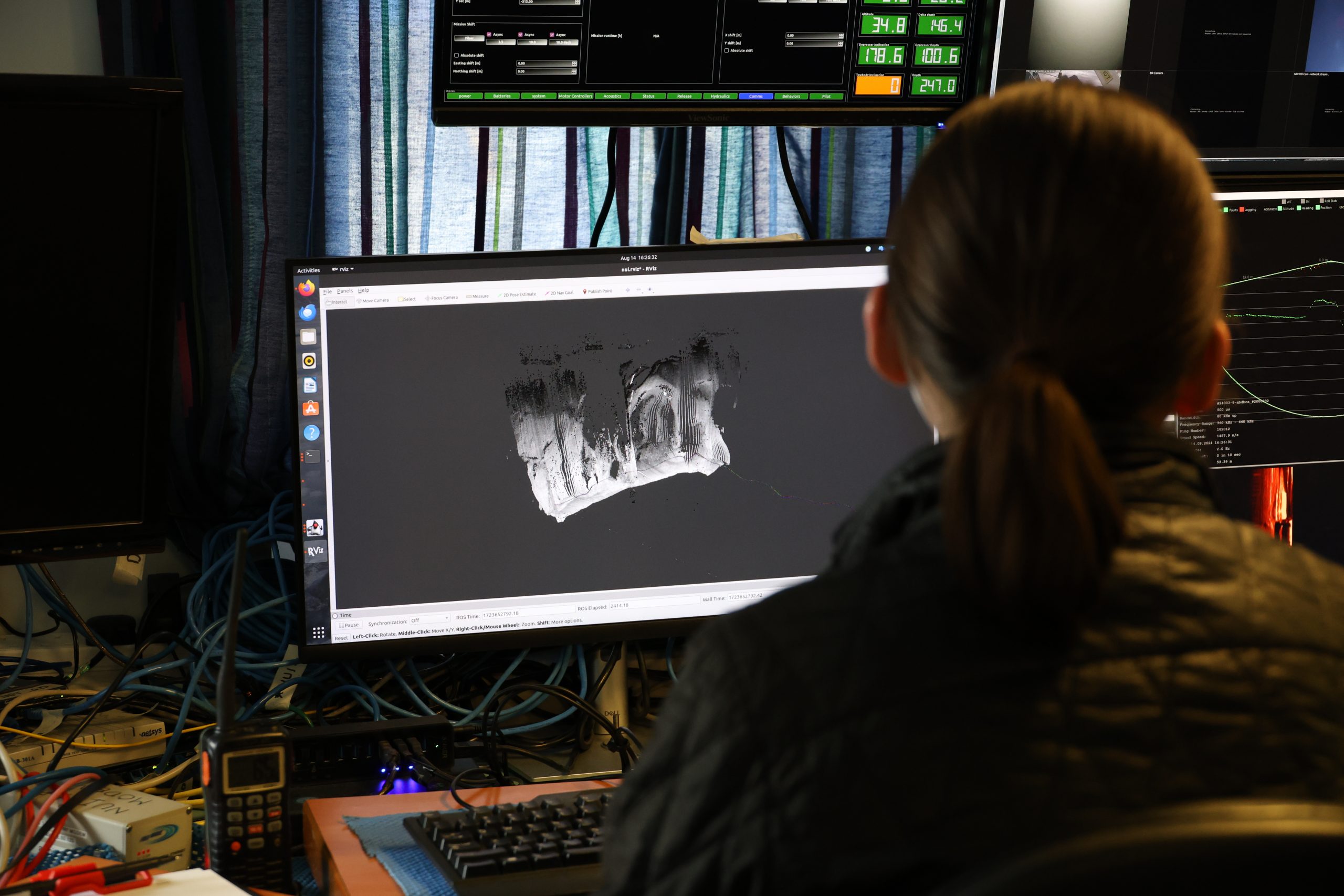
A display shows a real-time rendering of the ice-face as seen by NUI’s multibeam sonar. In some places, the ice is cliff-like, rising 1,000 feet from seafloor to surface. In other places there are vast ice caves hundreds of feet across. It’s these that draw the most gasps from the watching scientists.
The caves drew one or two gasps from the team operating NUI too, but for different reasons. The first time NUI came to a large ice cave, they felt it being pulled inside by currents no one has ever measured before. They were more careful around the ice caves after that.
Catania said the ice caves probably are hollowed out by under-ice rivers carrying surface melt. But she thinks the cliff-like portions are being smoothed down by meltwater leaking from the bottom of the glacier. If that’s true, the volume of meltwater would be enormous, but it would support an idea put forward by one of the expedition members, Rutgers University researcher Becca Jackson, that glaciers lose as much ice through contact with the ocean as they lose by contact with warm air.
“This could be evidence that that’s true because we see so much leakage of water from this distributed system. It’s coming out everywhere and causing melt everywhere,” Catania said.
Until the data are fully processed and analyzed, they can only speculate about what these features mean.
Whirling, Swirling Ocean
After passing west of Ireland, the North Atlantic Current, which begins as the Gulf Stream in the tropics, heads north until it hits the southern tip of Greenland.
Here, the current’s warm, salty seawater plunges beneath Greenland’s cold, fresh coastal waters. But it still reaches many glaciers and erodes them at their deepest points. With global warming heating up the Atlantic, that means even more heat could be reaching the glaciers, said Rutgers University oceanographer Bridget Ovall.
That’s where the shield-like moraines come in. For instance, under the surface at the second, smaller glacier, Kangerluarsuup Sermia, the expedition found a secret defense against the warm Atlantic seawater: a large, old moraine.
“What we saw was that all that warm Atlantic water can’t get to the glacier because it can’t get up over that sill (the moraine). The only water reaching the glacier is cold polar water,” Ovall said.
Surveys found that this old moraine probably was dumped into the fjord during the Little Ice Age, a period in the Middle Ages when the Northern Hemisphere cooled, glaciers advanced and Kangerluarsuup Sermia reached further into the fjord.
Back at the main glacier, Kangerlussuup Sermia, the picture is muddier, and not just from sediments pouring into the fjord. Here, the ocean currents are much more complex, and until data from NUI and the Celtic Explorer are analyzed, it won’t be clear how much warm water makes it to the glacier.
What the scientists do know is that the sea near the glacier is being churned up by meltwater jetting out of the glacier. Some of it comes out from underneath in sheets of flowing water. In other places it shoots out of the face of the glacier in vigorous spouts.
Ovall said that each stream makes its own little circulating layer in the ocean. That could mean one of two things.
By stirring up seawater, the curtain of circulating currents is stopping warmer Atlantic water from reaching every part of the ice.
“Or it might mean that you’re creating more lateral circulation cells in front of the glacier, potentially bringing more heat to the glacier. It could go either way,” she said.
Reading the Ice’s Future in the Mud
After nearly 12 hours in the water and dwindling battery power, NUI is hauled gently back on deck. Beneath a twilight Arctic midnight sky, the Celtic Explorer transitions to nighttime research operations. The researchers head below to wind down and rest.
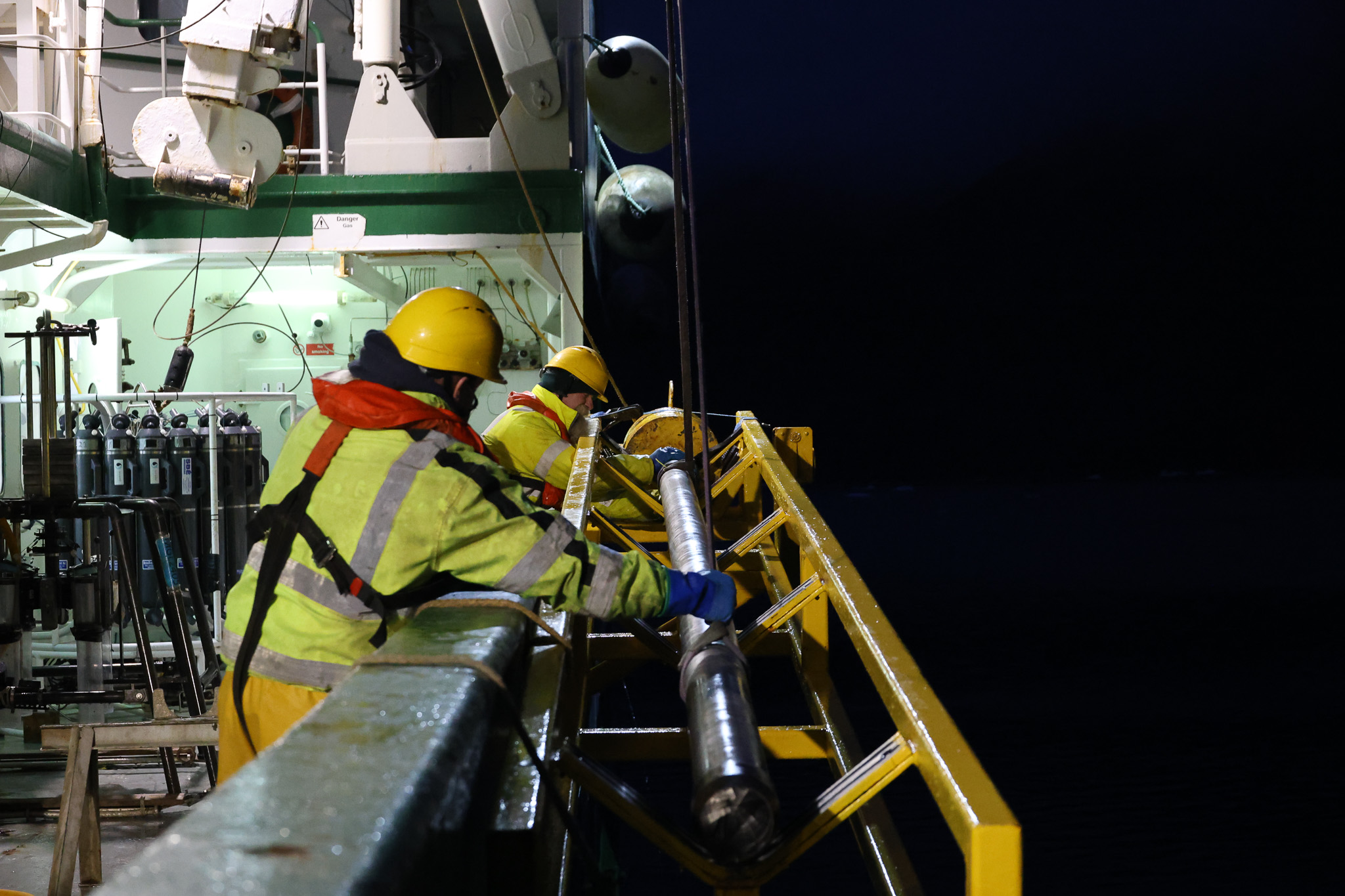
The nightshift scientists emerge, steaming coffee in hand. It’s Sean Gulick, a research professor at UTIG, and John Jaeger, a professor at University of Florida, accompanied by graduate students Pascual and Emily An of Oregon State University. For the next 12 hours, the ship will sail up and down the fjord, trailing a mile-long seismic antenna and stopping periodically to recover cores from the seafloor.
These operations are all about peering into the glacier’s muddy past.
A thousand years ago, a brief climate anomaly known as the medieval warm period forced glaciers to retreat and coincidentally allowed Vikings to settle where once there had been ice. Then followed a period of global cooling starting around 1215, during which glaciers advanced (and Vikings left) three times. After each surge, the glaciers retreated again.
Understanding this back and forth tells us what to expect as the planet warms, said geophysicist Gulick.
“The retreat from the Little Ice Age is an interesting analog to retreat today. How did it actually retreat? What did it leave behind? Does it have a stuttery start where it seems to retreat and then holds?” Gulick said.
The answers are buried in the seafloor that Gulick and the subsurface geophysics team have imaged using seismic waves. The X-ray-like pictures of layered sediments will tell them a story of glacial advance and retreat going back centuries.
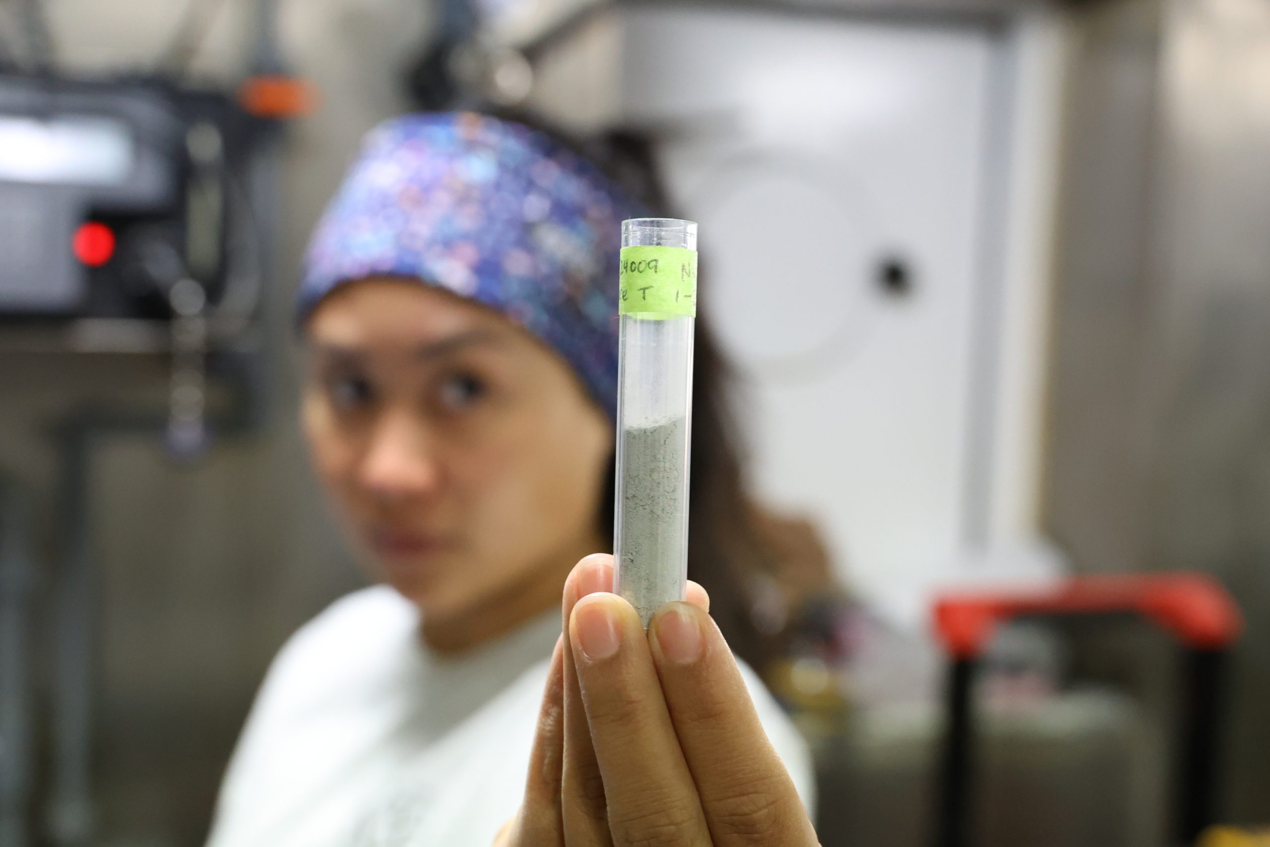
A long metal cylinder hits the deck with a clang. It holds 20 feet of sediments cored from the seafloor when the cylinder, weighed down by metal weights, slammed nose-first into the bottom. It’s called a gravity core, and it works as you’d imagine.
This is the mud that Jaeger, a sedimentologist, has been waiting to get his hands on. Along with NUI’s haul from the foot of the glacier, samples like these can tell scientists much more about how the moraines are physically built and how stable they may prove to be.
And when paired with seismic imaging, the cores will give the scientists an accurate history of the glacier’s behavior during past climate changes, Jaeger said.
Farewell to Ice
It’s the morning after NUI’s last dive at the glacier. The science deck is busy. At mid-starboard, deck crew are deploying an ocean measuring sensor to eke out some last-minute science. Nearby, NUI engineers are busy packing up instruments and securing their gear for the voyage home. On the other side of the deck, Jaeger and a bleary-eyed coring team are stacking the sediment cores that they pulled from the seafloor overnight.
Over the course of seven dives, NUI delivered astonishing surveys of the glacier’s underwater ice-face, retrieved pristine glacial sediments, and even measured ocean currents inside a submerged glacial ice cavern.
“Giving scientists the tool to access that environment and seeing the excitement on their faces the first time we did that was just super rewarding,” Curran said. “It’s why I love my job.”
For NUI, it’s home and a well-earned rest. The submersible has been incredibly successful. That bodes well for another WHOI-led, Keck Foundation-funded project: an autonomous underwater observatory that will use NUI’s technology to explore and monitor Antarctica’s floating ice shelves.
But for Catania and the other researchers, the science has only just begun. In among the terabytes of information and stacks of glacial sediment samples are possible clues to the ice sheet’s future. It’s difficult to know which of those clues will be most valuable.
“We’ve never seen anything at the glacier terminus with this much resolution before,” Catania said. “The measurements that we got were just so novel that the analysis has to be novel, and that requires rewriting a lot of the book on how we’ll do that.”
The wind whips up white caps on the fjord. On the Celtic Explorer’s bow, the drone team wraps up their last aerial survey. The two uncomplaining drones have surveyed nearly 1,000 miles of ice. With the last drone on deck, the sun breaks over the buttressing mountain and sets the glacier alight.
The scientists came into this project with a hypothesis that glacial sediments are protecting some glaciers from retreating too fast. To test that, they crossed an undiscovered frontier where for now at least, they’ve found more questions than answers.
There’s much work ahead of them, but it’s clear that historic science has taken place. During the years to come careers will be written from the findings.
“I cried when NUI first saw the ice, just a little,” Catania said. “It’s so much effort putting all this together that finally seeing it working in the way that we expected was really moving.”
At the mouth of the fjord, the Celtic Explorer turns for open seas. An armada of icebergs trails in its wake.
More Underwater Glacial Exploration |
||
| Mission Blog: ig.utexas.edu/greenland-blog | ||
| Mission Website: ig.utexas.edu/greenland-terminus | ||
The University of Texas at Austin
Web Privacy | Web Accessibility Policy | Adobe Reader