
FIRST DIVE TO GLACIER'S EDGE
The underwater face of Greenland’s glaciers was an unexplored climate frontier. Until now.
By Constantino Panagopulos
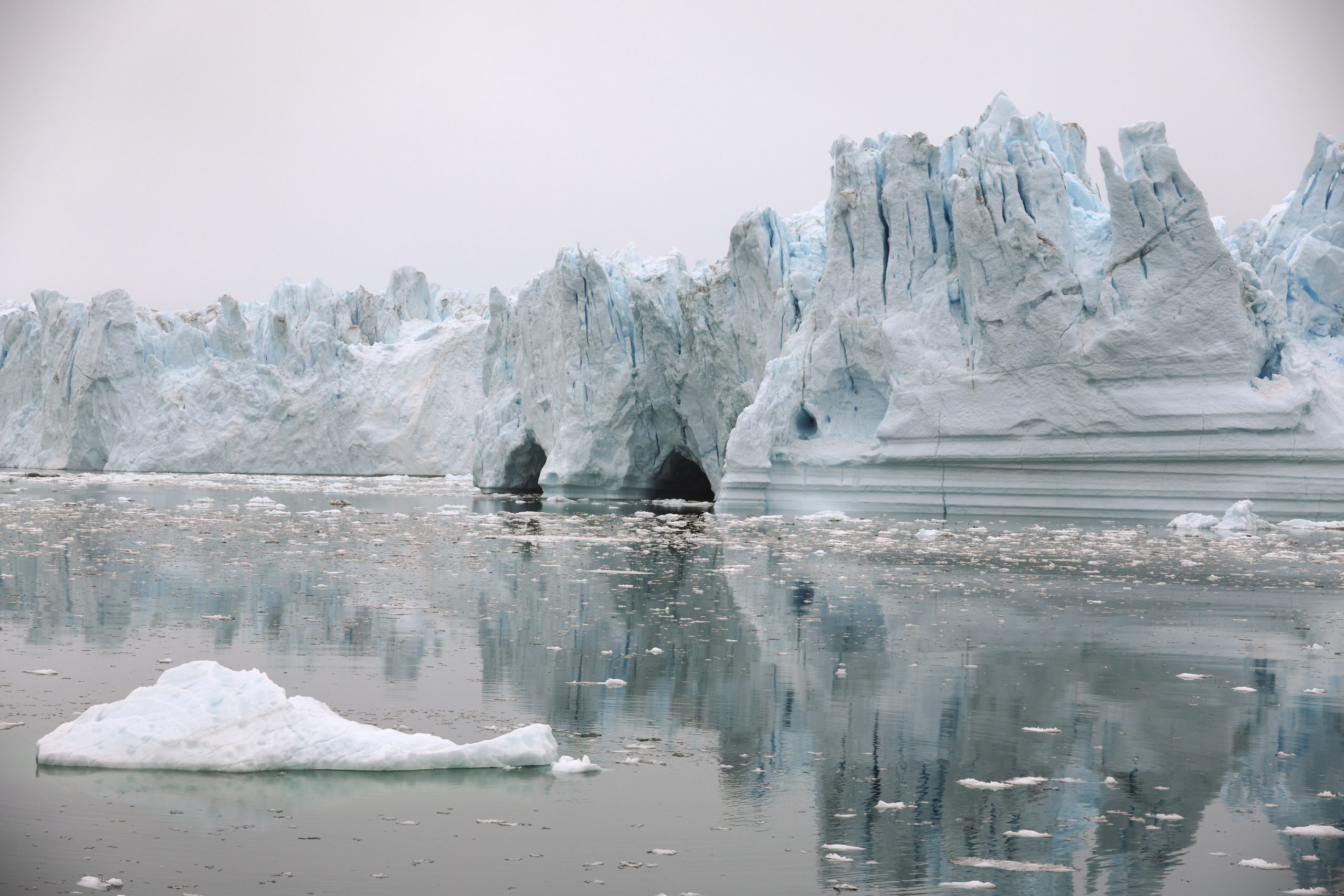
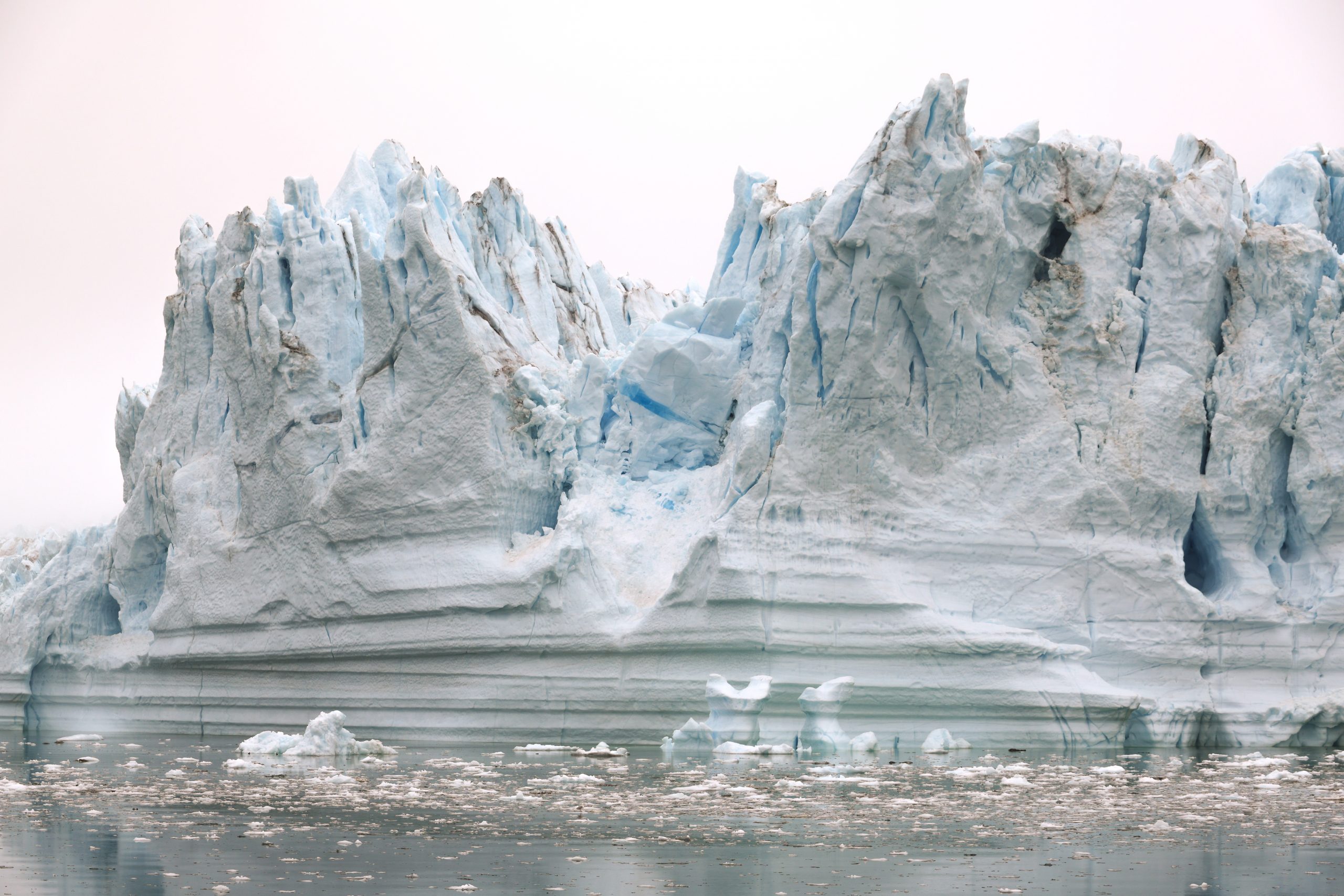
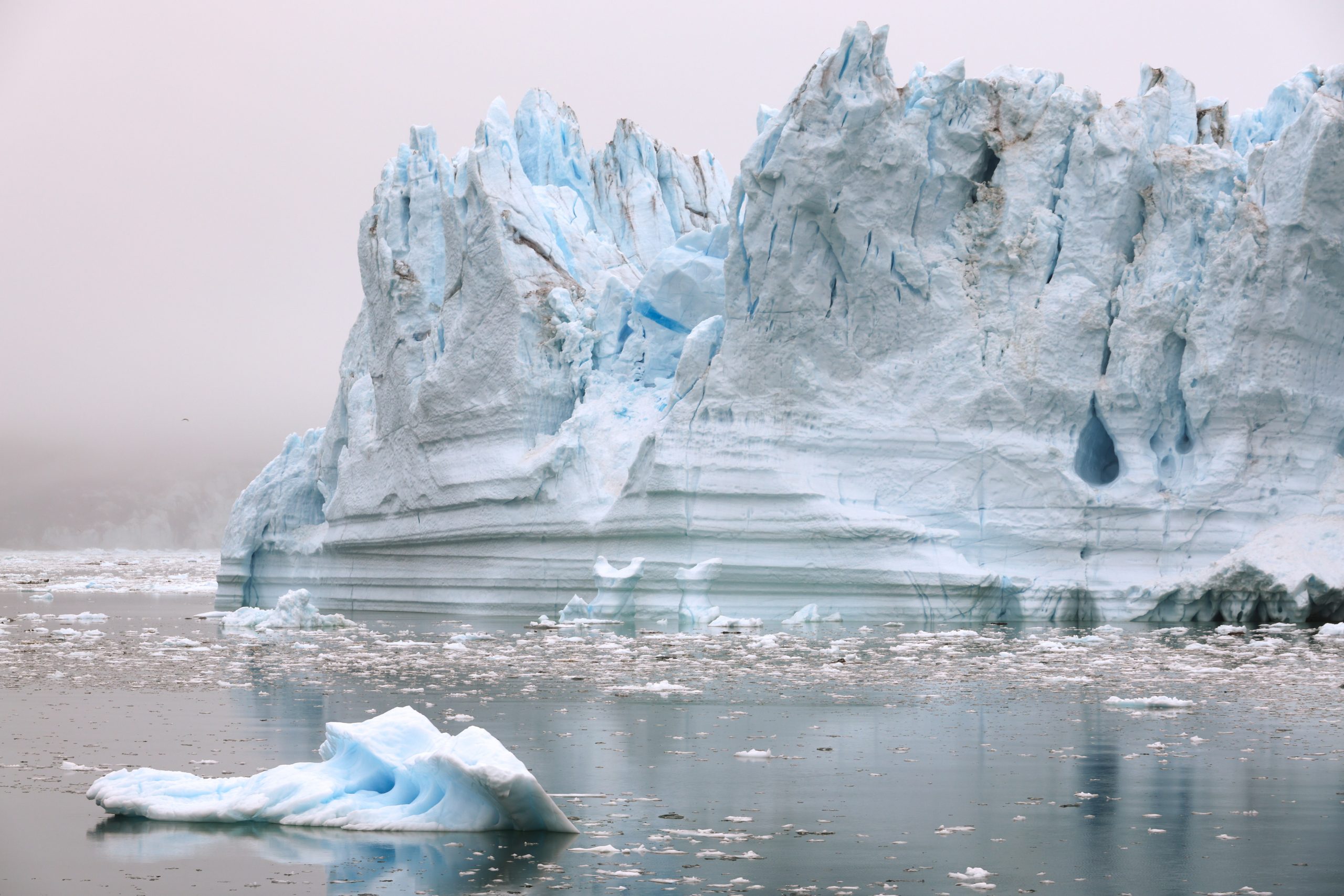
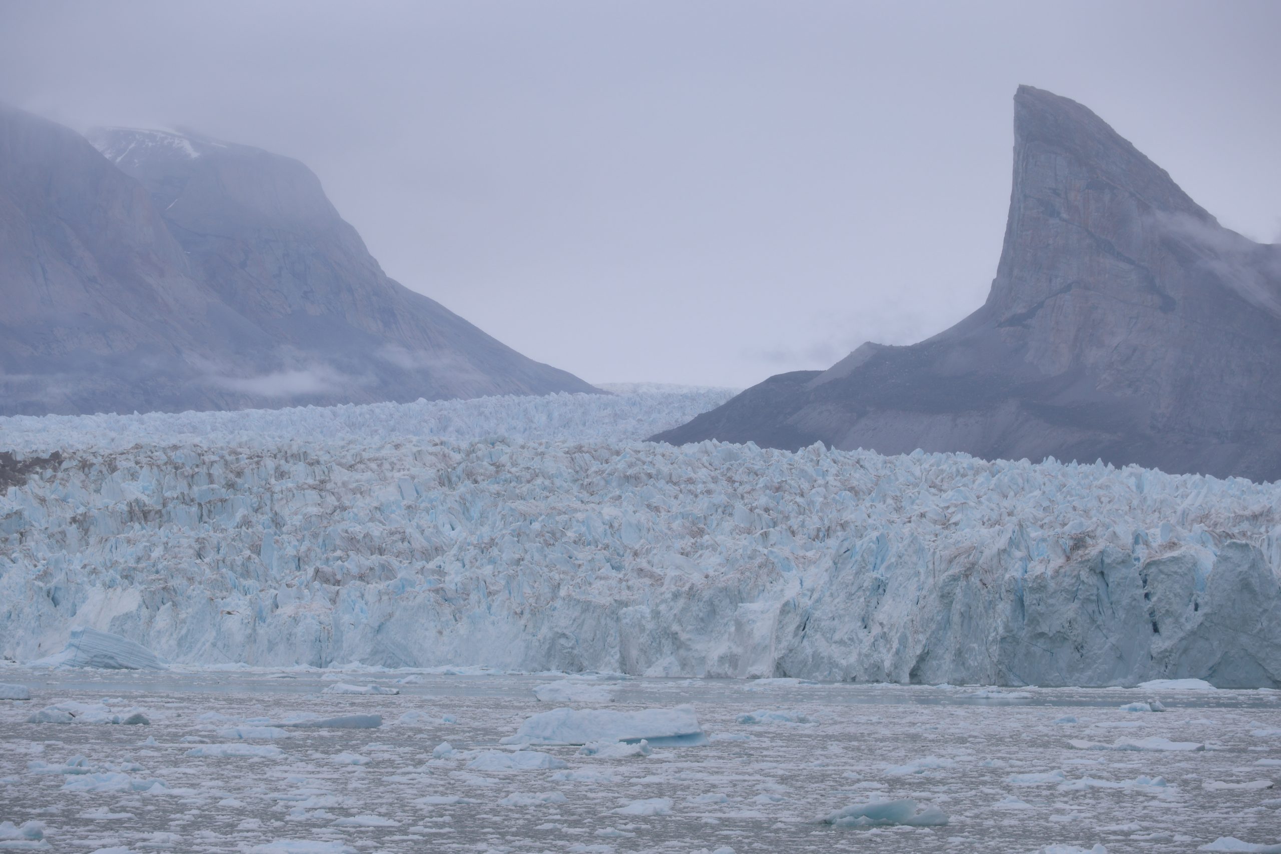
On the far western edge of Greenland’s ice sheet, a large glacier leads to the sea where it breaks against the water like a frozen wave 5 miles across. Here, dark with mud, the sea seethes with the force of subglacial rivers rushing in from beneath the ice.
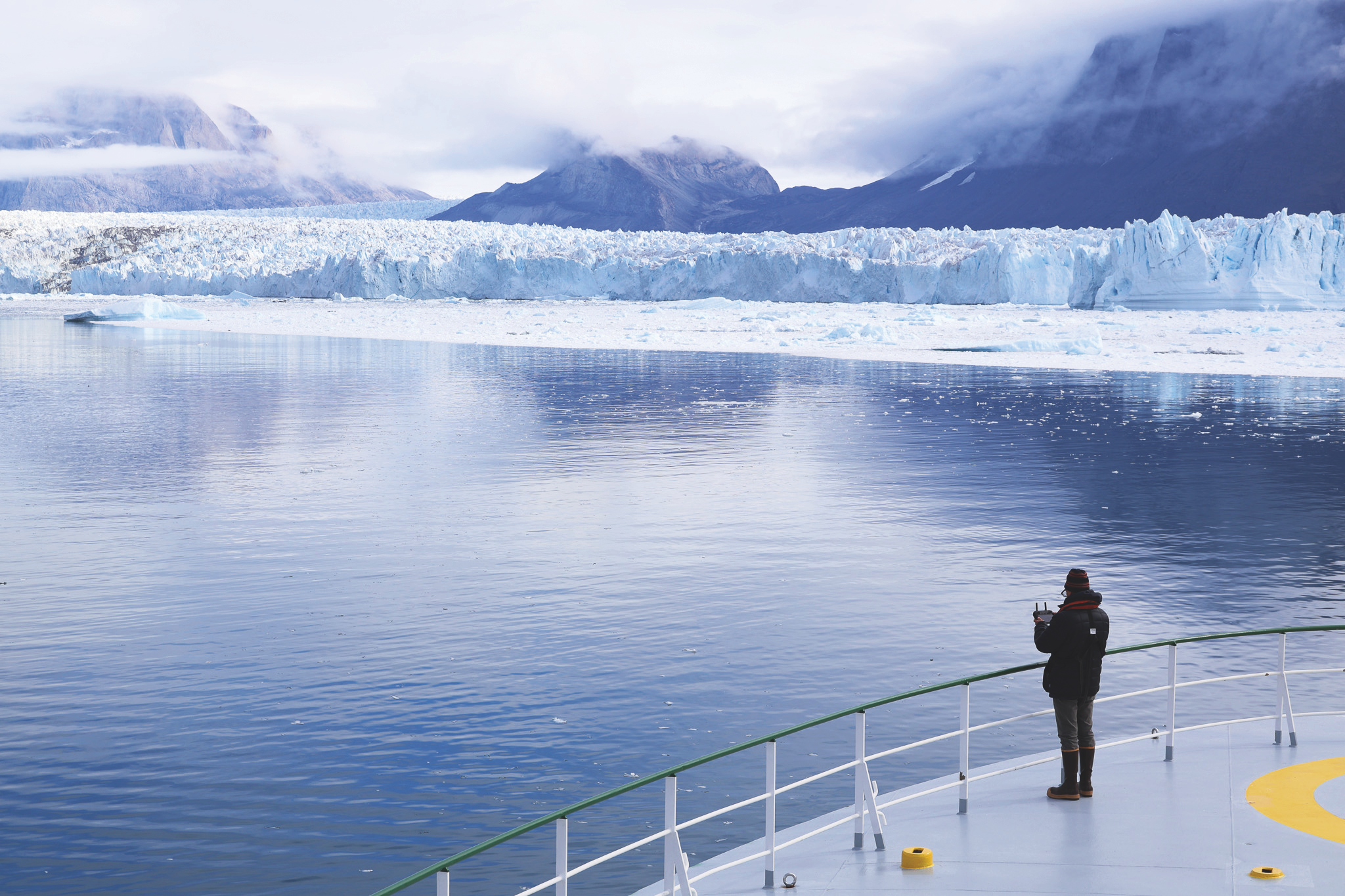
Suspended beneath the ship’s arms is a car-sized contraption. The large white lettering on the red and orange body reads Nereid Under Ice. This is NUI, a unique robot submersible on its way to embark on a historic dive. For the first time ever, scientists are about to take an up-close look at the underwater face of the glacier.
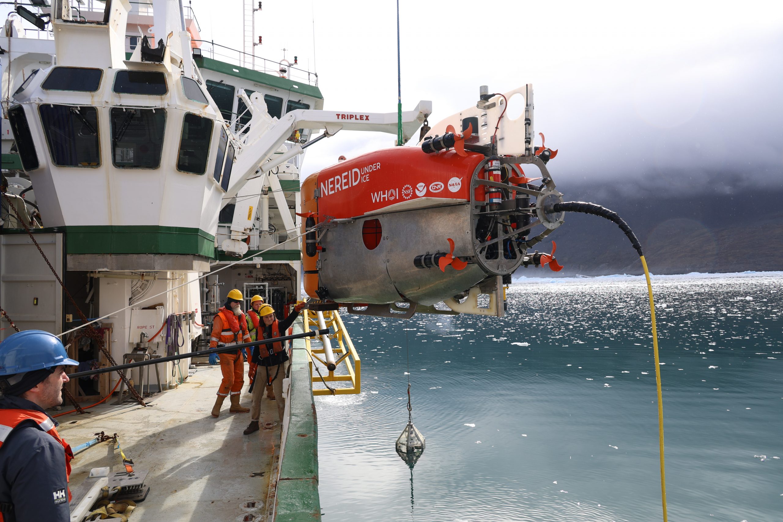
The dive is part of a scientific expedition led by the University of Texas Institute for Geophysics (UTIG) to study the turbid, treacherous waters where glaciers fall into the sea and learn why some of Greenland’s glaciers are retreating quickly under climate change while others are not.
“The biggest uncertainty in predicting sea level rise is how ice sheets will behave in the future and the biggest uncertainty in predicting ice sheet behavior is how the ocean, atmosphere and bedrock interact with the ice,” said chief scientist Ginny Catania, a professor at UTIG at the Jackson School of Geosciences, and a veteran of polar fieldwork.
Headed by Catania, the expedition’s primary mission is to survey naturally forming underwater sandbanks — called moraines — and see whether they might be slowing the ice sheet’s retreat.
Catania has assembled a 23-member team of scientists, students and engineers from seven institutions, including the Woods Hole Oceanographic Institution (WHOI), the University of Florida, Rutgers University, Oregon State University, Tufts University and Aarhus University in Denmark. They’re supported around the clock by the 15 crew members of the Celtic Explorer, a research vessel of Ireland’s Marine Institute.
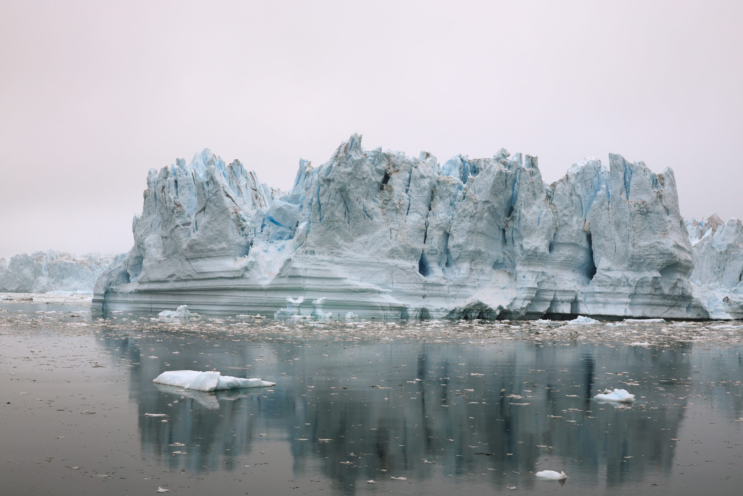
Ships rarely come this close to large active glaciers and no submersible has ever gotten as close to one in Greenland as NUI has. There’s good reason. Aside from strong subglacial currents, icebergs the size of skyscrapers topple from the glacier’s edge or emerge from the depths without warning, filling the fjord with ice.
A mission like this was long considered too big a risk for most funding agencies. But the W.M. Keck Foundation supports high-risk, high-impact research and saw the potential in Catania’s ideas to open new fields of science. With the Keck Foundation on board and additional funding from the National Science Foundation, the expedition set out for Greenland in July 2024.
Back on deck, NUI is ready to dive. Cables and cranes retract, NUI’s thrusters spurt to life, and the plucky submersible disappears into the turbid depths.
Riddles in Greenland’s Ice
Greenland’s ice sheet is vast. Its surface covers an area that’s nearly three times the size of Texas and it holds enough water to raise sea levels 23 feet. At the edges where it spills into the sea, its glaciers — rivers of ice that drain the ice sheet — carve wide valleys in bedrock.
As glaciers flow downhill, they scrape the bedrock to a fine powder. This gets washed into the sea via meltwater channels, visible from above as muddy sediment plumes. Over time, the sediments pile up in front of the glacier as underwater moraines.
The expedition scientists think these moraines could be why 30 out of Greenland’s 300 glaciers have bucked the trend and refused to retreat in recent years.
One idea is that glaciers get wedged on their moraines, giving them a grounding point and keeping the ice from retreating deeper into the fjord. A large-enough moraine may also block warm ocean currents from reaching the ice.
But the waters near Greenland’s active glaciers are so treacherous that no one has ever gotten close enough to say which scenario is accurate, or whether something else is at play. Until now, that is.
The expedition has targeted two glaciers. The largest, Kangerlussuup Sermia, is about 5 miles wide. It sheds many icebergs during the summer, but despite that, its terminus, or edge, has stayed roughly where it was when satellite observations began 30 years ago. The second glacier, Kangerluarsuup Sermia, is about half the size. Its terminus stopped retreating in 2016. Today it shows little activity and sheds few icebergs.
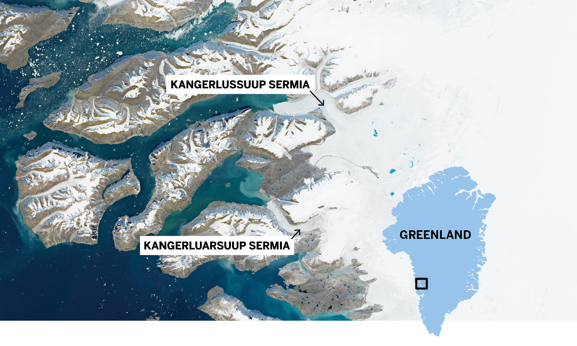
Image: Jackson School / Copernicus Sentinel-2.
All this is important because Greenland is losing ice and raising sea levels fast — 270 billion tons of annual meltwater, or about 2 millimeters of sea level rise a year. That rate is twice that of Antarctica’s and increasing.
“Understanding how much ice Greenland will lose by the end of the century is really important for coastal communities all over the world,” said Mikayla Pascual, one of the
Jackson School students on the expedition. “Is it going to be a meter or 3 meters of sea level rise? Ultimately, that’s what we want to answer.”
Pascual’s research is devoted to creating an ice sheet model that will include the Greenland data and perhaps answer that question. Hundreds of feet below the Celtic Explorer, NUI signals that its systems are healthy. All is well.
Rotors spinning, the submersible turns from the vessel and begins its transit to the glacier.
Robot Bumblebee Goes Diving
A bank of screens shows a live feed from inside NUI’s bay doors. The submersible’s outstretched robot arm is all that’s visible in the muddy water. The screen turns milky white.
NUI has hit the seafloor, kicking up clouds of powdery fine sediments. It’s all very intentional. With zero visibility at the base of the ice, the NUI team came up with an unorthodox way of collecting seafloor samples.
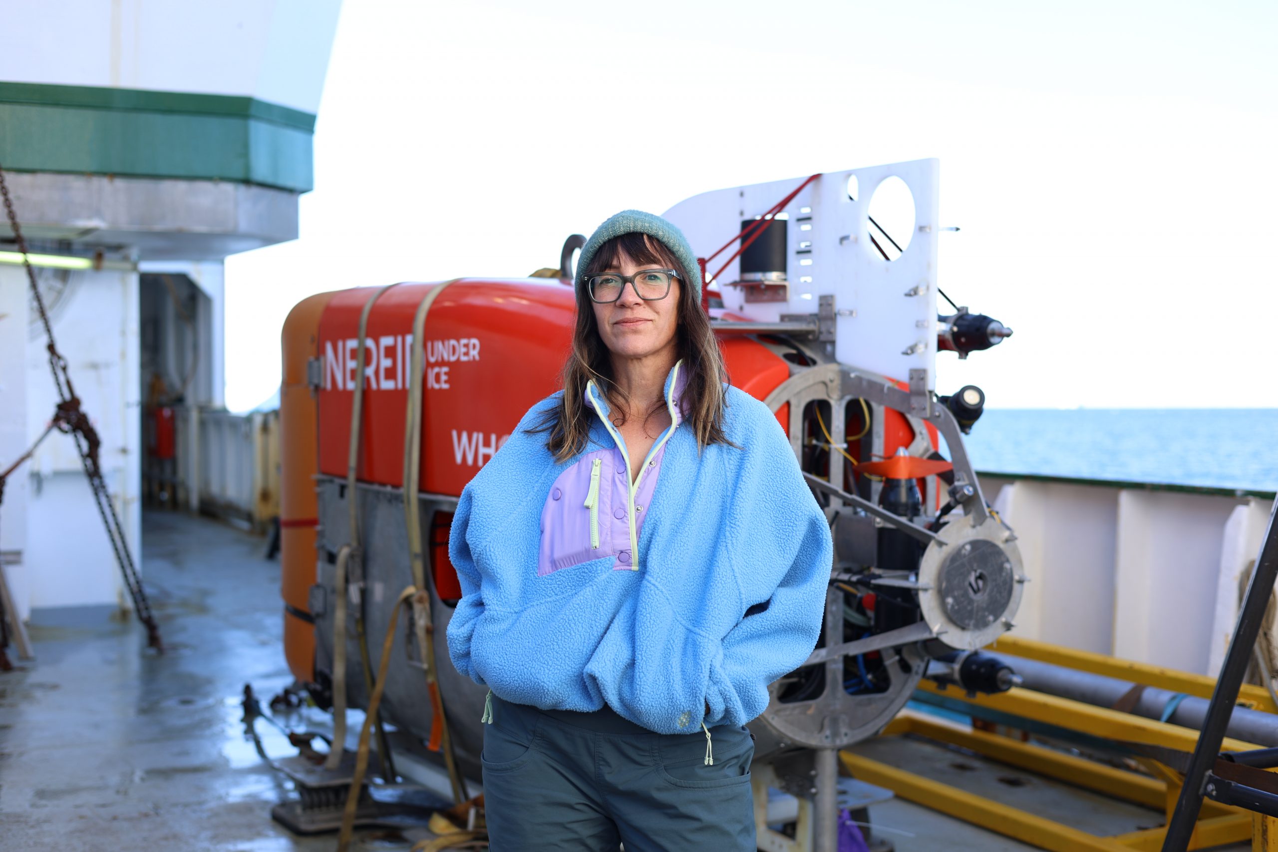
“We call it the bumblebee. It’s worked surprisingly well,” said NUI expedition leader Molly Curran.
The technique involves rising to clearer depths, directing the submersible to grab a coring tube from its basket, then diving to the seafloor with the tube held out in front. It takes immense coordinated skill from the NUI team, but moments later a screen confirms that the foot-long core is secure.
NUI is designed to operate in unique environments. Its chief advantage is that it can be directly controlled via a hair-thin fiberoptic tether that’s nearly 25 miles long, and is much longer and lighter than the cable used by a conventional remotely operated vehicle. It can also operate as an autonomous underwater vehicle if the fiber breaks.
Nearly everything NUI has done out here has been a scientific first: It has returned
seafloor cores from the shadow of the glacier, surveyed its towering underwater face, mapped moraines in real time, and measured swirling ocean currents inside ice caves.
On the face of it, what NUI encountered — sediments raining from above and holes in the ice — was anticipated. But the size of almost everything has been off the charts.
It’s led to some close calls. Curran remembered the first time NUI stopped beneath one of the glacier’s sediment plumes. When the submersible went to take off, it was as if something kept pulling it back down. Curran gave the order to drop NUI’s emergency ballast, and the submersible rose free to continue its mission.
When NUI got home, the engineers found its instrument bay filled with glacial sediments — a nerve-wracking experience for the NUI team but a 50-pound serendipitous win for the expedition’s sediment scientists.
Whirling, Swirling Ocean
Greenland lies at the northern tip of the North Atlantic Current. This ocean current carries heat from the tropics to Greenland’s coastal waters where the warm water erodes the ice sheet’s glaciers at their deepest points.
With global warming heating up the Atlantic, that means even more warm seawater could be reaching the glaciers, said Rutgers University oceanographer Bridget Ovall. But under the surface at the second, smaller glacier, Kangerluarsuup Sermia, the expedition found a secret defense against the warm Atlantic seawater: a large, old moraine.
“What we saw was that all that warm Atlantic water can’t get to the glacier because it can’t get up over that sill (the moraine). The only water reaching the glacier is cold polar water,” Ovall said.
Back at the main glacier, Kangerlussuup Sermia, the picture (and the water) is muddier. Here, the ocean currents are much more complex, and until data from NUI and the Celtic Explorer are analyzed, it won’t be clear how much warm water makes it to the glacier.
What the scientists do know is that the sea near the glacier is being churned up by meltwater jetting out of the glacier. Ovall said that each stream makes its own little circulating layer in the ocean. That could mean one of two things. By stirring up seawater, the curtain of circulating currents is stopping warmer Atlantic water from reaching every part of the ice.
“Or it might mean that you’re creating more lateral circulation cells in front of the glacier, potentially bringing more heat to the glacier. It could go either way,” she said.
If the latter is true, something else is stopping the glacier from retreating.
Reading the Ice’s Future in the Mud
After nearly 12 hours in the water and with dwindling battery power, NUI is hauled gently back on deck. Beneath a twilight Arctic sky, the Celtic Explorer transitions to nighttime research operations.
The nightshift scientists emerge, steaming coffee in hand. It’s Sean Gulick, a research professor and geophysicist at UTIG, and John Jaeger, a professor at University of Florida, accompanied by graduate students Pascual and Emily An of Oregon State University. For the next 12 hours, the ship will sail up and down the fjord, trailing a milelong seismic antenna and stopping periodically to recover cores from the seafloor.
These operations are all about peering into the glacier’s muddy past.
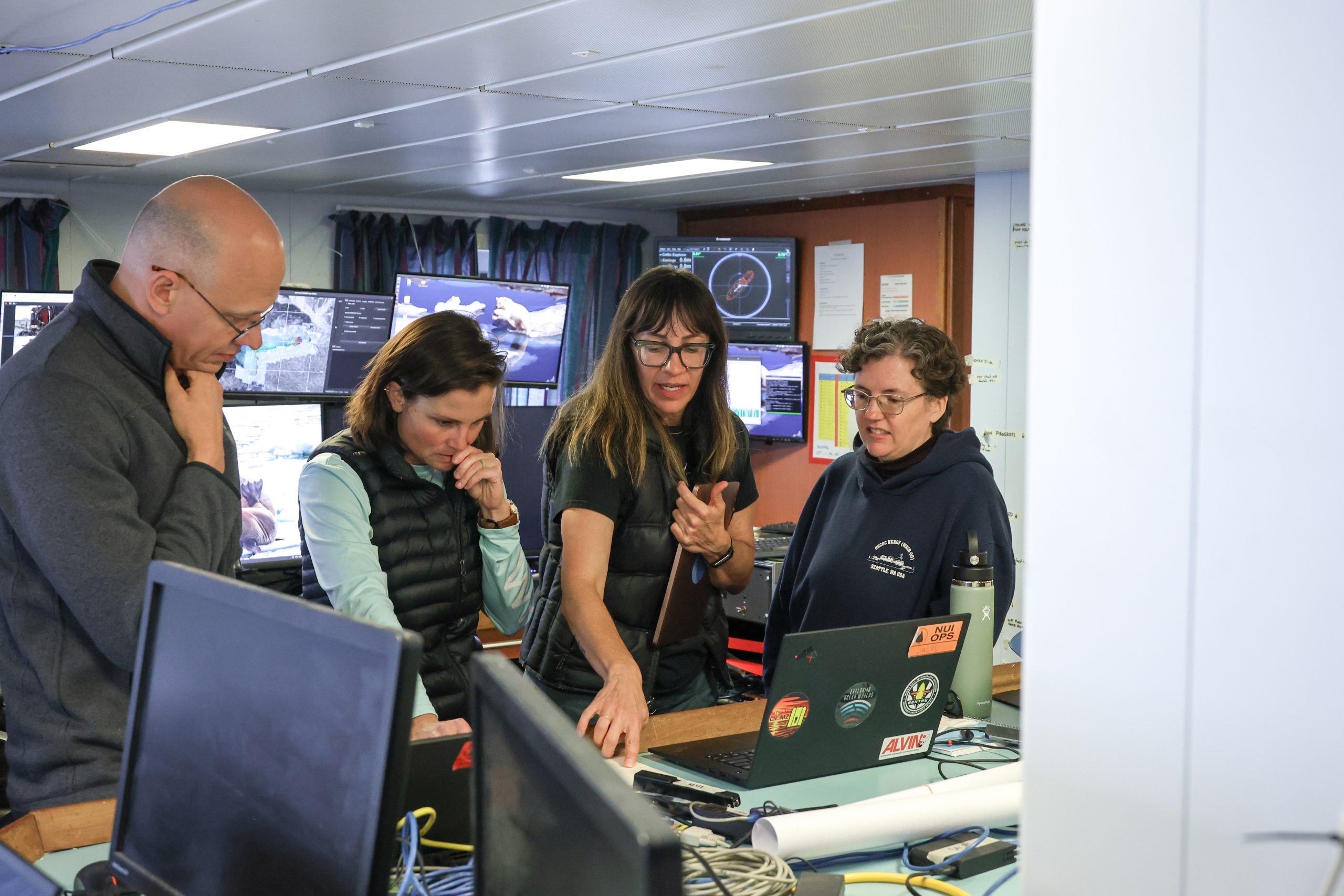
Photo: UTIG.
A thousand years ago, a brief climate anomaly known as the medieval warm period forced glaciers to retreat. Then followed a period of global cooling starting around 1215, during which glaciers advanced three times. After each surge, the glaciers retreated again.
Understanding this back and forth tells us what to expect as the planet warms, said Gulick.
“The retreat from the Little Ice Age is an interesting analog to retreat today. How did it actually retreat? What did it leave behind? Does it have a stuttery start where it seems to retreat and then holds?” he said.
The answers are buried in the seafloor. The X-ray-like pictures of layered sediments will tell Gulick and the subsurface geophysics team a story of glacial advance and retreat going back centuries. When paired with samples pulled from seafloor sediment cores, the scientists should have an accurate history of the glacier’s behavior during past periods of climate change.
Farewell to Ice
The deck is busy on the morning after NUI’s last dive. At mid-starboard, crew members are deploying an ocean measuring sensor to eke out some last-minute science. Nearby, NUI engineers are busy packing up instruments and securing their gear for the voyage home.
Over the course of seven dives, NUI delivered astonishing surveys of the glaciers’ underwater ice-face, retrieved pristine glacial sediments, and even measured ocean currents inside a submerged glacial ice cavern.
“Giving scientists the tool to access that environment and seeing the excitement on their faces the first time we did that was just super rewarding,” Curran said. “It’s why I love my job.”
For NUI, the work is done. But for Catania and the other researchers, the science has only just begun. In among the terabytes of information and stacks of glacial sediment samples are possible clues to the ice sheet’s future. It’s difficult to know which of those clues will be most valuable.
“We’ve never seen anything at the glacier terminus with this much resolution before,”
Catania said. “The measurements that we got were just so novel that the analysis has to be novel, and that requires rewriting a lot of the book on how we’ll do that.”
More Underwater Glacial Exploration
Mission Blog: ig.utexas.edu/greenland-blog
Mission Website: ig.utexas.edu/greenland-terminus
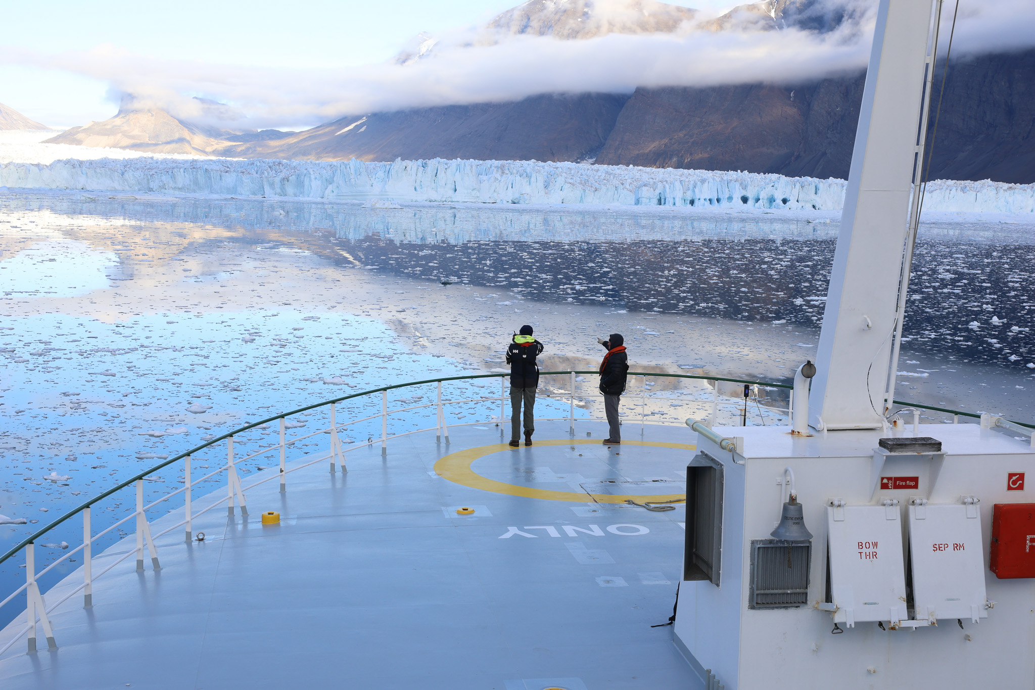
The wind whips up white caps on the fjord as the sun breaks over the buttressing mountain and sets the glacier alight.
The scientists came into this project with a hypothesis that glacial sediments are protecting some glaciers from retreating too fast. To test that, they crossed a frontier where for now at least, they’ve found more questions than answers.
There’s much work ahead of them, but it’s clear that historic science has taken place. During the years to come careers will be written from the findings.
“I cried when NUI first saw the ice,” Catania said. “It’s so much effort putting all this together that finally seeing it working in the way that we expected was really moving.”
At the mouth of the fjord, the Celtic Explorer turns for open seas. An armada of icebergs follows in its wake.
The University of Texas at Austin
Web Privacy | Web Accessibility Policy | Adobe Reader