
Mapping the White Outdoor Learning Center by Uncrewed Aerial Vehicle
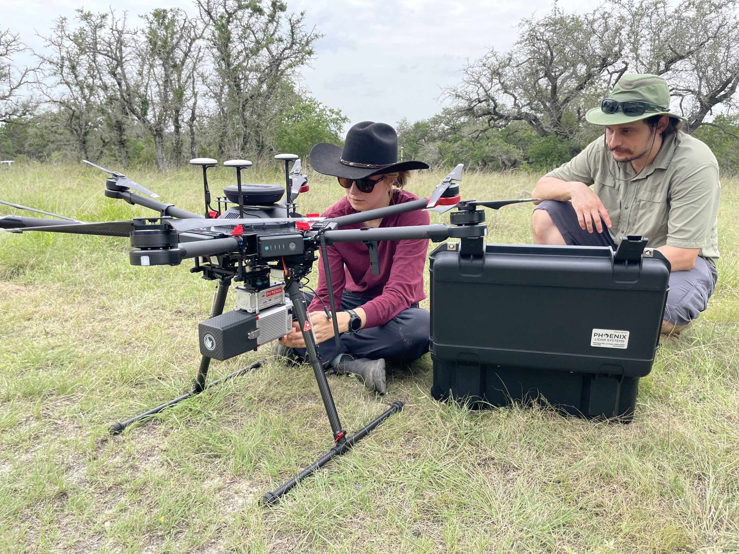
In July 2021, myself and Ph.D. student Mariel Nelson headed to the field to map the terrain of the Jackson School’s White Outdoor Learning Center. This mission marked the first use of our UAV (uncrewed aerial vehicle) system equipped with a LiDAR scanner, which allows us to map surface topography at extremely high precision and in fine detail. We were joined by Dana Chadwick, a research associate at the Jackson School, and Analie Armendariz, an employee of Phoenix LiDAR Systems, the company that built our custom instrument.
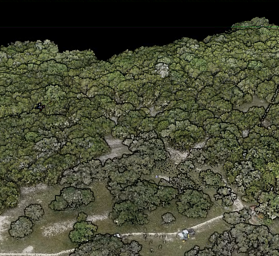
As we fly the UAV, the LiDAR unit fires 100,000 laser pulses per second in all directions. When pulses bounce off the ground and return to the UAV, the unit measures how long it takes and multiplies by the speed of light to compute the elevation of the land surface.
Our day in the field was different than a traditional day of field geologic mapping. We started by loading our SUV full with boxes of electronic equipment. When we arrived at the site, we set up the GPS base station, which allows us to accurately locate the UAV. Next, we set up all our gear — the UAV, the LiDAR unit, a computer to monitor data collection, and a local wifi hub so the UAV and computer can communicate. Once set up, we programmed the UAV to run a test flight on the southern portion of the property, where other UT faculty have installed long-term hydrologic monitoring systems. While most of the flight is automated, Mariel piloted the takeoff and landing. After triple-checking our setup, we repeated the flight while collecting data.
The resulting topography is spectacular. This data will provide a baseline dataset for future mapping missions that we can use to detect changes in the land surface and the tree canopy. We look forward to many, many more LiDAR acquisition flights, from monitoring coastal erosion to rockfalls to river migration across Central Texas!
Timothy Goudge
Assistant Professor
Mariel Nelson
Ph.D. Student
The University of Texas at Austin
Web Privacy | Web Accessibility Policy | Adobe Reader