
Surveying the Texas Coast from the Sky
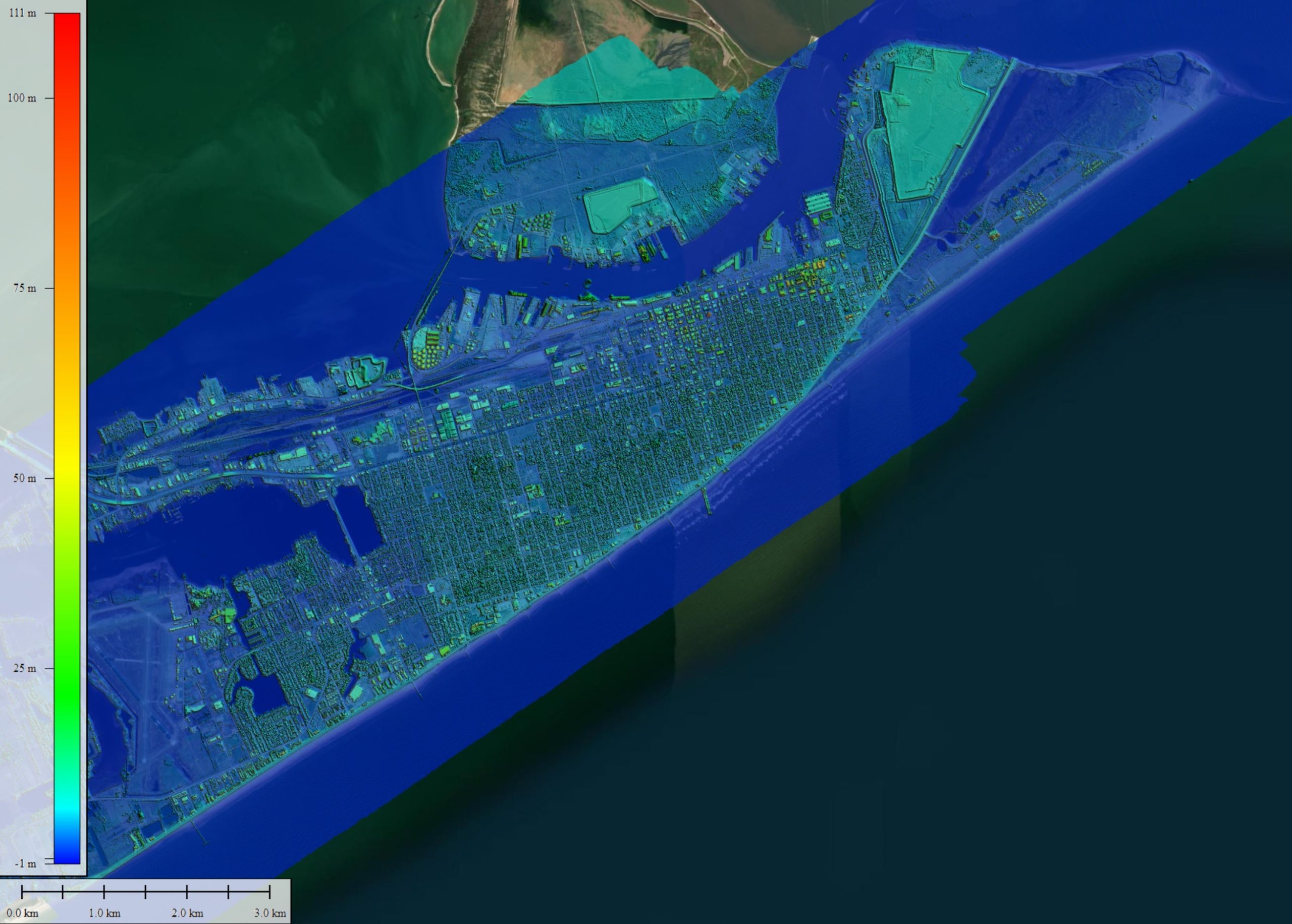
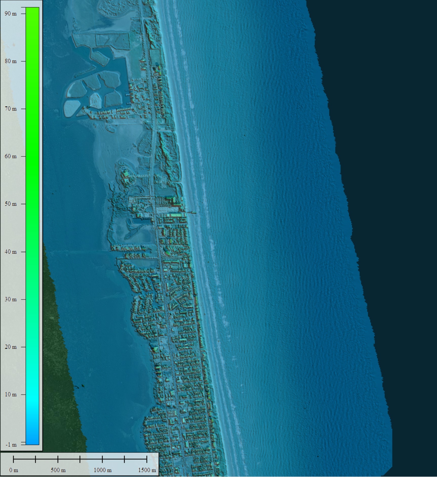
In February and March 2024, researchers from the Bureau of Economic Geology at The University of Texas at Austin conducted an airborne lidar survey campaign covering the beaches, barrier islands, and shallow offshore along the entire Texas Gulf shoreline. This project, funded by the Texas General Land Office, was the first major data acquisition project using the bureau’s new Leica Chiroptera Mark 5 airborne system. Preliminary results indicated higher spatial resolution of topography and deeper water bottom mapping in the nearshore environment than could be achieved with the previous system.
In addition to the coastal survey, researchers completed lidar data collection for other research groups. The Jackson School of Geosciences requested the elevation map of the Trinity rivershed in eastern Texas to examine ongoing flood effects, and the UT Integrated Biology department inquired about detailed elevation mapping of UT Austin-managed environmental monitoring and biology sites to establish baseline mapping. Researchers also acquired detailed near-infrared lidar data of downtown Austin to compare city infrastructure with that shown by data acquired with the bureau’s first lidar system in 2002.
Kutalmis Saylam
Research Science Associate,
Bureau of Economic Geology
The University of Texas at Austin
Web Privacy | Web Accessibility Policy | Adobe Reader