Research Projects
Check out our ongoing research projects, data collection, and longterm monitoring
Water Resources and Ecosystem Carbon Storage under Drought
People: Daniella Rempe, Caroline Farrior, Ashley Matheny, Amy Wolf, Tim Keitt
Funding: Exxon Mobile
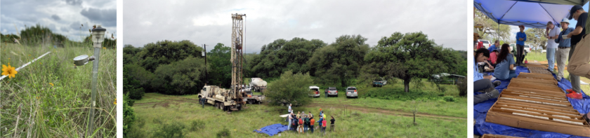
This project brings together ecologists and geoscientists to better understand the fascinating ecosystems of the Edwards plateau, their resilience to changing climates and their current and future potential contributions to the global carbon cycle. The project includes: detailed measurements of the subsurface fluxes of carbon and water coupled with aboveground vegetation and flux measurements at a single site, theoretical research to guide our understanding of the plant strategies and feedbacks to geology, and the analysis of large-scale observational data from forest plots across Texas. With this research, we cross disciplinary boundaries and seek answers that apply to both Texas and more generally to the role of the land surface in the global carbon cycle.
Trees as water towers
People: Ashely Matheny
Funding: National Science Foundation
Building on the idea that trees act as “water towers” that can store water in the environment, Ashley Matheny, an assistant professor in the Department of Geological Sciences at The University of Texas at Austin, secured a prestigious grant from the National Science Foundation’s Faculty Early Career Development Program. This award, known as a CAREER grant, provides five years of funding to help early-career faculty establish a strong research and educational program that leads to a lifetime of leadership in in their field. A central portion of this reasearch is being conducted at the White Family Outdoor Learning Center.
UAV monitoring of topography and landscape change
People: Mariel Nelson, Tim Goudge, David Mohrig
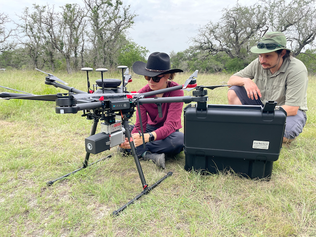
This project is aimed at using a UAV (uncrewed aerial vehicle), or drone, equipped with a lidar scanner to map and monitor the topography of the White Family Outdoor Learning Center at high-resolution (centimeter-scale). Initial mapping will provide a base dataset of the topography of the property, and follow-on lidar scans (every few months), will provide comparison to look for changes in the landscape from rock falls or along Onion Creek. These data will also be used to monitor changes in the vegetation and tree canopy, as the lidar scanner can pick up both the vegetation and the ground below. Finally, this project will serve as a testing ground to develop novel approaches for UAV-based lidar scanning, for a range of applications across central Texas.
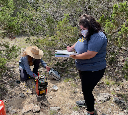
Hill country groundwater resources and recharge
People: Daniella Rempe, Brian Hunt, Marcus Gary
Groundwater resources are critical to the Texas hill country. Open questions remain about how climate and land use changes, including rapid development across central Texas, may impact water cycling, including rates of groundwater recharge. Researchers at the White Family Outdoor Learning Center have initiated long term monitoring of groundwater levels and soil and bedrock water storage across a network of wells across the site. Core samples have been collected to develop a model of the subsurface properties that control water storage.