Explore
Checkout the data that are helping us understand the hill country

Site map and GIS data
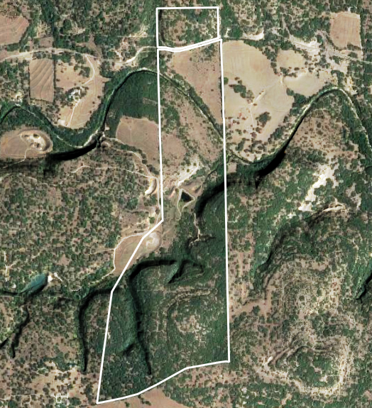
A variety of geospatial datasets are avaliable for the WFOLC property. We have aggregated some of them here for easy reference, as well as providing direct downloads below. Some datasets require UT credentials to access.
- Property Boundary
- Roads and fences
- Onion Creek extent on property
- Monitoring well locations
- LiDAR subset from TNRIS
Wells and down-hole videos
Texas Long Hole
Two deep wells have been drilled on the property to learn about the subsurface structure and ground water depth. Shown here is the video of the downhole data from Edwards Aquifer Authority for the 2021 well “TX Long Hole”. 270 ft of Core from TX Longhole is stored at the Bureau of Economic Geology.
Hilltop Wells
13 wells have been drilled on the property to learn about the subsurface structure and monitor rock moisture content in the strata. Shown here is the video of the downhole data from a subset of these wells.
iNaturalist

iNaturalist is an application for smart devices that allows users to submit biological observations regardless of prior knowledge. If you aren’t able to identify your observation, active experts in the community will help you. Our project is a collection of all research-grade observations on the 266 acres of the White Family Outdoor Learning Center, which can be found here. Our goal is to document the biodiversity of the past and present on the property. Take ID worthy images of living, or formerly living, organisms and upload them to iNaturalist.
Additionally, there is an article that provides a more comprehensive overview of the application.
iNaturalist is available for Android and iOS.
Groundwater Data
Coming soon! Check back for updates
Weather Station Data
Coming soon! Check back for updates
Additional references about local groundwater
Coleman’s Canyon Preserve info
Here’s a link to a paper on GW-SW interaction on the Blanco and Onion Creek