Skip Navigation
The University of Texas at Austin
 

Rock moisture in the news: Press for our recent publication in Nature on plant use of bedrock water storage

Check out some of the recent press from McCormick et al., 2021!


A recent paper out of the Rempe lab, “Widespread use of bedrock water by woody plants across the continental U.S.” (McCormick et al., 2021) has been covered in several magazines over the past few months, including

Science & Vie Magazine (France): Les Arbres Boivent De L’eau Dans Les Roches (Dec 2021)

Scientific American: “Trees Drill into Deep Bedrock for Water Surprisingly Often” by By Tess Joosse (Dec 2021)

Eos: “Thirsty Plants Pull Water from Bedrock” by Katherine Kornei (Oct 2021)

UT News: “Water in Bedrock is Sustaining Trees Across Country” by Monica Kortsha (2021)

Simon Fraser News: “Could the Water in Bedrock Save our Forest Ecosystems from Climate Change?” *2021)

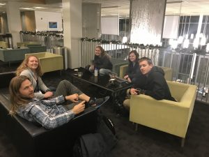
*Photo features co-author Jesse Hahm!

For more information regarding the paper, including data and code, check out this website.


New paper, published in Nature, shows that bedrock water is used by forests across the U.S.

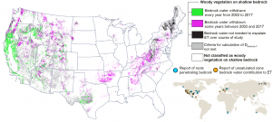
A new paper recently published in Nature by the Rempe group reveals that bedrock water storage – and rock moisture in particular – is a critical source for transpiration for many ecosystems across the United States.


The paper, led by Dr. Rempe and Erica McCormick, a former undergraduate researcher and current lab technician, also involved lab members Alison Tune and Logan Schmidt, as well as US Forest Service scientist David Dralle and former Rempe lab postdocs Jesse Hahm from Simon Fraser University and Dana Chadwick, now at NASA JPL.

For more information about the paper, including access to the data and code, check out the website for the paper here!

The University of Texas press release can also be found here.

Here are some of the main findings from the paper:

  • Temporal and spatial patterns of bedrock water use across the CONUS indicate that woody plants extensively access bedrock water for transpiration.
  • Plants across diverse climates and biomes access bedrock water routinely and not just during extreme drought conditions.
  • On an annual basis in California, the volumes of bedrock water transpiration exceed the volumes of water stored in human-made reservoirs, and woody vegetation that accesses bedrock water accounts for over 50% of the aboveground carbon stocks in the state.
  • Plants commonly access rock moisture, as opposed to groundwater, from bedrock and that like soil moisture, rock moisture is a critical component of terrestrial water and carbon cycling.

Rock moisture in the news and on the radio

Our multi-year study tracking rock moisture at the Eel River Critical Zone Observatory was recently published and was featured on various print news outlets and even, the radio!  The long-term monitoring was funded by the National Science Foundation Critical Zone Observatory Program and conducted at the University of California Angelo Coast Range Reserve.

We’re continuing to monitor rock moisture with old and new tools to understand how water storage in weathered bedrock impacts ecological processes and bedrock weathering. Stay tuned!

https://www.nsf.gov/news/news_summ.jsp?cntn_id=244513

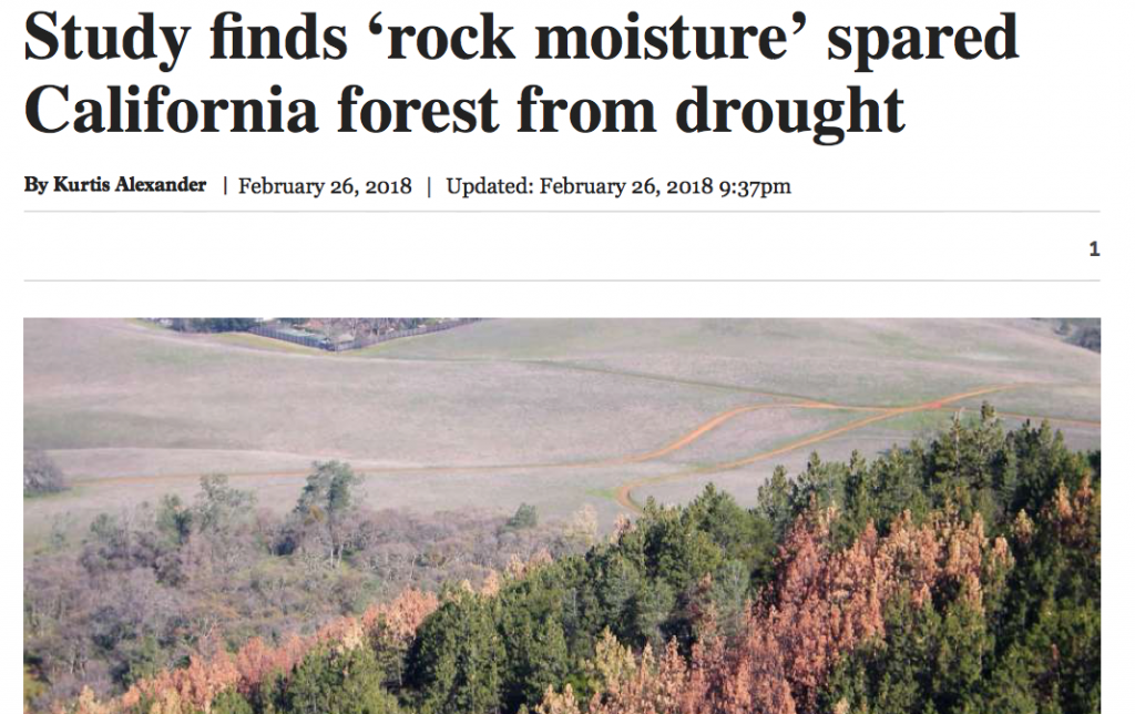
https://www.sfchronicle.com/news/article/Study-finds-rock-moisture-spared-California-12710035.php

https://www.atlasobscura.com/articles/trees-hidden-rock-water-drought-survival

http://www.dailycal.org/2018/03/01/overlooked-water-sources-aided-tree-survival-drought-researchers-discover/

http://news.berkeley.edu/2018/02/27/hidden-rock-moisture-may-be-key-to-tree-survival-during-drought/

https://news.utexas.edu/2018/02/26/hidden-rock-moisture-could-explain-forest-surviving-drough


Groundwater Recharge Investigations on the Nueces River, TX

Rempe Group member Caroline Hackett investigates the role of alluvium deposits in the process of groundwater recharge from the Nueces River to the underlying Trinity and Edwards Aquifers in south-west Texas. Using stream discharge gain-loss surveys, dye tracer testing, geophysical surveys, and water chemistry measurements, we study the storage capacity and transit times of surface water through alluvial deposits. Caroline is co-advised by Dr. Marcus Gary, and interned with him at the Edwards Aquifer Authority during summer 2017.

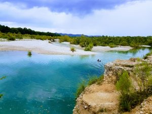
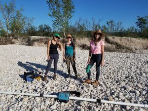
The upper Nueces River in Uvalde County, TX, has extensive alluvial deposits of mostly chert cobbles that overlay the limestone units of the Trinity Aquifer.

We use geophysical methods including electrical resistivity, ground penetrating radar, and electromagnetic surveying with the EM31, shown above with Amy, Bianca, and Kindra during the spring 2017 Karst Hydrogeology course.

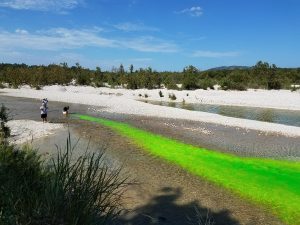
We use non-toxic fluorescent dye to investigate whether the dye travels through subsurface flowpaths through alluvium adjacent to the Nueces River.

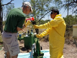
During August 2017, we also injected fluorescent dye into groundwater wells with help from Steve and Anastacio at the Edwards Aquifer Authority.

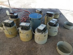
We use ISCO automatic water samplers to continuously monitor for the presence of dye during tracer tests.

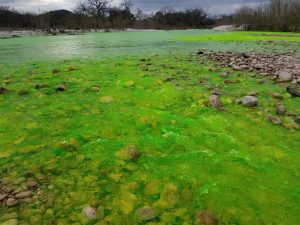
Uranine dye turns the Nueces River a fluorescent green while helping us determine whether the river water is the source of nearby springs.


Rempe Group Takes Over New Orleans (AGU 2017)

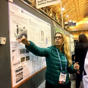
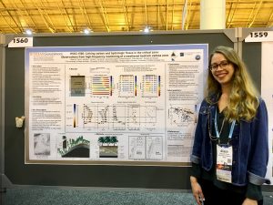
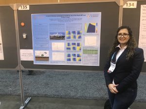
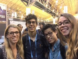
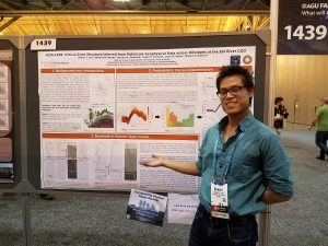
The American Geophysical Union 2017 Annual Meeting in New Orleans was a whirlwind. There were many posters from Rempe Group members and collaborators, in between many po’boys and beignets!
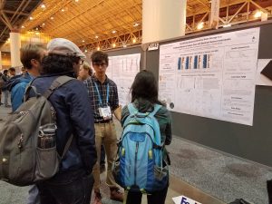
    

D. Dralle, W.J. Hahm, D.M. Rempe, N. Karst, S.E. Thompson, W.E. Dietrich, 2017, Identifying the Dynamic Catchment Storage That Does Not Drive Runoff,American Geophysical Union Annual Meeting.

W.J. Hahm, D. Dralle, S. Lovill, A. Bryk, T. Dawson, D.M. Rempe, W.E. Dietrich, 2017, The influence of Critical Zone structure on runoff paths, seasonal water storage, and ecosystem composition, American Geophysical Union Annual Meeting.

W.J. Hahm, J. Wang, J.L. Druhan, D.M. Rempe, W.E. Dietrich, 2017, Relating runoff generation mechanisms to concentration-discharge relationships in catchments with well-characterized Critical Zone structures and hydrologic dynamics, American Geophysical Union Annual Meeting.

S. Lee, D.M. Rempe, W.S. Holbrook, L.M. Schmidt, W.J. Hahm, W.E. Dietrich, 2017, Critical Zone structure inferred from multiscale near surface geophysical and hydrological data across hillslopes at the Eel River CZO, American Geophysical Union Annual Meeting.

D.M. Rempe, J.L. Druhan, W.J. Hahm, J.J. Wang, C. Murphy, S. Cargill, A.K. Tune, W.E. Dietrich, 2017, The role of rock moisture on regulating hydrologic and solute fluxes in the critical zone, American Geophysical Union Annual Meeting.

L.M. Schmidt, B.W. Minton, N. Soto-Kerans, D.M. Rempe, Z. Heidari, 2017, Quantifying Seasonal Dynamic Water Storage in a Fractured Bedrock Vadose Zone With Borehole Nuclear Magnetic Resonance, American Geophysical Union Annual Meeting.

A.K. Tune, J.L. Druhan, J.J. Wang, S. Cargill, C. Murphy, D.M. Rempe, 2017, Linking carbon and hydrologic fluxes in the critical zone: Observations from high-frequency monitoring of a weathered bedrock vadose zone, American Geophysical Union Annual Meeting.
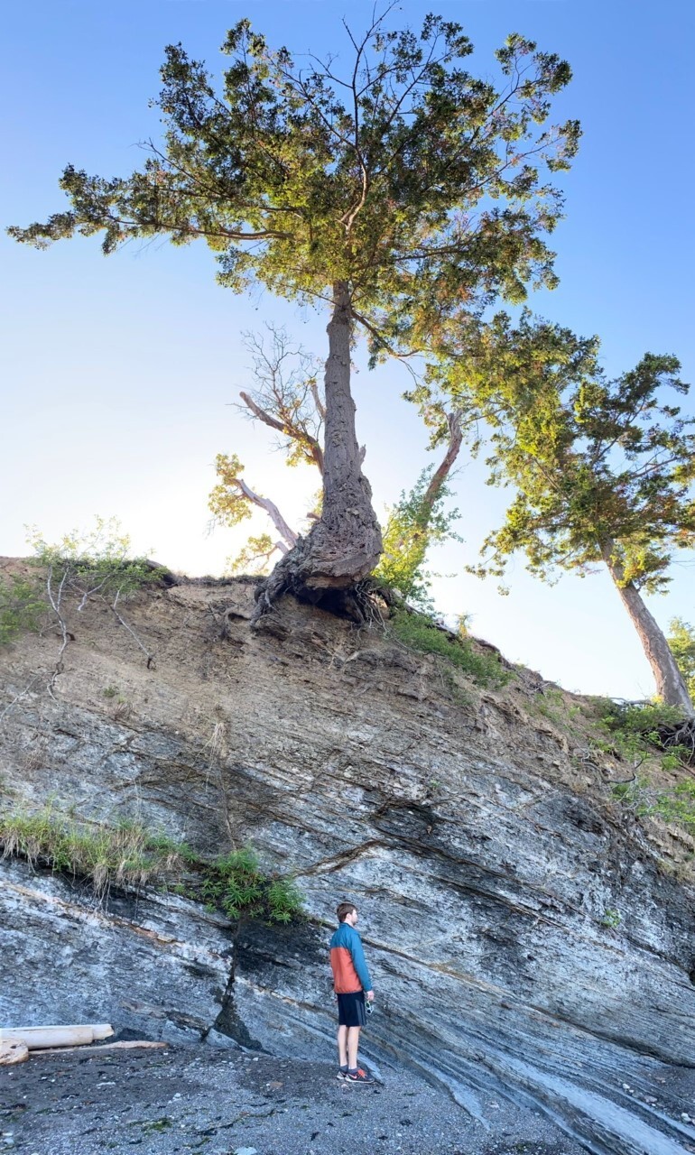
Rempe Group at GSA 2017, Seattle

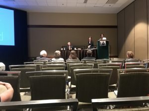
The Rempe Group had a strong showing at the 2017 Geological Society of America (GSA) Annual Meeting in Seattle! Dr. Rempe and Alison presented results of their field work at the Eel River site in a session titled The Critical Zone as Heterogeneous Media: Implications for Physical, Chemical, and Biological Processes.  Neera and Caroline presented their research in a session honoring the distinguished career of Jackson School hydrogeologist Dr. Jack Sharp.

Neera Setlur presented the results of field work conducted during the 2017 summer Hydrogeology Field Camp in New Mexico.

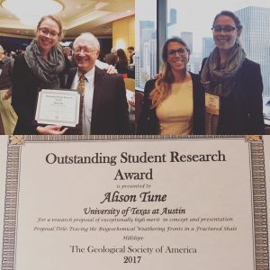
Alison won an Outstanding Student Research Award! At top left is Dr. Jack Sharp, who we celebrated in a day-long session honoring his impacts on the field of hydrogeology.

Made it to Pike Place Market for snacks during the lunch break. 

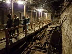
Tour of an abandoned section of the Seattle underground in downtown!

C.C. Hackett, M.O. Gary, D.M. Rempe, 2017, Quantifying alluvium effects on karst aquifer recharge: shallow groundwater and surface water exchange in the upper Nueces River, Texas, Geological Society of America Annual Meeting.
D.M. Rempe, J.L. Druhan, J.J. Wang, S. Cargill, C. Murphy, L.M. Schmidt, W.J. Hahm, K.L. Crutchfield-Peters, T.E. Dawson, W.E. Dietrich, 2017, Investigating coupled hydrologic and biogeochemical fluxes in the critical zone via distributed sensing and sampling in variably saturated, weathered bedrock, Geological Society of America Annual Meeting. 
N. Setlur, B. Valdez, A. De Luna, R. Craycroft, H. Houpt, D.M. Rempe, M.B. Cardenas, M.T. O’Connor, M.H. Kaufman, P.E. Carlson, S.B. Ferencz, R. Roback, G. Perkins, J.D. Gomez-Velez, 2017, Investigating morphological controls on hyporheic exchange in a meandering river,Geological Society of America Annual Meeting.
A.K. Tune, S. Cargil, C. Murphy, W.J. Hahm, W.E. Dietrich, D.M. Rempe, 2017, Preferential flow in the critical zone: direct observations of the spatial and temporal patterns of fluid composition in variably saturated weathered bedrock, Geological Society of America Annual Meeting.
Sagehorn Ranch Hydrologic Monitoring


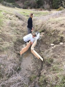
David Dralle (UC Berkeley) applies cement to the approach section of the flume.

The most recent trip to the Eel River Critical Zone Observatory provided the Rempe Research Group with an opportunity to aid UC Berkeley collaborators with the installation of new equipment for hydrological monitoring at Sagehorn Ranch.  UC Berkeley post-doc David Dralle and Ph.D. student Jesse Hahm first installed a flume in a gully feeding into Dry Creek.  Recent rainfall and subsequent flow in the gulley demanded some clever engineering from the group, but the team rose to the challenge and managed to divert the flow for long enough to level the flume and pour some cement.  This flume will be equipped with a pressure transducer  and has a fixed geometry that allows for very accurate discharge calculations.

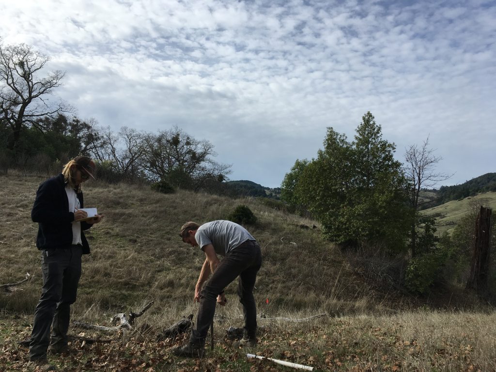
The second day at Sagehorn culminated in the installation of 8 piezometers with pressure transducers for monitoring groundwater head along hillslopes as they approach channels.  The piezometers will reveal whether water exfiltrates as the land surface slopes towards channels.  Installing four piezometers each on the adjacent north- and south-facing hillslopes should also allow for a comparison of subsurface water dynamics on each slope.

These new installations, in combination with ongoing saturated zone mapping at this site, will provide exciting new insights into moisture dynamics in the critical zone at Sagehorn Ranch.


David Dralle hang-augers a piezometer hole while Jesse Hahm makes note of subsurface material properties.

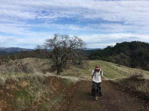
Jesse Hahm (UC Berkeley) utilizing the tactical utility wagon to transport piezometer materials.


CZO Network visits Eel River CZO

September 2017

A. Tune

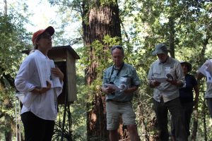
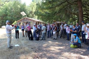
Dr. Daniella Rempe (UT Austin) describes results from geophysical surveys and rock moisture measurement campaigns to a group of visiting scientists from across the CZO network. Photo credit: Justin Richardson

One of the Rempe Research Group field sites, the Eel River CZO, had a number of visitors this September to view the collaborative research being done at field sites within the Angelo Coast Range Reserve. The group included researchers from the Critical Zone Observatory Network, the National Science Foundation, and other universities.

ERCZO PIs and collaborators gave great presentations on research being conducted to understand subsurface moisture storage, ecohydrology, weathering processes, biogeochemical cycling, salmanoid survival, and many more natural processes at this unique spot in Northern California.

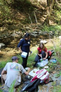
Graduate student Jia Wang (UI Urbana -Champaign), research assistant Marshall Wolfe (ERCZO) and graduate student Alison Tune (UT Austin) sample Elder Creek as part of an ongoing sampling campaign at the Rivendell hillslope. Photo credit: Justin Richardson

Dr. Bill Dietrich (UC Berkeley) begins the field trip and describes the geologic setting for the next stops during a full day of touring the ERCZO. Photo credit: Justin Richardson


We had a great time talking science and envisioning future projects and questions building upon studies and data at the Eel. However, the trip wasn’t only for presentations. We also spent time collecting samples for ongoing data campaigns that monitor seasonal changes in the subsurface. All in all, a fun, whirlwind weekend at the Eel! A big thanks to all of the organizers, collaborators, and visitors who made it such a special few days.


Star-gazing and well-logging

Trees near the McDonald Observatory seem to thrive despite growing almost directly upon bedrock. The Rempe Lab is investigating the hydrologic properties of such shallow bedrock and how they might influence vegitation

September 2017

L. Schmidt

In some places, thin soils mean that many plants must take root in in the fractures of shallow bedrock. Compared to soils—which are comparatively easy to access and measure—the moisture dynamics of near-surface bedrock are poorly understood. This means that we don’t understand how plants rooted in bedrock are supported by bedrock. For instance, how do plants access water in shallow bedrock, and when is that water accessible? How much water is actually stored in the bedrock anyways, and where is it stored, and for how long?

The Davis Mountains near Fort Davis, Texas provide an opportunity to  study these fundamental questions about rock moisture. Here on Mt. Fowlkes among the telescopes of the McDonald Observatory, very little soil has developed to mantle the underlying volcanic bedrock, yet trees grow everywhere! How do the rocks which compose the Davis Mountains interact with the climate and ecosystem to create the stunning West Texas landscape we see today?

With generous help from Sarah Doelger (UNAVCO), Craig Nance (Mcdonald Observatory), Burke O Fort (Center for Space Research) and Clark Wilson and Chris Linick (Jackson School), the Rempe Lab has the opportunity to investigate these exciting question. Early in October 2017, two 8 meter deep, 3 inch diameter boreholes were drilled on the peak of Mt. Fowlkes. Using nuclear geophysical instruments in these holes, the Rempe Lab will measure the amount of water held in the subsurface at close delpth intervals. Without holes drilled into the surface, the kinds of data we will collect would otherwise be nearly impossible to obtain. Therefore, the results of these well-logs will represent a large step forward in our understanding of rock-water-plant interactions.

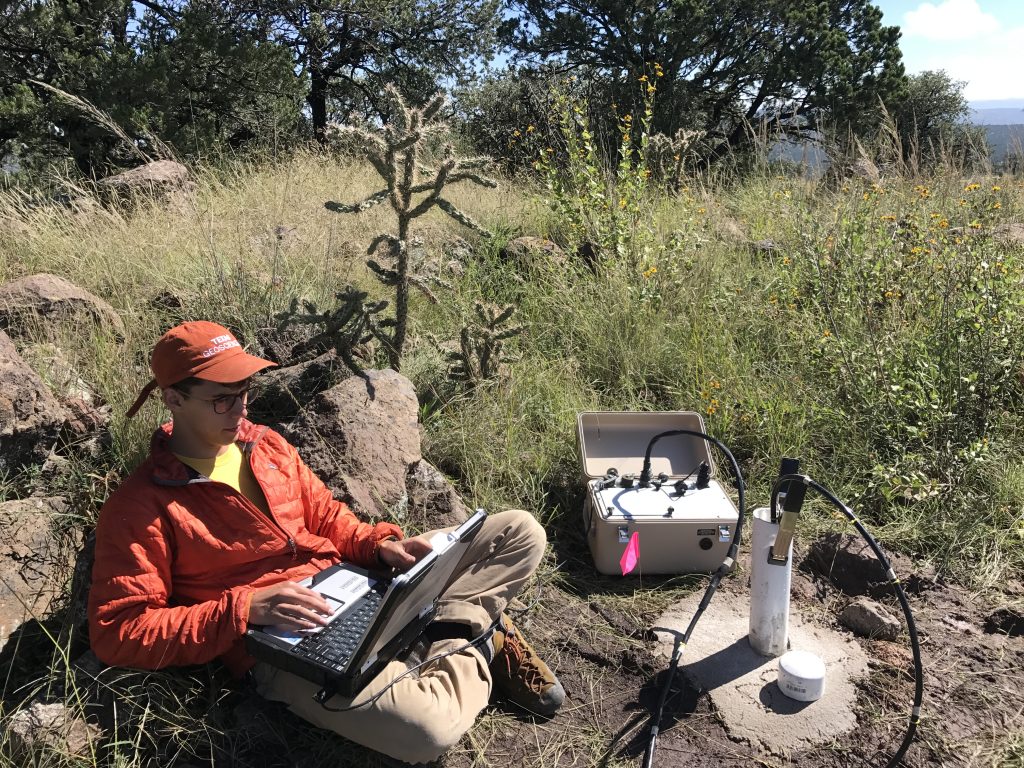
Graduate student Logan Schmidt sits near one of two newly-drilled wells. He is operating a downhole nuclear magnetic resonance probe which directly measures both the quantity of water in rock and the size of the pores in which it is held.

This work will tie in to an ongoing larger rock moisture study conducted by the Rempe Lab in Northern California where forests are rooted in metamorphosed marine sedimentary hillslopes—a starkly different lithology than the extrusive igneous geology of the Davis Mountains. Together, these projects allow us to compare how very different subsurface conditions shape their respective landscapes, and, perhaps, we may discover something fundamental about how the very closest rock influences the surfaces of the world.

Rivendell Vadose Zone Monitoring System Installation

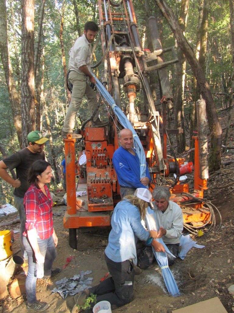
IMG_5867After much planning and coordination, Eel River CZO researchers gathered at the Rivendell experimental hillslope in Northern California to install a Vadose Zone Monitoring System (VMS).   The VMS is a custom flexible sleeve developed by Ofer Dahan and Sensoil Ltd. that houses samplers and sensors specially designed for complex unsaturated environments.  The VMS sleeve was installed into an inclined borehole, drilled at 55 degrees, and will collect access the unsaturated moisture that transits through the weathered and fractured rock above.

VMS Installation Photo Credit: Bill Dietrich VMS Installation Photo Credit: Bill Dietrich IMG_6124
UT Austin  |  Privacy Policy  |  Accessibility
© 2024 Jackson School of Geosciences, The University of Texas at Austin
Site Last Modified: February 21, 2024