Read about and see photos from the exciting work Sabrina is doing with Multi-Channel Seismic (MCS) data from the Blake Plateau.
Description of MCS fieldwork:
With the guidance of my advisors Harm Van Avendonk and Nathan Bangs, I have been analyzing marine seismic reflection data from the Blake Plateau and Carolina Trough regions, proximal to the Florida/Georgia/Carolinas coast. Our work draws from a combination of existing data (from International Ocean Drilling Program sites, well sites, etc), Multi-Channel Seismic (MCS) data, and Ocean-Bottom Seismometer (OBS) data.
Our complete analysis, to be conducted back on shore, will hopefully illuminate some of the mechanisms behind Jurassic-era continental breakup (better known as the breakup of Pangaea); moreover, I and my advisors are hoping to learn more about the stratigraphy, magmatic profile, magnetism, and bathymetry of the Blake Plateau. Features such as the Central Atlantic Magmatic Province (CAMP) may have caused two different types of the crustal movements that make this area unique: “rift,” where a nearby mid-ocean ridge had spread and pushed the crust away from the source of the upwelling; and “drift,” which is caused by the delicate balance and movement of the crust on top of the molten mantle asthenosphere. In short, we are attempting to resolve the various conflicting interpretations of Pangaea’s dissociation through comparison of our own data analysis with models derived from literature values.
A bit about life at sea:
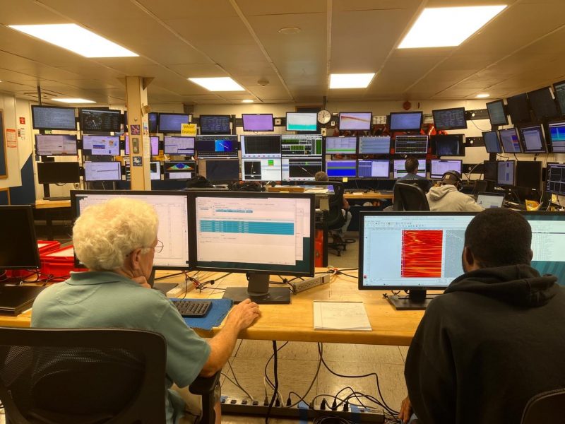
The team’s time at sea collecting the MCS and OBS data has been full of both fun times and interesting science. I and colleague Ranpeng Li put together a blog to document some of the cruise’s noteworthy moments, such as the successful completion of each line of collected data, some interesting points in analysis via Paradigm (such as being able to see the Moho discontinuity in the visualization of reflection data, or a really good view of the subsurface without problematic noise), and some routine (and not-so-routine) maintenance on the air gun/streamer setup. Keep reading for snapshots of some of the more exciting moments at sea.
AGU Abstract has been submitted, will become public domain closer to the AGU Fall 2023 meeting date.
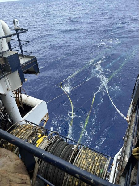
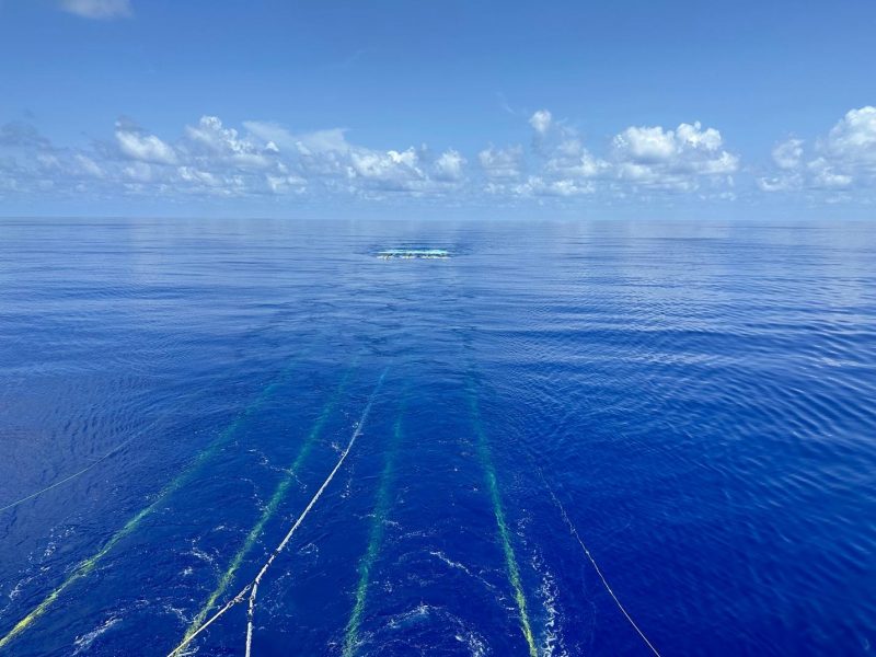
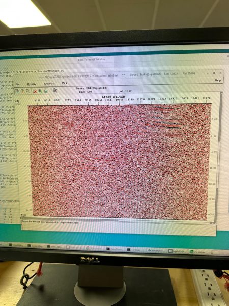
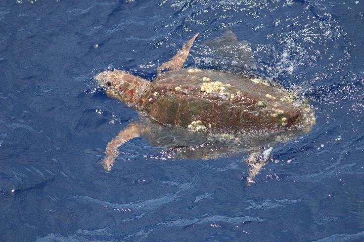
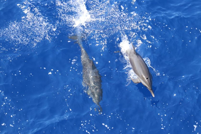
This photo was taken during the hydrophone streamer deployment at the beginning of the cruise, where the necessary equipment for collecting seismic reflection data was set up to trail behind the R/V Marcus Langseth. Each streamer consists of an air gun source (propagates the initial seismic signal that is then perceived and recorded as data), a GPS buoy (to give us precise coordinates for further calculations and data refinement), lots of sensors along the length of the streamer, and other gear such as stabilizing devices called “digi-birds.”The streamers trail uninterrupted behind the research vessel as the team completes the first “line” (geospatial increment) of data acquisition. Behind the scenes, the team processes the data with Paradigm, a highly capable seismic interpretation software), in the ship’s computer lab.The image on this monitor is a very preliminary rendering of data from line 1002. The data collected by the air gun/streamer complex has a lot of noise and rough edges prior to processing, so all seismic teams always complete a bit of preliminary processing for quality control of existing data and any lines that have not yet been completed (and save the majority for post-fieldwork back on land).Nathan shares his Paradigm expertise with other students on the cruise.A Loggerhead Sea turtle, photographed by the ship’s Protected Species Observers (PSOs).The relatively scarce observance of wildlife was a good thing when it came to data collection: if whales, dolphins, or sea turtles interfere with the ship’s and equipment’s trajectory, the MCS team has to shut down the air guns.