
Sierra Nevada
Physical Map of California
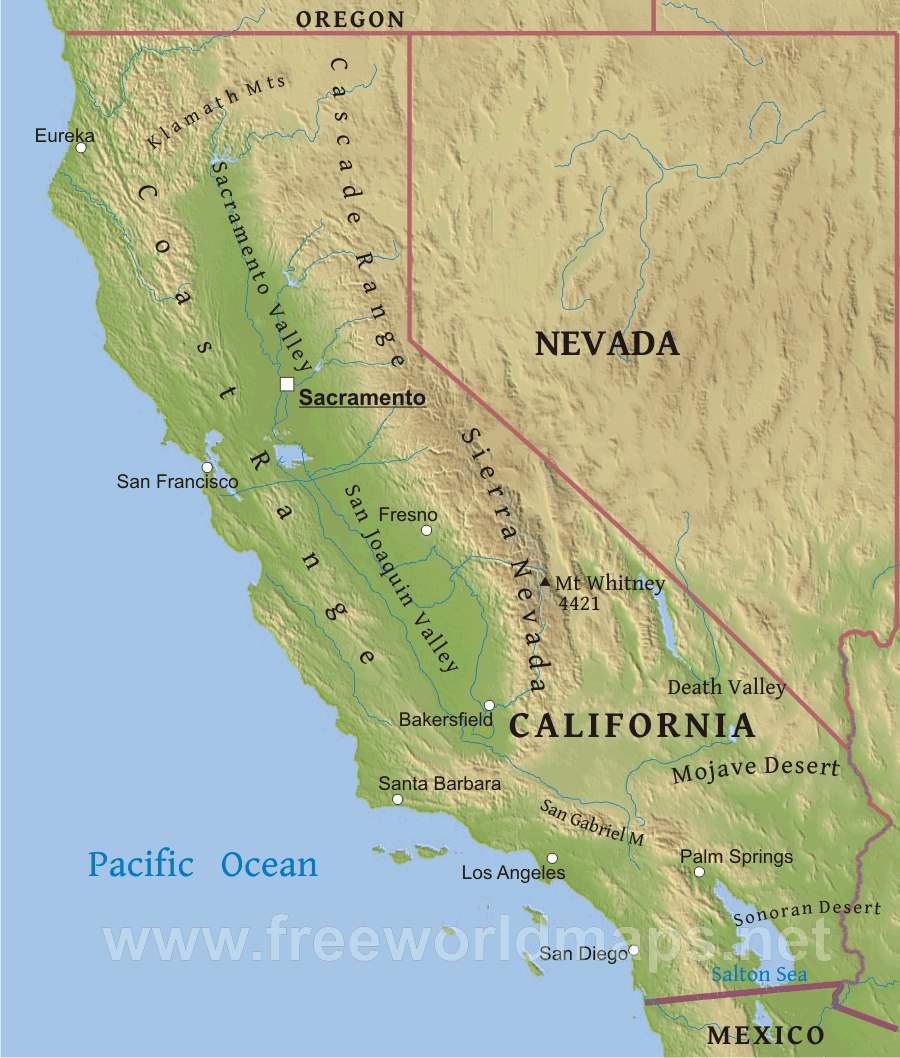
The Sierra Nevada is the spectacularly beautiful mountain range directly east of the San Joaquin Valley (Bakersfield area). It extends from Northern California along the Nevada border south to Tehachapi where the mountain chain take a large bend to the west and change in character and history. The Sierra Nevada are the core of an ancient line of volcanoes. One hundred million years ago, the Sierra Nevada volcanoes probably looked a lot like the Cascade Range in the northern California because they formed by the same process, subduction. What we see now in the Sierra Nevada is what likely lies 10-15 km below the Cascade volcanoes, large masses of igneous rock (rock formed from cooling of melted rock or magma). The rocks that we see today in the Sierra Nevada were exposed as the rocks in the volcanoes were worn down by rain, snow, ice, and wind. The broken pieces of rock were carried down hill by rivers, ice and gravity and now lie in the San Joaquin Valley. The thick layers of sedimentary rocks in and around Bakersfield are mainly made up of pieces the Sierra Nevada volcanoes that were broken off and carried down hill to the valley.
There are four activities in this module.
1 Sweet age dating uses m&m’s© candies to demonstrate the concept of halflife, a critical component in determining the age of igneous rocks using the rates of radioactive decay of elements inside the rock as a geologic clock.
2 Kern River Drainage has students map the entire region drained by the Kern River, in other words, the area from where rain and snow-melt end up in the Kern River. The area extends from Mt Whitney in the eastern Sierra down to Bakersfield. Students learn how to read topographic maps. Laminated maps are located in a repository with the Kern County Superintendent of Schools and can be delivered to your classroom within 48 hours of request. You may purchase your own laminated copies of these maps from CSUB Geology.
3 Rocking It!! has students identifying rock samples from the Bakersfield area that were all piece of the Sierra Nevada volcanoes brought down to the valley by rivers. Students learn to identify the different rock types and think about how the rocks in the valley impact our economy. The rock samples are located in a repository with the Kern County Superintendent of Schools and can be delivered to your classroom within 48 hours of request.
4 Shoebox faulting has students create different kinds of faults in “sediment” layers inside of a shoe box. Students observe how the layers are “messed up” by the faulting. This activity was modified from one found at the Science Education Resources Center (SERC) housed at serc.carleton.edu. SERC is an amazing resource for Earth science educational activities!
Additional Resources on the Sierra Nevada can be found here.