Research
MARS
Global paleolake basins: fluvial erosion, sediment transport, and deposition
Valley network formation era and ancient Mars climate
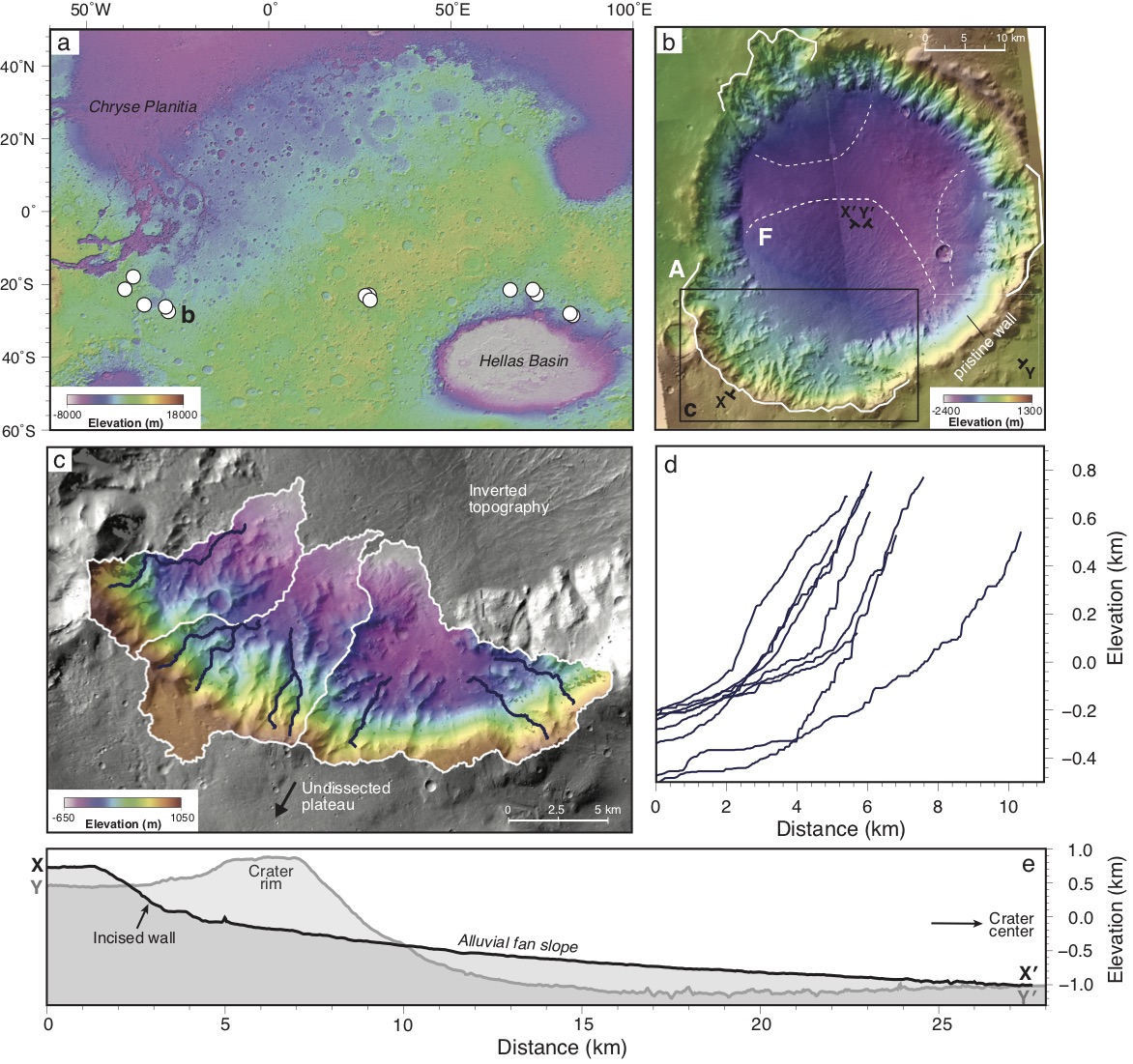
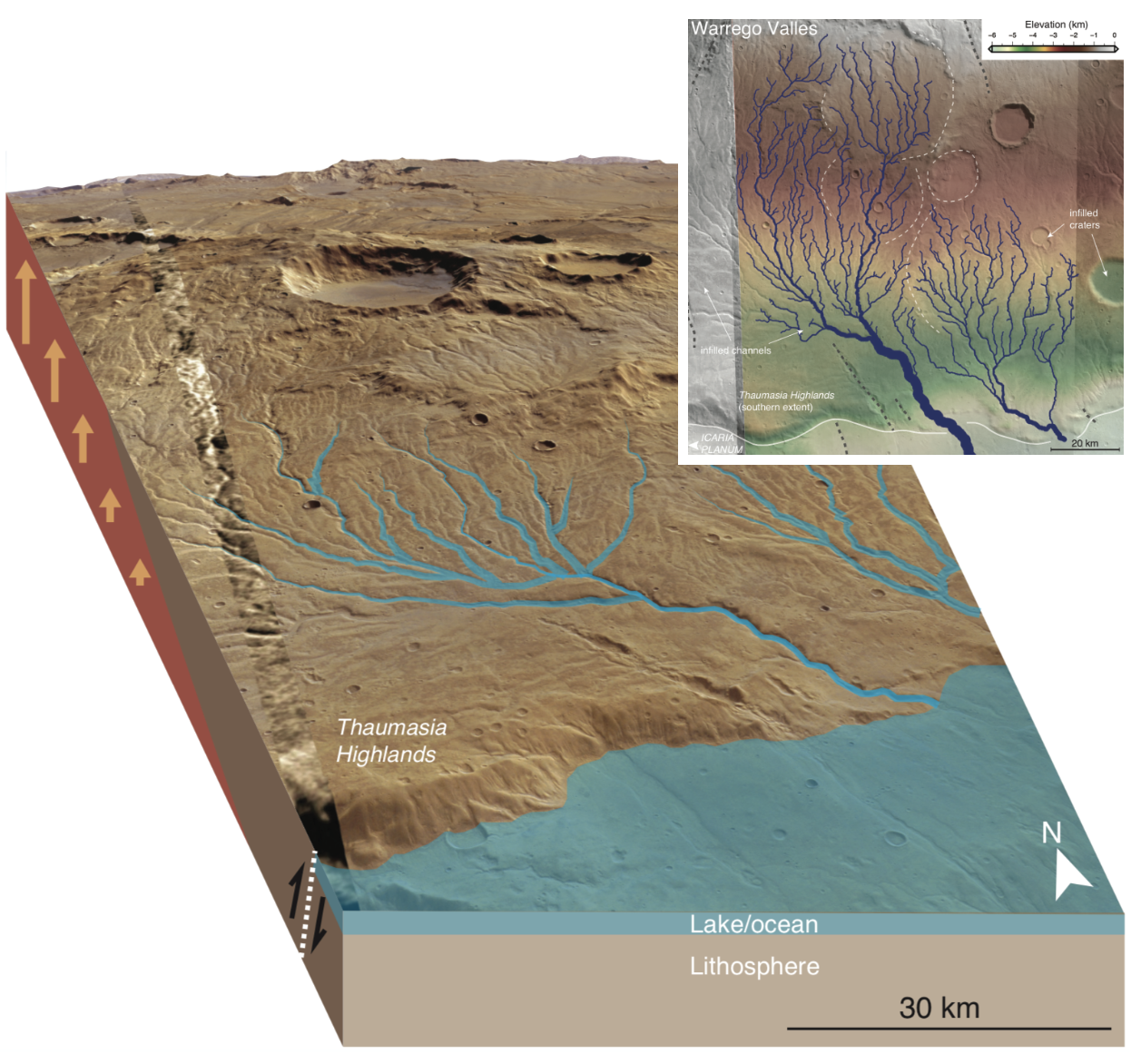
Orbital and in-situ datasets have revealed the existence of > 400 paleolakes on Mars, which can be subdivided into open- and closed-basin lakes. These hydrological systems contain large watersheds with eroded inlets valleys and sometimes breached outflow channels. The observed morphologies of these features can be combined with simple hydrological balances, stream power parameters, and sediment transport models to provide important constraints on the amount of water and sediment required to form them.
The widespread occurrence of fluvial features on Mars suggest an ancient climate capable of sustaining abundant water on its surface. However, thus far martian climate models have been unable to recreate the necessary conditions required to support a persisting wet climate. Understanding and quantifying the absolute timescales, fluvial event frequencies, and evolution of valley networks is key to understanding the ancient climate history of Mars, water sources and sinks, and past habitability on the surface.
EARTH
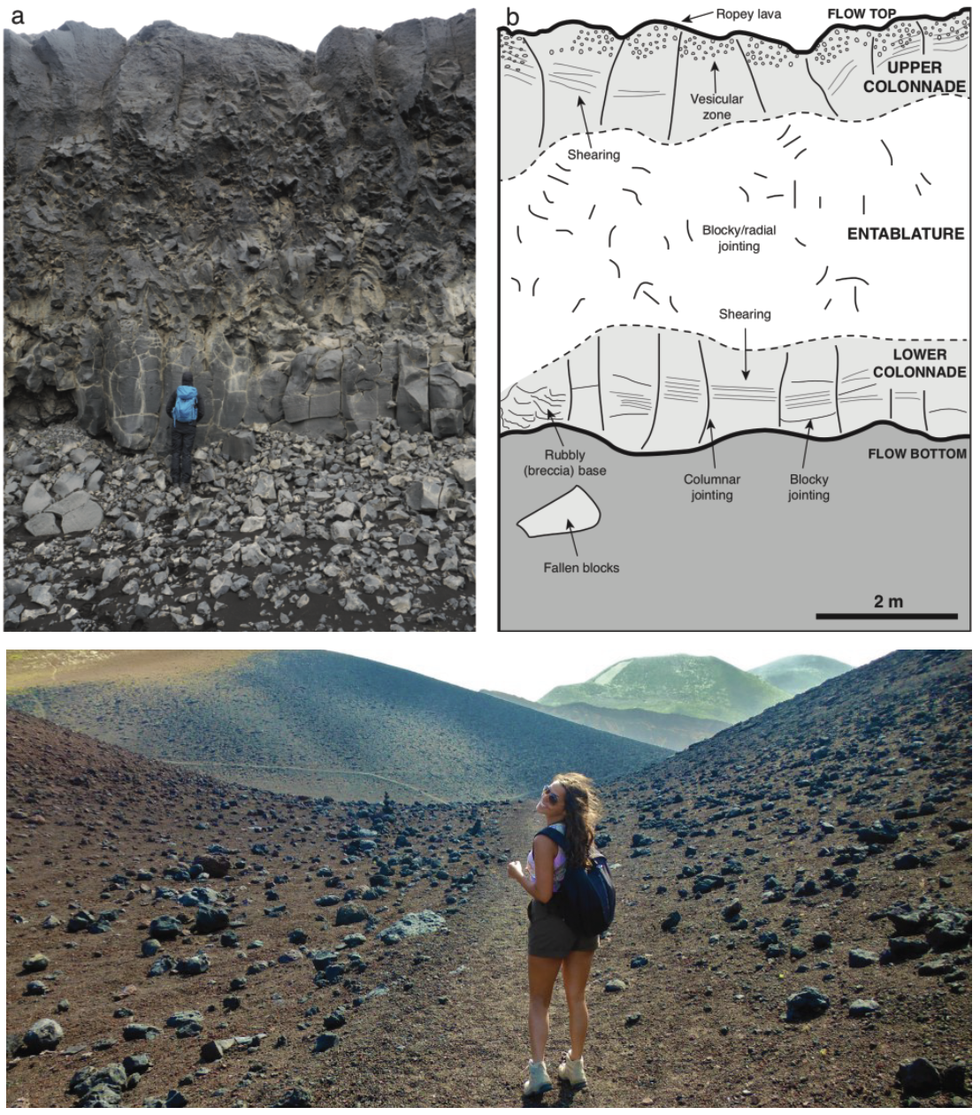
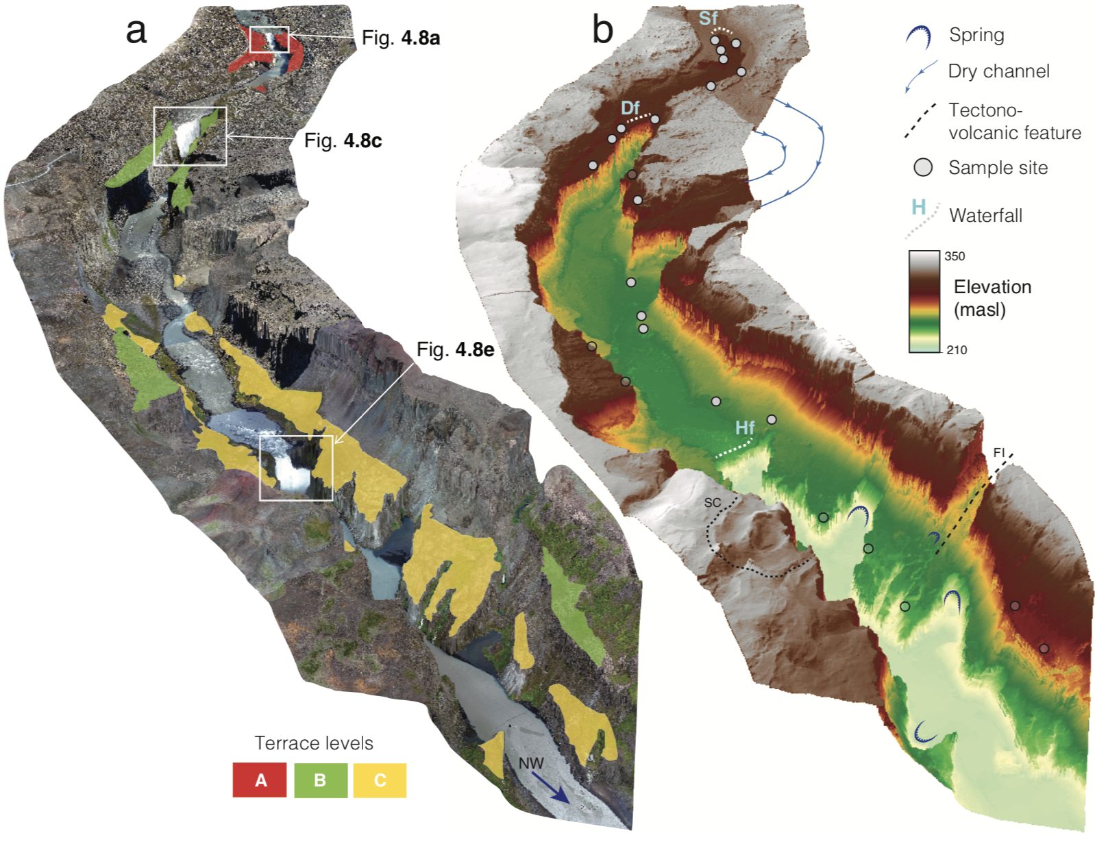
Waterfalls, channel mechanics, and local river morphology
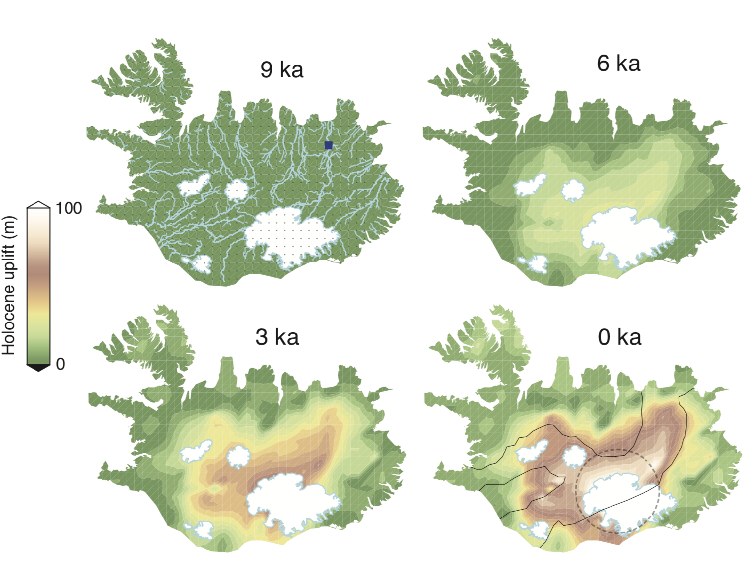
Landscape evolution: tectonics, erosion, and climate interactions
Channels carved into planetary surfaces display complex geometries resulting from interactions between climate, precipitation, sea-level, bedrock lithology, sediment transport mechanics, and tectonics, among others. Key metrics such as variations in channel slope (= ´knickpoints` or waterfalls) record perturbations in these basin-wide feedbacks which result in upstream propagation of steep river reaches. Linking high resolution field measurements of incision and knickpoint retreat rates to drainage evolution models is currently limited despite their important role in dictating the past, present, and future morphology of landscapes.
To understand the geological, geodynamic, and environmental processes that shape landscapes we need to address the following antithetical questions: how can we deconvolve the various controlling processes which shape dynamic landscapes?; how can erosional constraints be used to obtain histories of uplift, climate, and other dominant processes over different time and length scales? These problems may be tackled by incorporating results from field studies, laboratory techniques, and experimental studies into 2- and 3-D geomorphic models (e.g. Landlab, or forward/inverse fluvial models).

SOLAR SYSTEM
Volcanic islands and basaltic terrains as martian analogs
Geochronology and quantifying planetary surface process histories
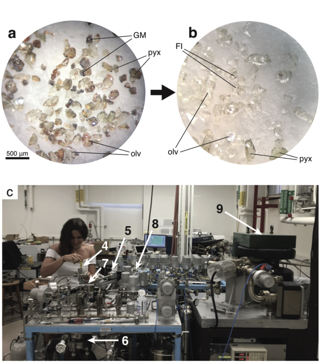
The study of solar system bodies generally relies on remote sensing data (spaceborne and airborne) to study present-day signatures recorded in the topography, mineralogy, and sedimentary rock record. Understanding their generation and development requires comparative study sites (i.e. analogs) such as volcanic islands which resemble the basaltic surface of Mars.
To directly quantify erosion rates and landscape evolution we use fundamental techniques such as cosmogenic exposure dating. For example, Helium-3 isotope measurements are used to derive fluvial surface exposure ages, which when combined with high-resolution mapping, provide important constraints on river evolution over thousands of years.