

Welcome to The Search for Devil's Eye
In the late 19th century, three geologists set out to map a large part of central Texas. During this journey, they mapped a location called, "The Devil's Eye," an eddy along the edge of the river. This page collects materials from the original expedition as well as those from modern-day geologists attempting to re-create this historical journey. Use the menu items above to read about one geologist's trip, explore the journey's path, read the 1889 journals of R.A.F Penrose, and compare images of the past and present.
It all began with a historical expedition...
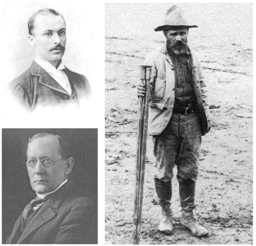
RAF Penrose (top left), E.T. Dumble (bottom left), and R.T. Hill (right)
In the late nineteenth century, a mapping frenzy began that ushered in an era of internal exploration that led to a massive expansion in our knowledge of the internal regions and resources of the United States. In 1888, with approval from the State of Texas, E.T. Dumble (the State Geologist), R.T. Hill (a professor in the Geology Dept of UT), and R.A.F. Penrose (former employee of the Anglo-Canadian Phosphate Company) embarked on the third geological survey of the State. In 1889 some of their efforts to unravel the geology of the Gulf region of Texas led them from Austin to La Grange via the Colorado River, and provided Texans with a wealth of vital information about potential resources. During their explorations, they sampled rock beds, interacted with settlers, argued with each other, and generally produced a delightful record of the daily experience of exploration and mapping of one of Texas’s most important rivers. Many of the geological and historical treasures detailed and collected by these early explorers are available to visitors to the Texas Memorial Museum.
Dumble left the survey after 1895 to work for the Southern Pacific Railroad and its subsidiary, the Rio Bravo Oil Company. Penrose left the survey after less than two years. In later years he worked with several other geological enterprises, traveled widely to study ore deposits, and is renowned for his role in the Geological Society of America. Hill, regarded by many as “the Father of Texas Geology”, produced seminal works relating to the geology of the state that are still relevant today. How these men related to each other and to the settlers of the time leads us into scandal and scientific impropriety, injury and abandonment.
The three geologists left behind a tantalizing mystery—the survey was terminated prematurely and Dumble was accused of impropriety. There are clear and intentional instances of omission of information. Dumble, Penrose, and Hill are known to have reached a location called, “Camp Disaster.” There is but a simple comment in the field notes that Hill left at that point, as did the hired oarsman. Was there an argument here between Dumble and Hill, and if so over what? Is that the origin of the name “Camp Disaster?” Or did the place get its name in some other manner? Much earlier in history Noah Smithwick overturned a dugout canoe at or near this site while trying to ferry cattle across the river in the Runaway Scrape prior to the battle of San Jacinto. Even UT’s researchers have had their share of trouble here; one research fellow has twice dropped his camera in the river, another sprained his ankle, and both have suffered from extensive poison ivy.
A modern day mystery...
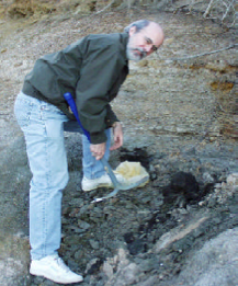
Louis Zachos explores the riverbank
This page’s title, “The Search for Devil’s Eye,” signifies both the original exploration and “search” for geological evidence and our modern attempt to reconstruct or “search for” the original sites of field collection. We know these sites, such as “Devil’s Eye”, only from the explorers’ written descriptions and given mileage from a known geographical or human location. Searching for the original Devil’s Eye draws attention to the real problems involved in verifying the science of early exploration: river banks have eroded, names have disappeared from maps, weather patterns and human development have wrought profound change in the topography of the river.
The very process of searching is a graphic demonstration of the effects of natural- and human- influenced river channel changes, including urbanization, flooding, and dams. Debris high in the trees, the high water mark on the bridge at Smithville, and a look at the USGS river gauge data tell us the enormous range in river flow, even after the Colorado was dammed. The trail’s gradual disappearance sheds light on the river’s renewal, change, and migration, and it brings into focus the importance of collecting, recording, and studying our local landscape.
Geological exploration did not end with these early scientists. Universities and the private sector continue to unravel the fascinating geology of Texas. In about 1908 the State’s role in geological and mineral research was taken over by the Bureau of Economic Geology, which continues to concern itself with the resource potential of Texas.