
Drilling into Dino Doomsday
October 14, 2016
By Monica Kortsha
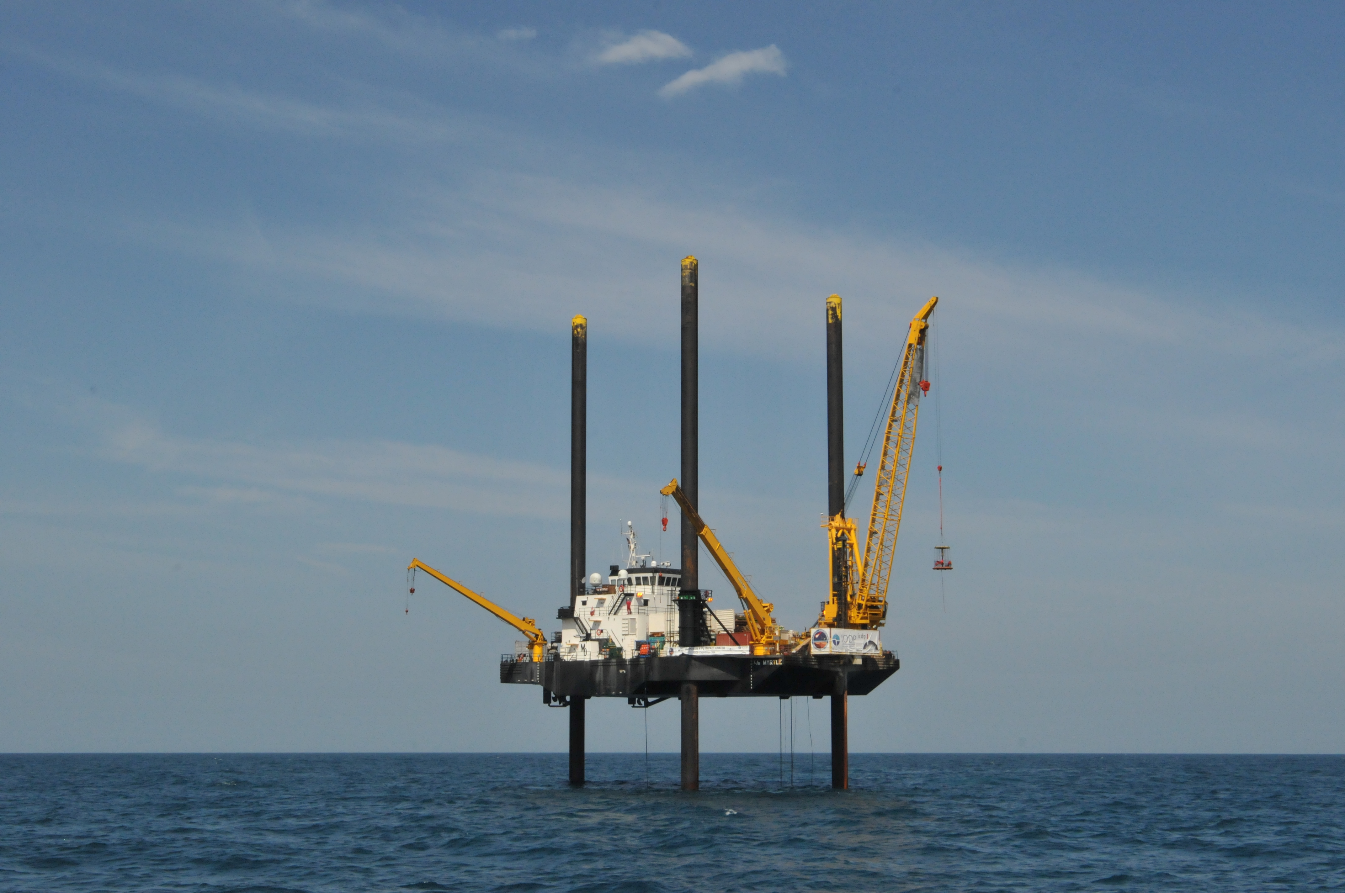
About 15 miles offshore of Progreso, a beach town near the Yucatán Peninsula’s capitol city Mérida, a black and yellow boat called Myrtle stands still in the Gulf of Mexico, dark blue waves rolling beneath it.
While other boats float, Myrtle really does stand, supported by three stout legs that rest on the seafloor and act like giant kickstands to lift the vessel 40 feet above the water.
Usually the Myrtle is a delivery vessel for oil platforms, with the legs raising the boat right to the deck of the platform for easy cargo transfer. But for the past month, the Myrtle’s legs have been used to suspend the boat above ground zero of one of the most violent events in Earth’s history: the asteroid impact that caused the extinction of the dinosaurs 66 million years ago.
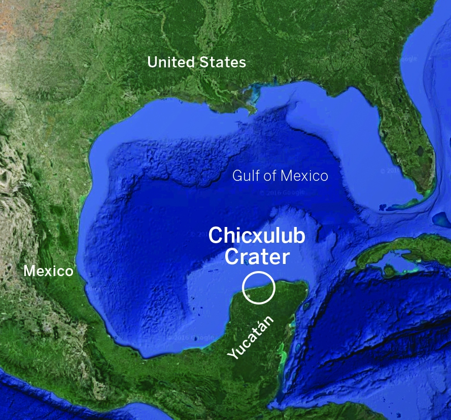
The impact site, called Chicxulub (chic-SOO-loob) after a nearby town, is invisible from the surface; millions-of-years-worth of rock and sediment fill the crater basin. Preserved in these rocks is a record of the impact and the worldwide extinction event that followed, as well as life’s recovery.
The rocks also hold physical evidence for how large impacts happen how, in about five minute’s time, a six-mile-wide asteroid can deform the Earth into a crater 124-miles wide and almost 1-mile deep.
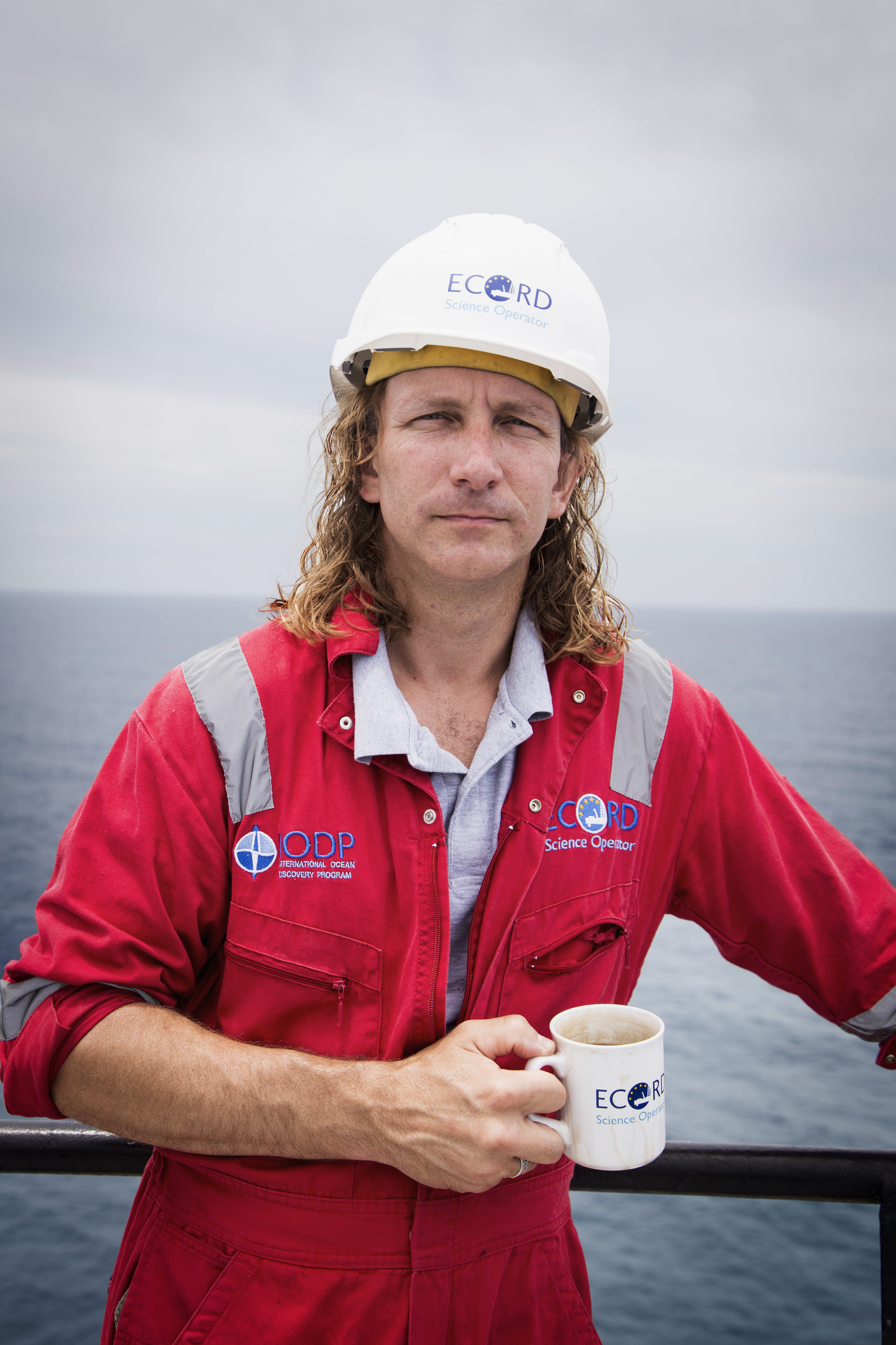
The Jackson School’s Sean Gulick, a research professor at the University of Texas Institute for Geophysics (UTIG), is on a mission to retrieve the record from the apocalyptic impact. He and a team of scientists from around the world are doing it by drilling deep into the impact from the deck of the Myrtle and bringing up evidence one core sample at a time.
On May 10, 2016, they’re currently at 823 meters—more than halfway to their 1,500 meter goal.
“It’s rare that you can design a project where you’re going to have a win, a real slam dunk by simply seeing what rocks are made of,” Gulick said. “And this one is that way because it took so many years to build, so many (impact) models, so many ideas, that we’ve gotten to the point now where we have a truly testable set of ideas that can be
answered with a single drill site.”
Gulick is co-leading the mission with Joanna Morgan, a professor of geophysics at Imperial College London. The two first met in 2005 when conducting a marine seismic survey of the crater area, a project that helped lay the groundwork for the current drilling research.
More than a decade after the survey, the International Ocean Discovery Program, a multicountry consortium for scientific drilling, approved Gulick and Morgan to lead IODP Expedition 364—a $10 million mission to recover rock from the impact site.
“The IODP is big science; it’s our version of the Hubble Telescope or
the Large Hadron collider. It’s how we get samples that we could never ever get otherwise,” said Chris Lowery, a micropaleontologist and postdoctoral researcher at UTIG who was aboard the Myrtle earlier in the mission. “It’s so important for the community and science as a whole to have this program.”
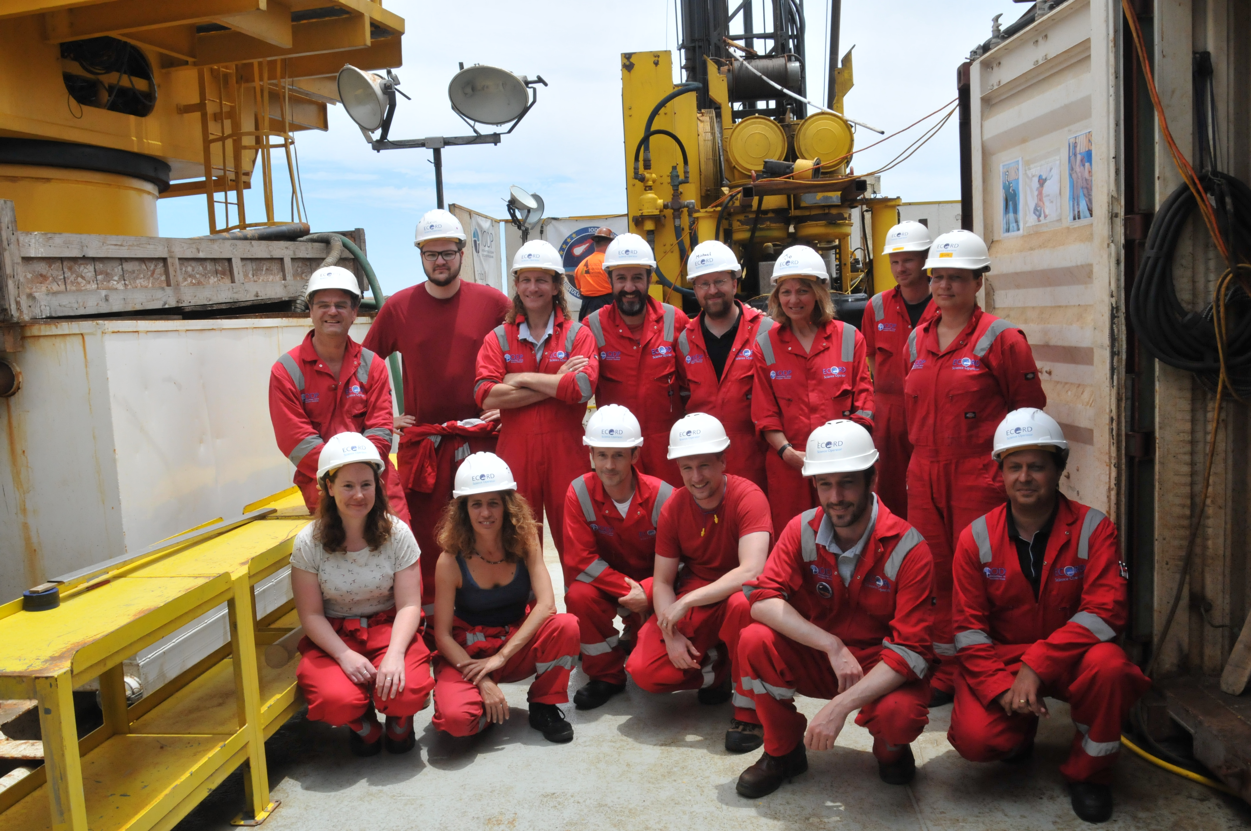
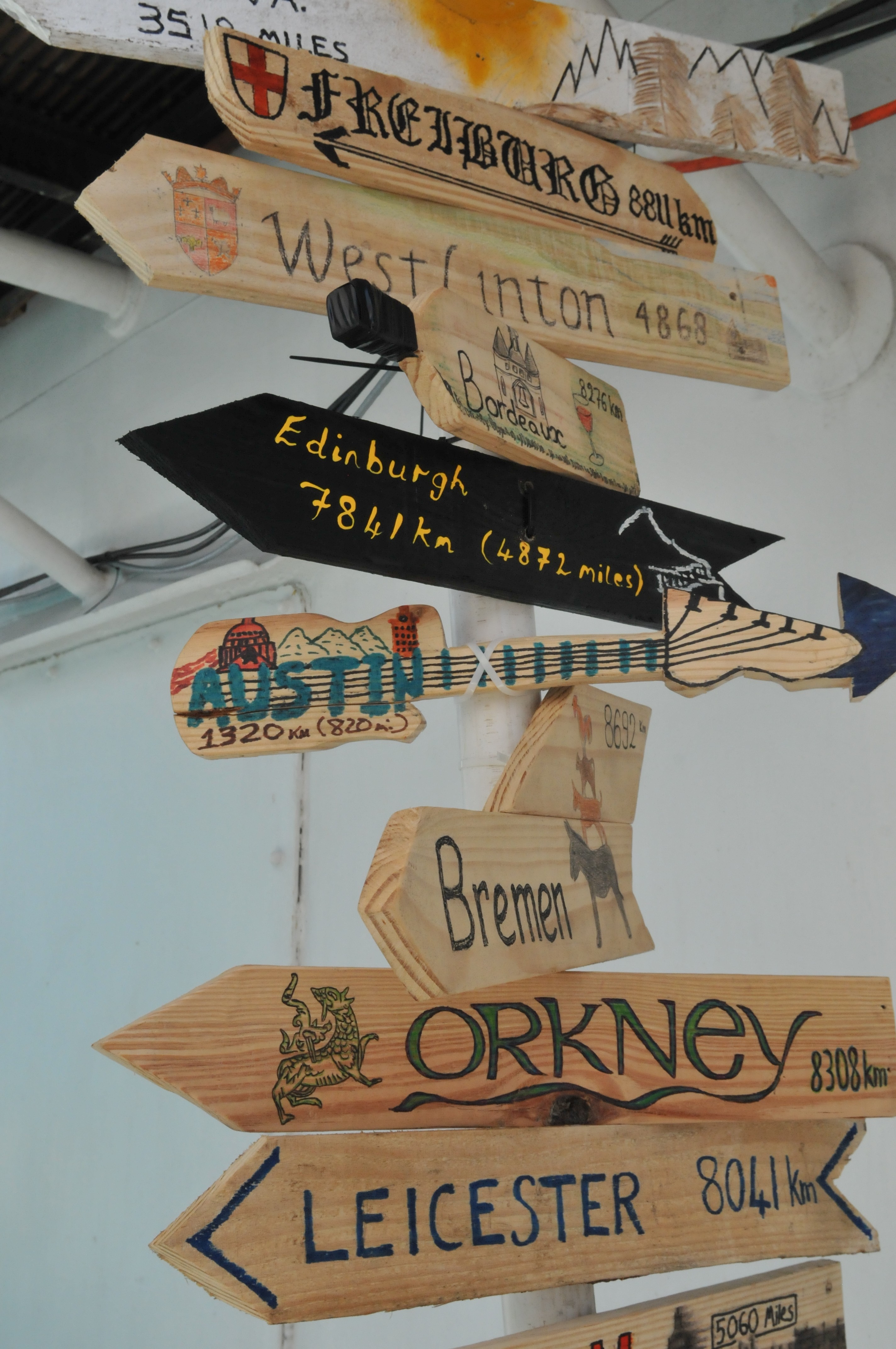
On board the Myrtle, life and science is made possible by a team of eight scientists from across geosciences disciplines, drill operators and ship crew. A series of handmade wooden crossroads signs, zip-tied to a thin metal support beam on the boat, show how far everyone has come. According to one sign shaped like an electric guitar and decorated with a doodle of the UT Tower, Austin, Texas, is 820 miles away.
That plank represents home for Gulick, as well as other Jackson School researchers that were on the Myrtle earlier in the mission. Gail Christeson, a geophysicist and UTIG senior research scientist; Steffen Saustrup, a UTIG geophysicist and research scientist associate; and Lowery all left at the start of May to make room for other scientists to come aboard.
But it’s not just scientists who want to see the core. The governor of the Yucatán State, Rolando Zapata Bello, sent an envoy to the Myrtle to meet the researchers. And the mobile phone mogul, Carlos Slim Helú, the “Warren Buffet of Mexico,” paid a visit to the boat with his grandchildren.
Since the expedition started in April, The media coverage has been a constant, too. Journalists are frequent guests on the Myrtle, with a record of 29 reporters coming aboard in a single day. Dozens of publications, including Nature, the BBC, and The Washington Post, have run articles on the mission, and for the first two-weeks of coring a documentary crew kept their cameras rolling.
“By a long way, this is the most newsworthy item we’ve ever done,” said Dave Smith, an operations manager for IODP ESO who helps arrange scientific drilling missions around the world. “We’re receiving more attention than any other project I’ve worked on.”
From scientists to school kids, everyone is interested in the same question: After the asteroid hit 66 million years ago, what happened next?
AFTERMATH AND DISCOVERY
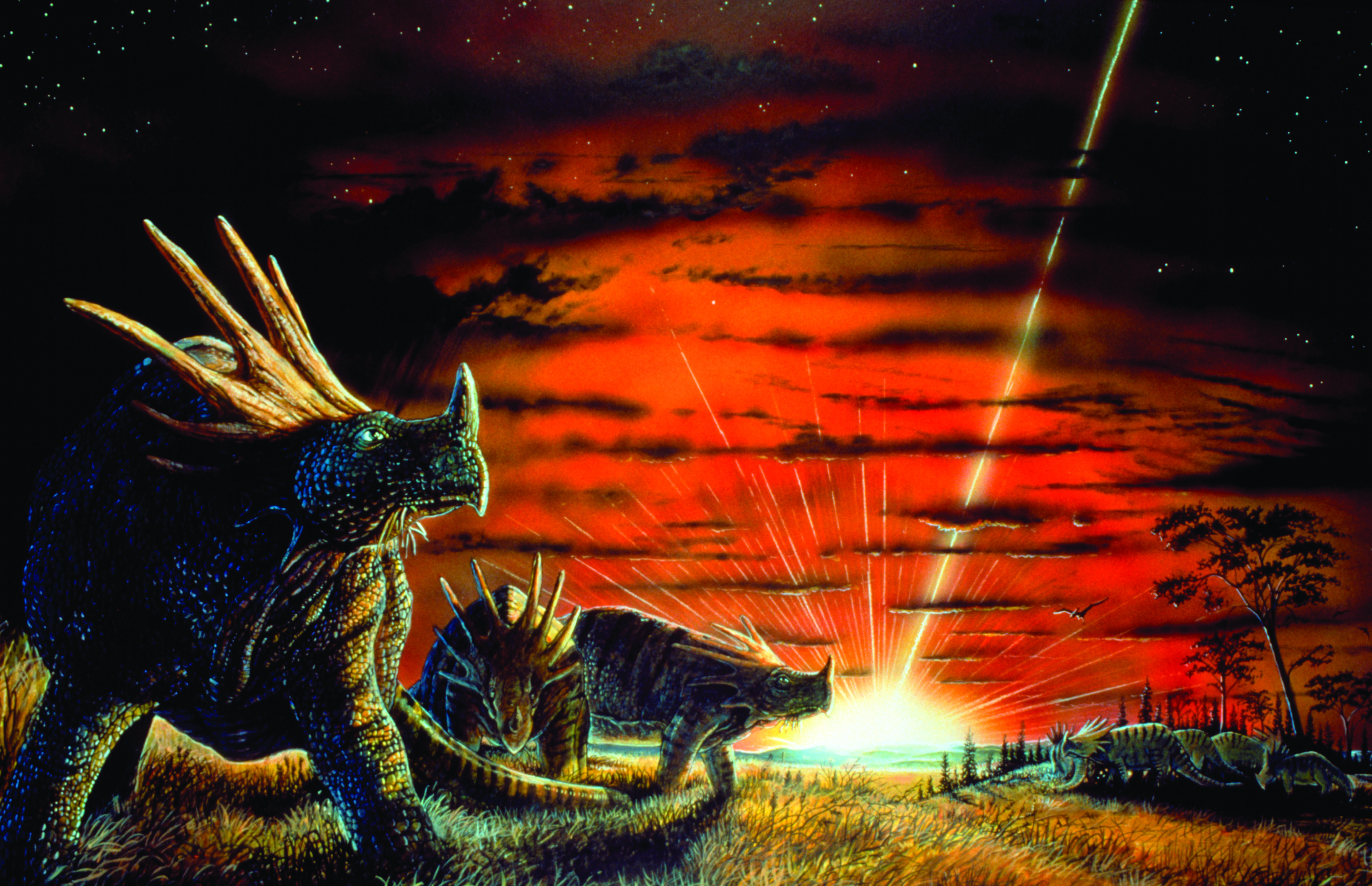
The Chicxulub asteroid hit what is now the Gulf of Mexico with a force of 100 million atomic bombs.
What followed was a cascade of disasters that the scientists call “kill mechanisms”—a term that describes the different ways life was wiped out across the globe.
“It’s expected that most of the kill mechanisms happened and most of them were important,” Gulick said. “But the relative importance of these things needs to be figured out.”
Still, researchers say the combined effect added up to nothing less than environmental apocalypse.
The Chicxulub impact instantly blew the asteroid apart, spewing a mixture of pulverized Earth rock and asteroid into the atmosphere, with some making it to outer space. The shockwave of the impact triggered earthquakes across the planet and birthed monstrous tsunamis that swept as far inland as where Illinois is today.
Anything within 1,000 square miles of the impact was killed almost instantly, obliterated by the ruptured Earth, burned away by the heat of the impact or swept away in the tsunami’s waves. Worldwide, the ejecta that was blasted high into the atmosphere fell back to Earth as friction-heated fireballs that ignited wildfires and cooked wildlife alive by heating up parts of the atmosphere for minutes.
But most of the dying came days to months later. Dust kicked up from the impact likely lingered in the atmosphere for months, blocking sunlight and causing massive dieoffs of plants and phytoplankton, the base of the food chain. The sulfurous carbonate composition of the Yucatán’s rock likely exacerbated the killing by releasing a glut of sulfur and CO2 into the atmosphere. The sulfur made acid rain, and the CO2, when reabsorbed into the ocean, made carbonic acid. Both acidified the ocean, likely dissolving shells of marine organisms before they could fully develop.
When the killing was finally done, 75 percent of life on Earth was extinct, no animal weighing more than 55 pounds remained and the reign of the dinosaurs was over.
“It’s the death of an era,” Gulick said. “Dinosaurs and marine reptiles ruled the Earth as the top set of species for nearly 200 million years, they were absolutely kings of the ecosystems, and a lot of things evolved alongside them and with them to take advantage of that type of ecosystem —that all ends.”
But the ashes of the old order provided fertile ground for mammals to begin their ascent as the new dominant lifeform on planet Earth.
“We end up with an entirely different system and in that system mammals evolved to be very important and ultimately led to humans,” Gulick said. “And it wouldn’t have happened without
this cataclysmic event.”
The extinction event is evident in the fossil record. However, what caused three-quarters of the world’s species to go extinct was unknown until 1980, when a team of scientists found iridium—a mineral common in meteorites but rare on Earth—in the K-Pg boundary, the thin geological section found across that planet that marks the extinction event and separates the Cretaceous from the Paleogene.
The finding suggested that an extraterrestrial impact was responsible for creating the layer—a hypothesis that started a search for a crater.
Interestingly, signs of the Chicxulub crater were first detected two years before iridium was found in the K-Pg boundary during a gravity survey of the gulf by the Mexican oil company PEMEX. The ringed features on the data suggested that an area of the gulf had been shaped by a massive impact or a volcano, a finding that was presented at a Society of Exploration Geophysicists meeting in 1981.
The identity of the site as an impact crater was confirmed in the 1990s when scientists reexamined the PEMEX cores taken in the 1950s and found shocked quartz, a mineral that’s present in only
two places: nuclear bomb detonation sites and large impact craters.
“When we realized what this impact had done, suddenly everybody became interested,” Morgan said. “The whole world started talking about impacts, both public and scientists.”
The discovery spurred more research on the Chicxulub impact, which only strengthened the connection between the impact and the extinction event. A paper published in Nature in 2010 and authored by 32 scientists—including Gulick, Christeson and Morgan—made the connection official by concluding that the Chicxulub impact was the best explanation for the mass extinction at the K-Pg boundary.
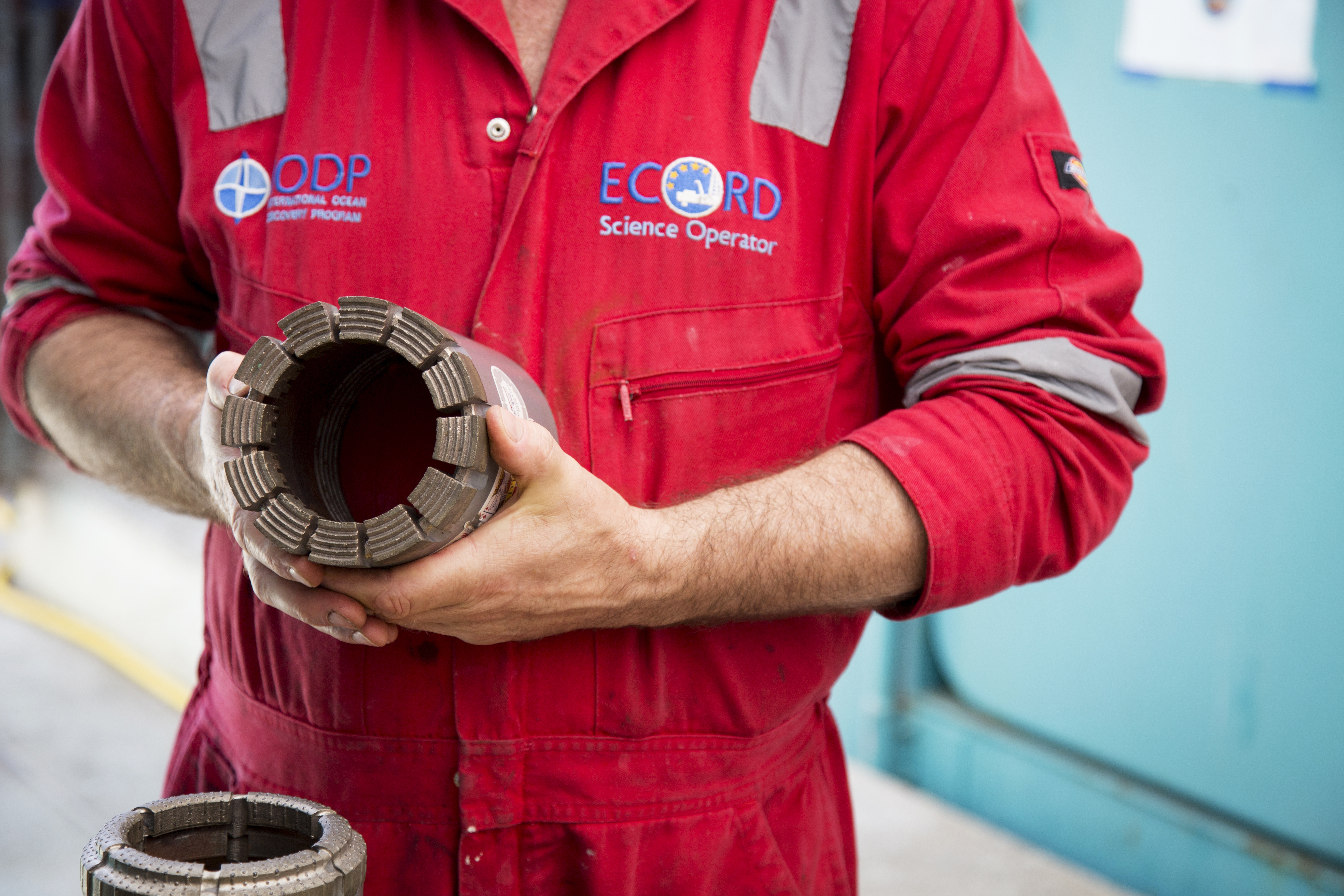
The cores being retrieved on the research mission are different from the PEMEX samples because they’re continuous. The mining-grade drilling equipment collects uninterrupted cores all the way down, capturing each geological layer of the crater. The preliminary science conducted on board the Myrtle also allows for core properties that may change over time to be noted.
“The reason we’re doing any science on board is some of these measurements are ephemeral measurements,” Gulick said.
“If we waited months to measure their physical properties, the drying out process could change them.”
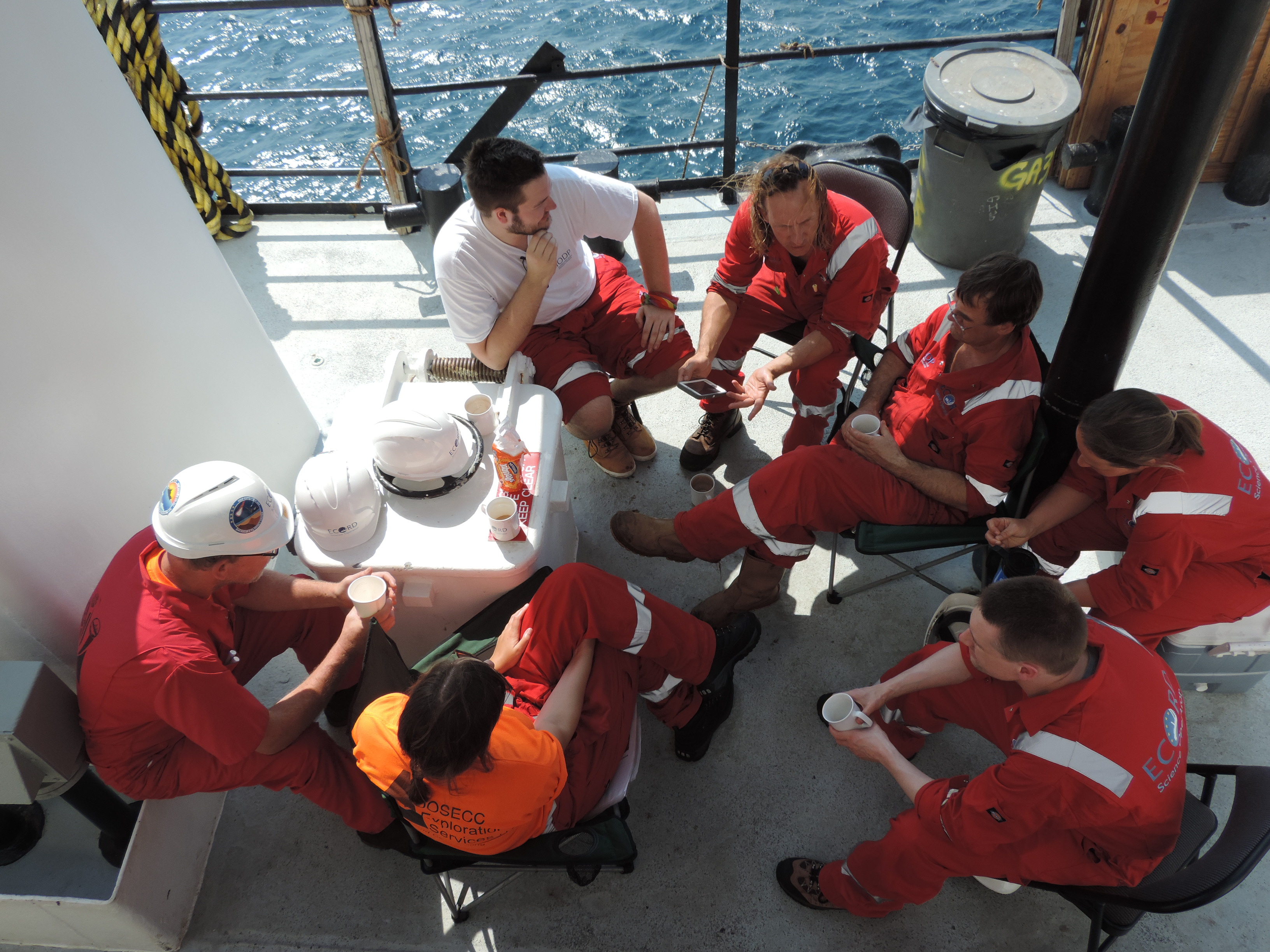
On the Myrtle, life and work revolves around pulling cores and analyzing them, 24 hours a day, seven days a week. To cover it all, scientists are split into two teams that are assigned 12-hour shifts.
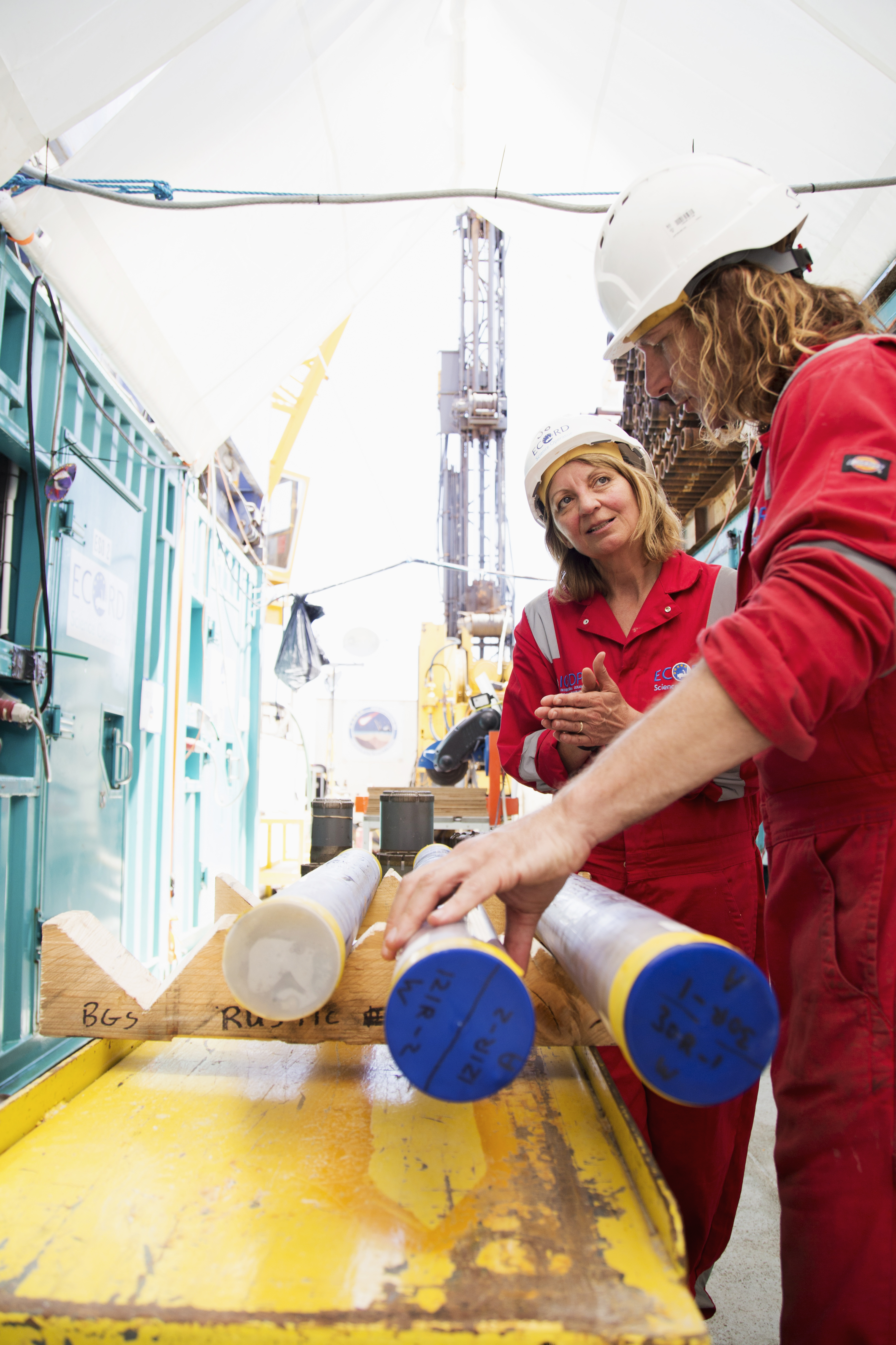
When a core comes to the surface the science team springs into action to take measurements. Features that can be viewed through its plastic sheath are noted; samples chipped for microfossil analysis or DNA collection; a geophysical scan taken to record initial density, chemicals present, water content and other physical features that are likely to change as the core adjusts to being at the surface instead of hundreds of meters below the seafloor.
At the same time the core is being analyzed, other scientists are taking readings from inside the borehole. The acoustic imaging team, led by Johanna Lofi of the University of Montpellier in France, uses sound to create images of the rock surrounding the hole, revealing rock layers and cracks. And the vertical seismic profile team uses instruments dropped in the borehole and a sound source at the surface to record core depth and image surrounding rock layers.
Gulick, and until this week, Saustrup, control the sound source while University of Alberta researchers Doug Schmitt, a geophysics professor, and Chris Nixon, a graduate student, man the geophones that are dropped down the hole. To cut costs and save space aboard the Myrtle, Schmitt and Nixon only come aboard when it’s time to take borehole readings. Otherwise, they’re at a century-old villa in Mérida, complete with a courtyard pool and green coconut trees.
THE LIFTED LIFE
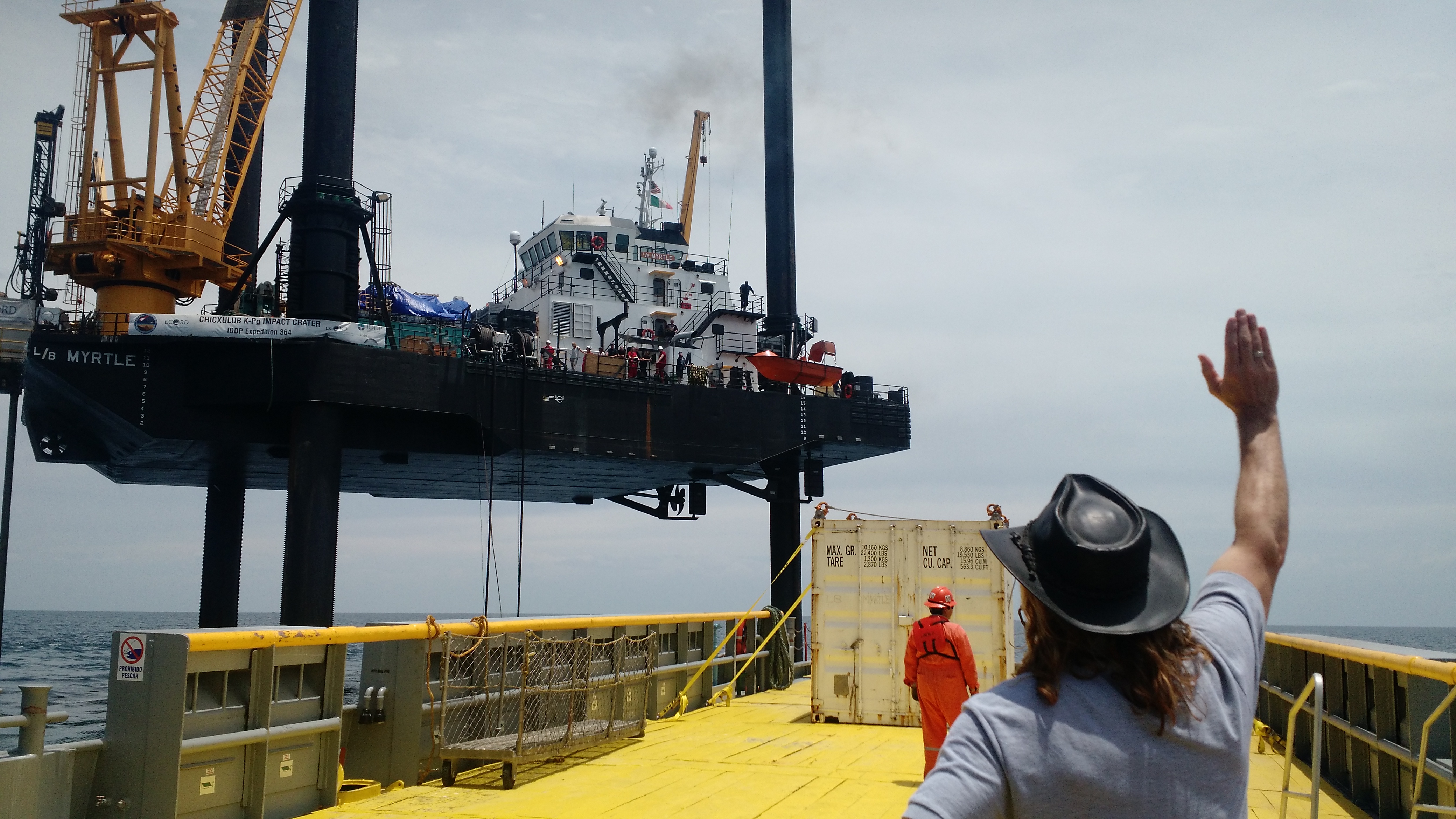
The reason the Myrtle is lifted above the water is to provide a stable environment for the drilling rig. Held high above the beating waves, there’s nothing more than a slight sway on deck.
The position requires all who board the Myrtle to be plucked from a transport boat and raised up to the Myrtle’s decks in a crane operated basket. On May 10, two scientists and a BBC photographer are among those taking the ride. The scientists are Mario Rebolledo-Vieyra, a geophysicist specializing in physical properties from the Unidad de Ciencias del Agua, a water research center in Mérida, and Axel Wittmann, an inorganic geochemist from Arizona State University. The ride up gives a good view of the drilling rig, the stack of pipes used to guide the rig down the borehole and the six teal shipping containers that serve as scientific laboratories. The basket touches down near a grouping of scientists, easily identifiable in their red work suits and white hardhats.
Who’s on board the Myrtle depends on the drilling stage. Costs and tight living arrangements don’t allow for any more extra researchers than necessary. So last week the two micropaleontologists packed up to make room for Rebolledo-Vieyra and Wittmann, both experts in impact geoscience. They’ve been called aboard because the drill has passed into a new layer of the crater.But they’ll have to wait to see any new cores samples pulled up from the depths; the drill bit has dulled, so today it’s being pulled up, pipe-by-pipe, so a new diamond embedded bit can be fitted on the end.
The times when the drill operators are busy pulling the pipe up or pushing it back down, offer opportunities for other things. The researchers review data, hash out theories on the deck, file the daily reports on coring progress, update the IODP expedition blog and even enjoy some wildlife spotting. The boat is a good bird watching spot—though some of the sightings are a bit gruesome. The peregrine falcons that hang around the ship have a habit of dropping the disembodied heads of songbirds on deck.
The “Fish-Cam,” a GoPro on a rope, lets the scientists look at wildlife swimming below the boat. Along with silvery fish and sharks, the footage captures a view of the drill rig, encased in a pipe, sticking out of the seafloor like a straw. A large starfish nearby seems none the wiser.
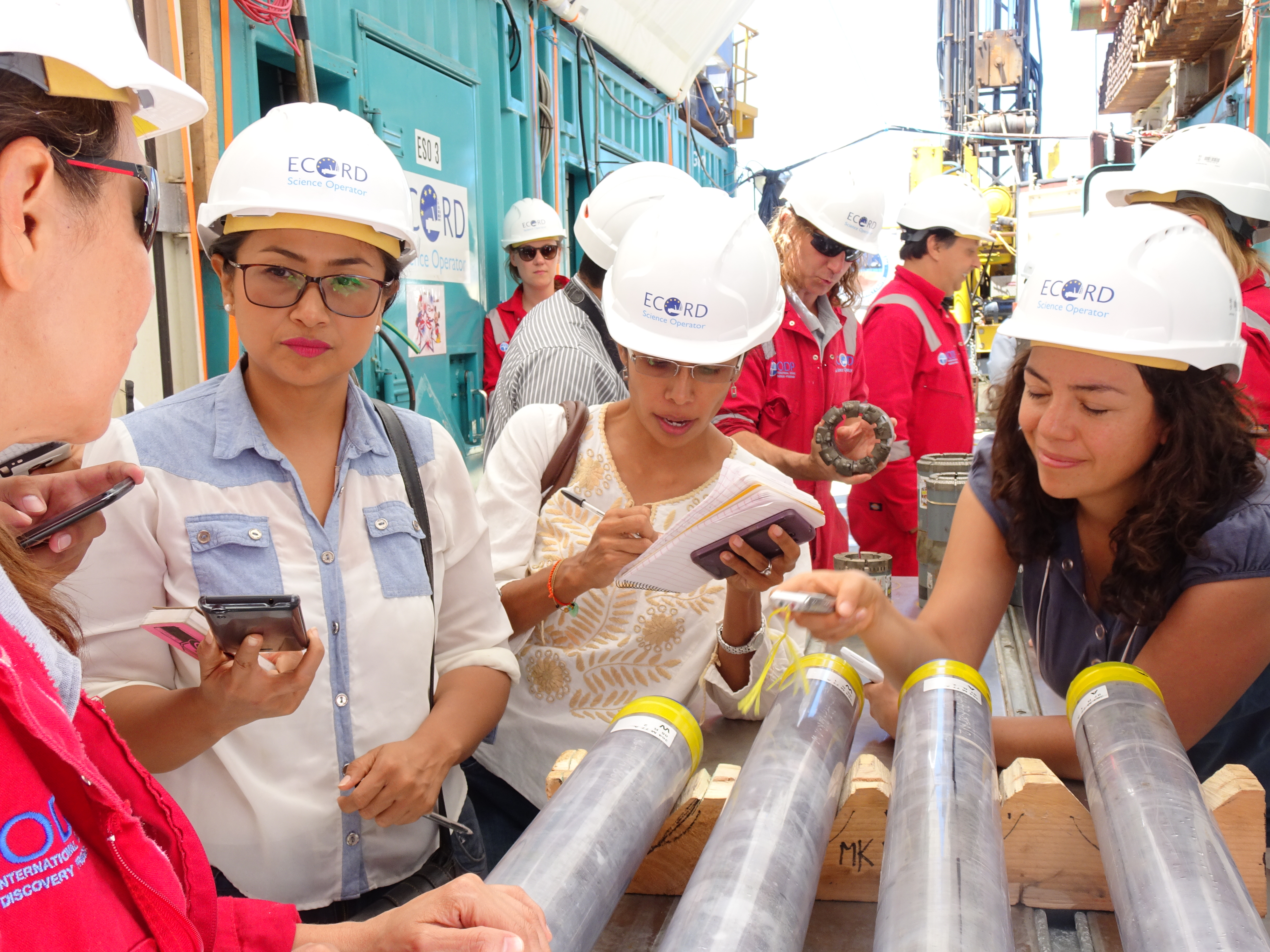
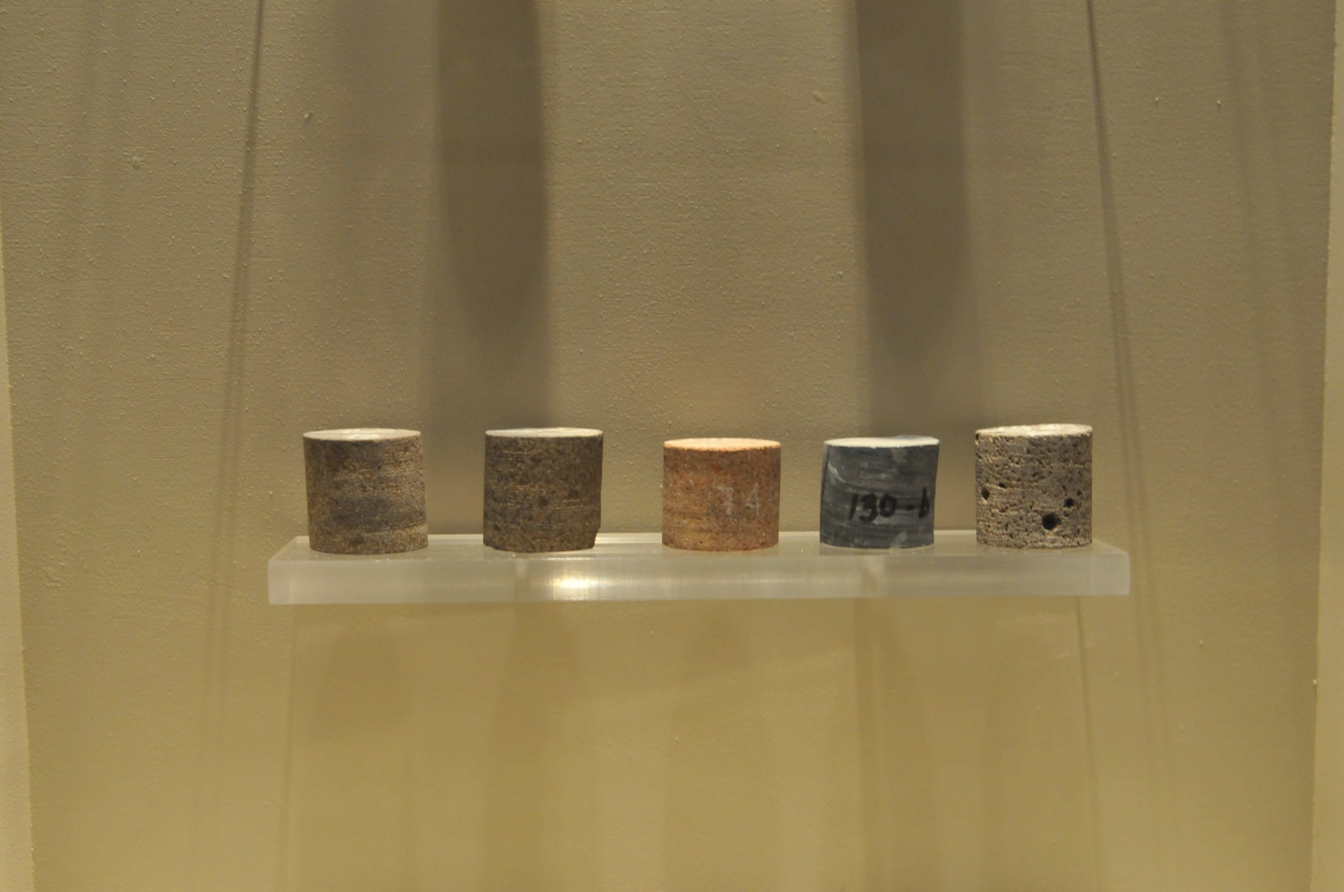
So the new arrivals don’t have to wait to see the core, Gulick and Morgan are happy to show them a sample of what’s been brought up so far. They carry out three cores from the reefer—a refrigerated shipping container where the cores are stored—and line them up on a holding stand in the walkway between the containers.
Each core is from a different section of the impact crater and looks surprisingly distinctive from one another.
The first core is a swirling grey rock made from sediments that filled the crater millions of years after impact, while the second core contains pink granite breccia, rock that was cracked by the impact or fell back into the crater after being blown apart, peeking out from grey sediment.
Gulick said researchers can use these cores to learn about the Earth after the impact. But he and Morgan are most interested in the Earth during the impact. So their treasure is the third core—a sample from the crater’s peak ring, a circular mountain range that sprung up when rocks deep in the Earth’s crust rebounded from the force of the impact.
Understanding how the peak ring forms can give clues not only about how the Chicxulub impact occurred, but also about large impacts on Earth and around the universe, Gulick said.
“Large impacts are the most important process of how the surface of planets are built,” Gulick said. “Most don’t have plate tectonics like Earth.”
HITTING THE PEAK,
REVEALING RECOVERY
A peak ring is the tell-tale mark of a large impact crater on a rocky surface. Although Earth is known to have been struck by three large impacts, Chicxulub is the only known crater to have its peak ring intact. All other large craters have been distorted by tectonic activity or have had their impact structures eroded away.
“The next closest peak ring after Chicxulub is on the moon,” Lowery said.
According to models, the force of large impacts can make solid rock temporarily behave like fluid, with the crater forming from rocks flowing apart and the peak ring recoiling up from the impact, like a drop of water bouncing up from a lake’s surface when a stone is dropped into it.
“The rock appears to flow like a viscous fluid,” Gulick said. “It’s basically hit so hard that it fractures all the way down to the crystal scale. The fractures are causing little earthquakes, which cause more fractures, so as a medium it can move temporarily.”
The core samples taken from the peak ring rocks offer direct evidence to compare to models, Gulick said. “We can see the crater’s morphology and we can see the shape, but there’s all these competing theories on how you make that shape,” Gulick said. “By drilling the peak ring, we’re basically able to calibrate everybody’s models and come up with an answer amongst the competing theories.”
Another interesting feature from the peak ring core is a fibrous looking, scarlet mineral creeping between the cracks of the peak ring rocks. It is a sign of hydrothermal activity, of hot water trapped in the peak ring rocks.
Hydrothermal areas on Earth are a literal hotbed for diverse microbial life called extremophiles that are adapted to live off the minerals associated with hydrothermal activity. The mineral is a good sign that life may have once inhabited pores in the peak ring rock, said Marco Coolen, a microbiologist from Curtin University in Australia.
Coolen is taking sterile samples from the peak ring cores. Once back on shore, he, along with astrobiologist Charles Cockell of the University of Edinburgh, will analyze the samples to see if they contain DNA or RNA from ancient life. Any microbial evidence that shows up almost certainly came from Earth, Coolen said.
The force of the impact would have destroyed any interstellar hitchhikers. But the new niches available after impact could have provided an array of ecosystems for peak ring life to inhabit.
In cores taken from above the peak ring, life is clearly visible.One thumbnail-sized sample of groundup core can reveal thousands of microfossils, mostly shells from free-floating nannoplankton and foraminifera, or forams. Before the scientists hit the peak ring, they used different species of microfossils as landmarks to know where in the geologic record the drill was at.
“Fossils are the building blocks of geologic time,” Lowery said. “So as a paleontologist, you’re the first one who gets to look at (the core) and say ‘what age is this?’”
Fossils, along with other data, served as a check on the 2005 seismic
readings the team was using to predict what layers they were coring. The 10-year old data matched up perfectly with the recovered core except in one case, said Christeson, when a core taken at 618 meters revealed unexpected deposits of sandstone that puzzled the onboard scientists.
Gulick thought the rocks could be from K-Pg boundary—a layer that the seismic data indicated was 30 feet deeper. But Christeson wasn’t convinced. A vertical seismic reading of the borehole, supported by microfossil and geological analysis, revealed that Gulick was right—a finding that revealed a depth conversion error in the seismic data and settled a bet between Christeson and Gulick (his prize: a bottle of single-malt scotch).
Besides using microfossils as a geologic roadmap, they’re useful measures of how life responded after impact and in what conditions, Lowery said.
“What makes these things so powerful is that they are so good at reconstructing what was going on in the oceans,” he said. “And so, using different proxies associated with forams we can look at oxygen, we can look at salinity, we can look at productivity, and by reconstructing things like that we can make some larger inferences about the larger ocean ecosystem.”
The fossil readings taken on the boat are important, but they’re just the beginning. A month-long examination of the cores and associated data will happen in Bremen, Germany in the fall. Here, the Myrtle team will reunite and be joined by an onshore team of scientists who will cut the cores in two. One half of each core will be stored, and the other half studied by the researchers.
GOODBYE CHICXULUB
On May 13, the borehole has reached a depth of 859 meters. It’s staying that way because the drill bit needs to be changed again.
Beau Marshall, the drill company manager, brought two diamond-studded drill bits on board this morning to do the job. But for Gulick, this is as deep as he’s going.
Like other researchers before him, his time to leave the ship has come. Morgan will take full command of the research operations on board.
Back in Austin, Gulick’s son is graduating from UT, as well as three Ph.D. students he advised. Less than a week later, he’ll be back at sea leading the Jackson School’s Marine Geology and Geophysics field course with Saustrup. So, after a lunch of lasagna with the researchers, crew and drillers, Gulick trades his white hardhat and red IODP work suit for blue jeans and a brimmed hat made of black leather.
He boards the basket that took him on the Myrtle a month ago. It raises him above the lifted boat and softly places him on the deck of a transport boat called Linda waiting on the water below.
While Myrtle stood still, this boat is softly sloshed back and forth over the waves. He stands on deck and looks up at the Myrtle and turns to Claire Mellet, the expedition project manager, who is also leaving the ship today.
“What are we doing here? We belong up there!” he laughs.
He waves goodbye to the Myrtle and the scientists who have lined up along the edge of the boat to see Gulick and
Mellet off.
The Linda does a lap around the Myrtle, and then it’s back to the docks of Progreso.
“I feel like I’m leaving in the middle of a chapter,” Gulick said.
Although he’s gone for now, he’s hardly closing the book on Chicxulub. He’ll join the others in Bremen, when the next leg of the research starts again.
The weeks of analysis in Bremen will help reveal the details of the destruction, and the great extinction that followed. And if DNA is found in hydrothermal minerals, the cores could show that life thrived in the peak ring on our world and may do so on worlds outside our own. If anything, the success of the drilling project shows that after the destruction of the Chicxulub impact, life came back. And it came back curious.
Impact Creates Ring of Hidden Oases
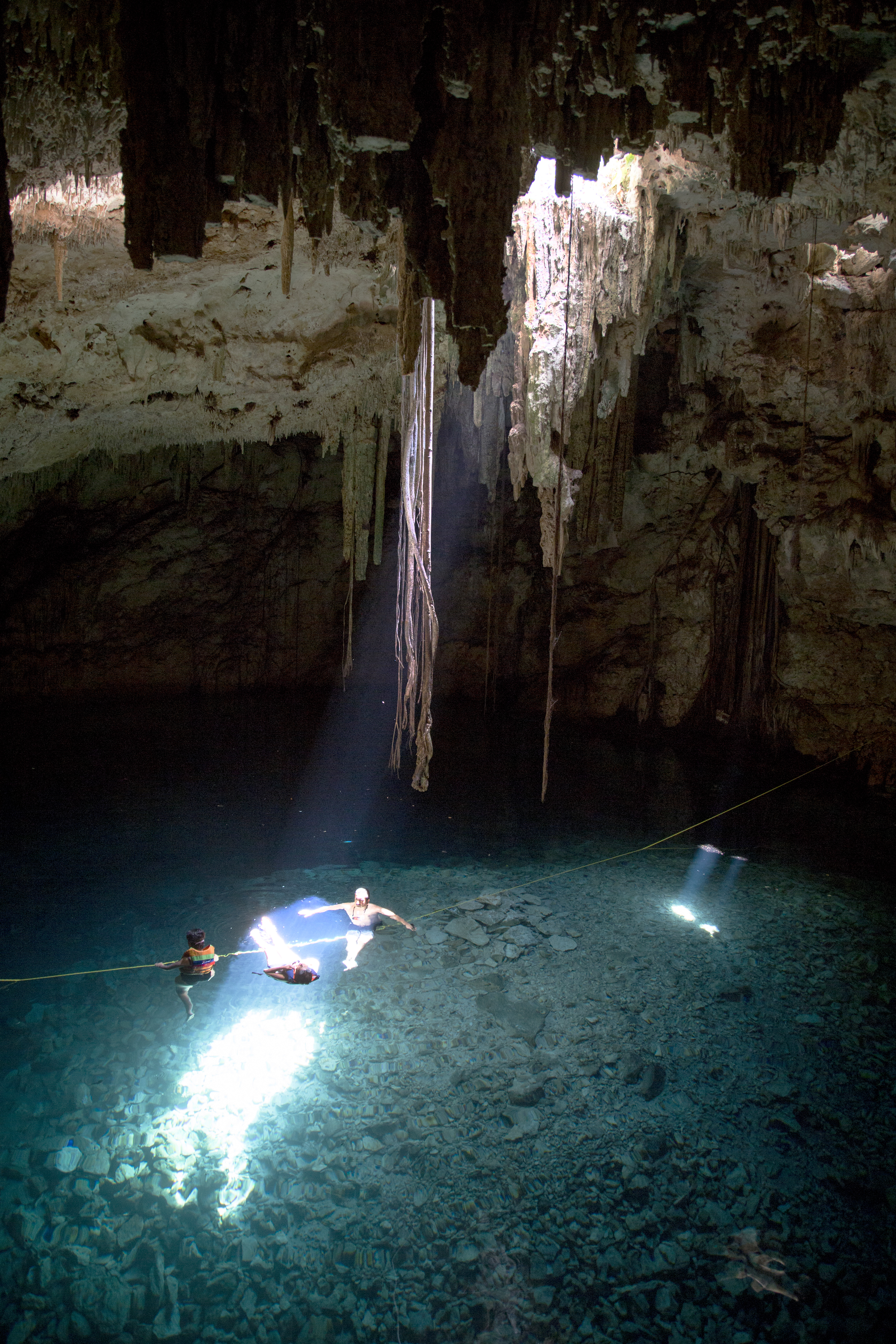
The onshore rim of the Chicxulub crater is surrounded by a ring of water-filled caverns called cenotes.
The cenote pools can be hundreds of feet deep, with some being completely exposed from the surface and others being visible only through a small hole in the ground.
Nearly a thousand cenotes form a “ring” around the land portion of the Chicxulub crater. The Chicxulub impact directly influenced the formation of the cenotes by creating fractures in the carbonate rock that radiate from around the rim of the crater. Over time, groundwater entered into some of the fractures and eroded away the surrounding rock, creating underground caverns.
A cenote is born when a surface opening forms above the cavern—often by tree roots breaking through the ground to dip into the pool of water below.
The ancient Maya considered cenotes symbolic passageways to the underworld and used certain ones as sites for human sacrifice. The bottom of the sacred cenote (called “Chen Ku” by the Maya) at the ruins of Chichen Itza is covered with a 14-foot-thick layer of blue pigment, remnants of paint that coated people and valuables that were thrown into the cenote as sacrifices to the rain god Chaak.
Today, cenotes are popular swimming holes in the Yucatán. The cool, clear water offers an underground escape from the hot and humid climate at the surface.