
Field Work in Alaska
December 4, 2019
In summer 2019, Jackson School of Geosciences Professor Bayani Cardenas led members of his lab on field work in Alaska. The team studied groundwater within subsea permafrost at the bottom of Arctic lagoons, and they explored how soils store and transmit water. Graduate students Micaela Pedrazas Hinojos, Cansu Demir and Michael O’Connor wrote about the experience.
Science at the Arctic Circle
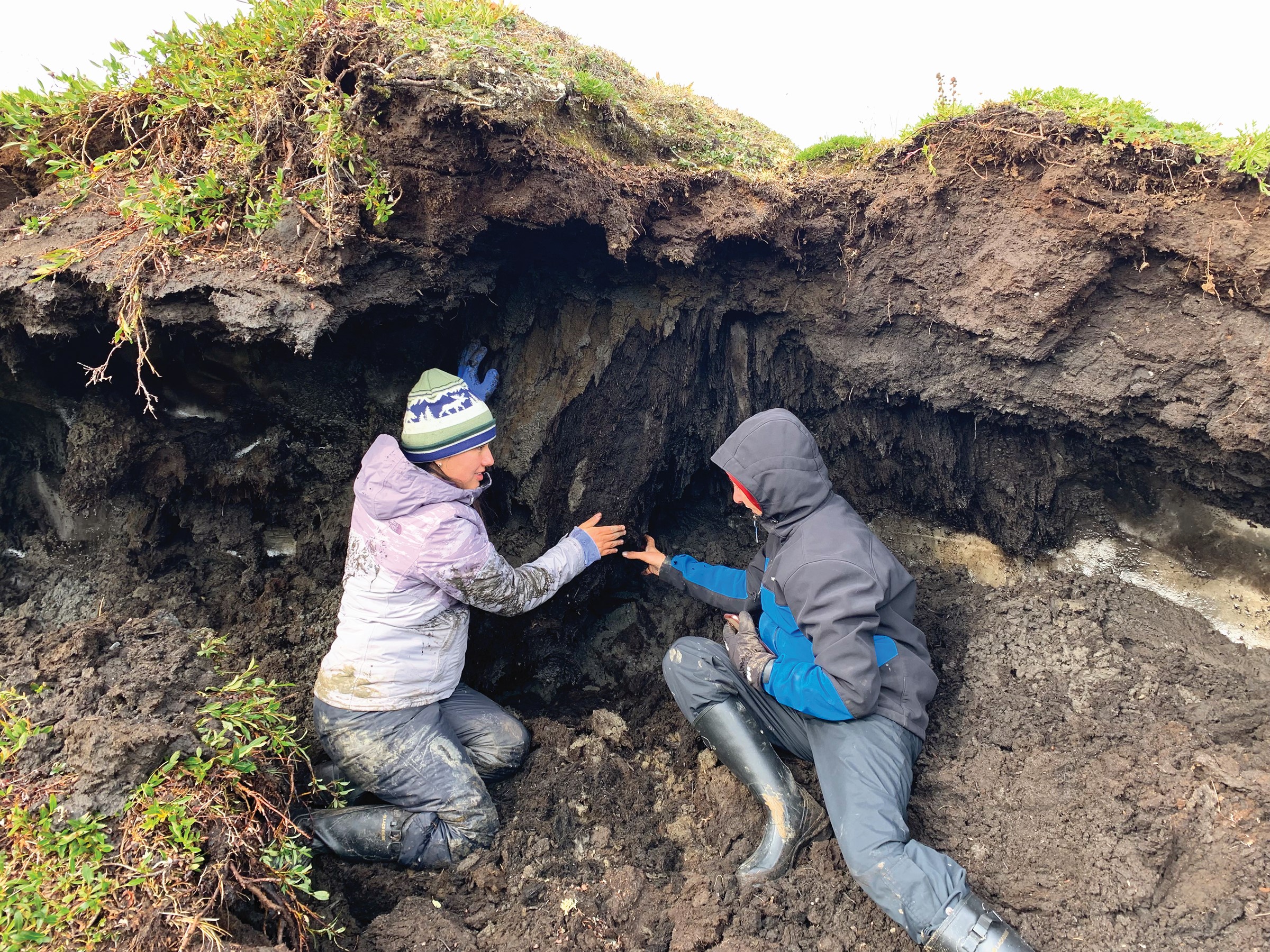
Arctic lagoons along the Beaufort Sea coast of Alaska are sensitive systems hosting vast amounts of ecological life and are home to native Alaskan coastal communities. Subsurface geologic understanding and delineation of the groundwater lagoon connectivity is necessary to understand the contribution of thawing ice-rich permafrost to lagoon systems in terms of organic carbon, greenhouse gases, petrophysical properties and potential impacts to coastal communities, infrastructure and ecosystems. There emerges the need of subsea permafrost distribution investigation across the lagoons. To study this phenomenon outside the comfort of our office, we set on an adventure to acquire data in Kaktovik, Alaska. Micaela Pedrazas Hinojos, M.S. student, used electrical geophysics to infer the petrophysical properties deep in the subsurface both along and across the coast of Kaktovik Lagoon. This method was used to reveal the spatial extent of permafrost thawing and the interplay between saltwater from the Beaufort Sea and freshwater from thawed permafrost. Cansu Demir, Ph.D student, seeks to build on this petrophysical model to modelgroundwater flow beneath the Arctic lagoon and predict concomitant changes in Arctic coastal areas based on field observations. During the campaign, we acquired electrical resistivity data, groundwater samples, temperature and salinity data. To understand the community’s perspective on these issues, we were able to share ideas, meals, and partake in the native Iñupiat culture, and go polar bear watching.
Cansu Demir, Doctoral Candidate, and Micaela Pedrazas Hinojos, Master’s Student
Alaska: The Final Frontier
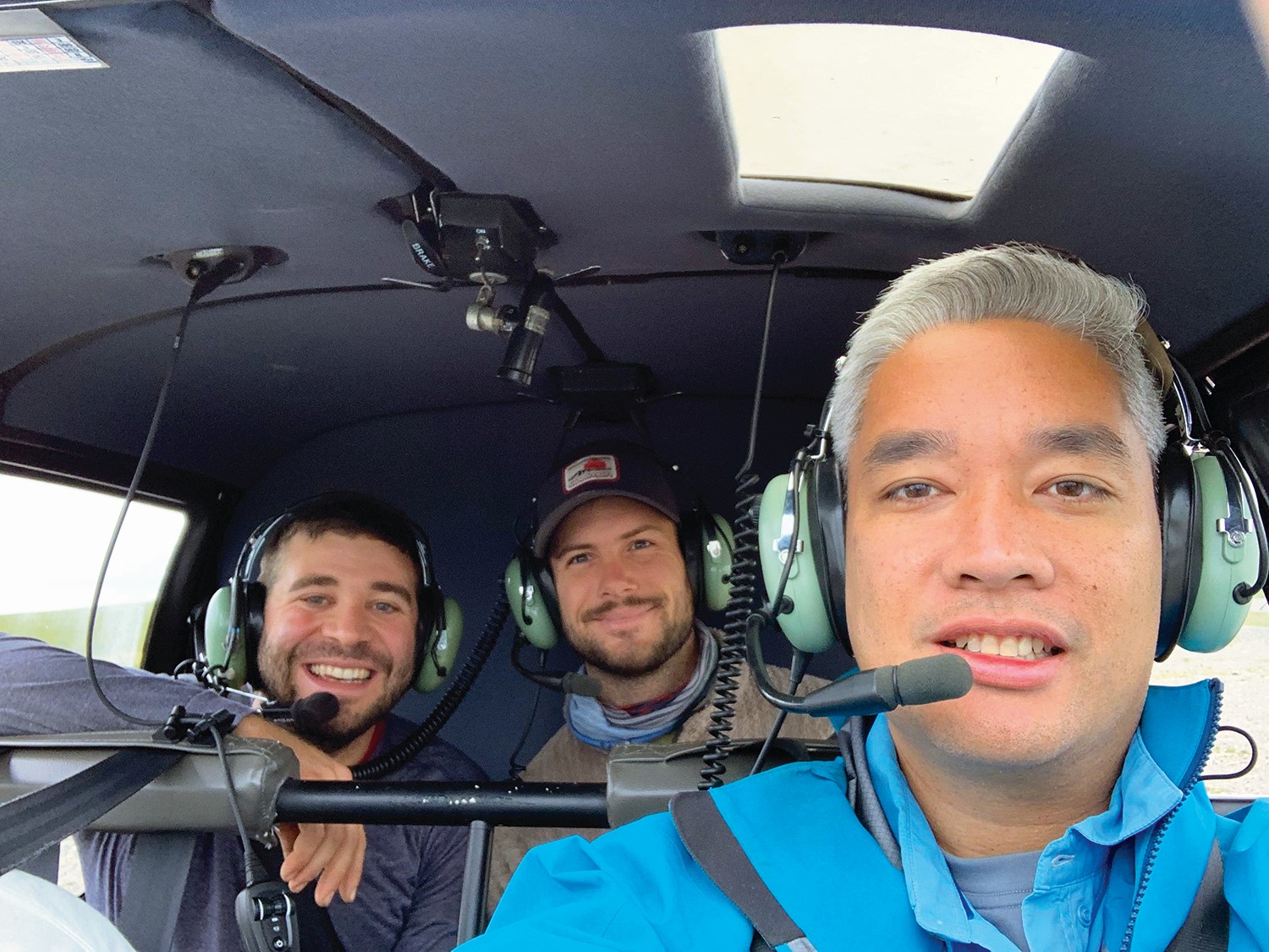
The goal of our summer 2019 field campaign was to expand our understanding of how Arctic soils store and transmit water and how much carbon is stored within them. Our research is motivated by estimates that about half of the soil carbon on Earth is stored in the Arctic, and as the Arctic warms (which it’s currently doing, rapidly), that carbon can be released into the atmosphere and exacerbate global warming. Understanding how much carbon is in these soils and how water is stored and flows in them will help to more accurately predict how these soils will respond to changing climate. Much of the previous work in Alaska has been based on data collected in a very small area of the Arctic in the vicinity of the permanent Toolik research station. Our aim this year was to expand beyond that small area — from the local to the regional scale. Thanks to NSF and NASA funding, we had the incredible opportunity to use a helicopter to access remote and otherwise inaccessible locations. It was more successful than we hoped for! In total, we collected approximately 100 soil samples distributed over hundreds of square miles. These observations represent the first ever documented data in this region and will undoubtedly improve our understanding of Arctic soils.
Michael O’Connor
Doctoral Candidate