
UT, LCRA teaming with NASA on $900 million satellite
February 10, 2015
AUSTIN — The University of Texas and the Lower Colorado River Authority will be utilizing data from a new NASA satellite to better forecast droughts and floods.
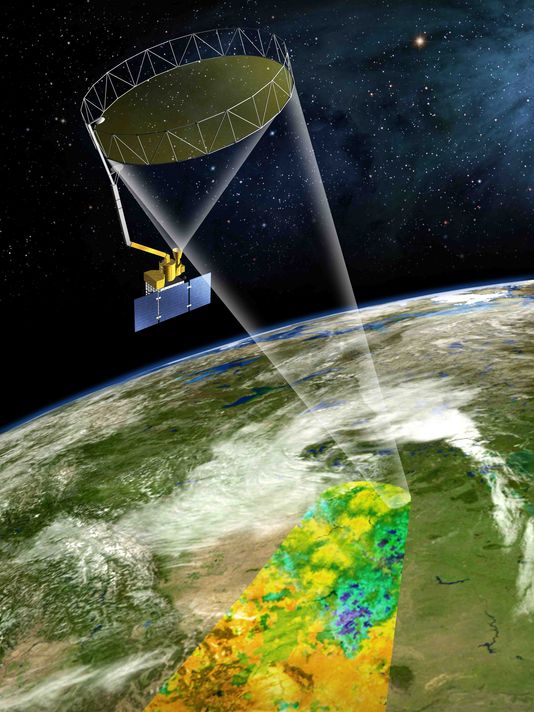
NASA launched the $900 million Soil Moisture Active Passive (SMAP) satellite Jan. 31. The satellite orbits the earth approximately every 90 minutes and is capable of measuring the moisture of soil in the ground. Its mission is to vastly improve forecasting for droughts and floods.
UT and LCRA will be working with NASA by working to confirm what the satellite records. The new information comes with a few obstacles.
“It’s challenging on a whole bunch of different levels. It’s challenging from the fact, this data set, that is going to be the first of its kind, and it’s at a fairly large scale and a lot of times we need these estimates, even at a finer scale, say for drought. We need to know if farmer A’s field is more prone than farmer B’s field,” said Dr. Todd Caldwell at the University of Texas.
KVUE, Feb. 6, 2015
NPR’s StateImpact Texas, Feb. 2, 2015
Nature, Jan. 27, 2015
El Paso Times, Jan. 31, 2015
Featuring Todd Caldwell, research associate at the Bureau of Economic Geology